Pemandu selam regional ini dimaksudkan untuk memberikan yang sudah memenuhi syarat penyelam scuba dengan informasi yang akan membantu merencanakan penyelaman di perairan Cape Peninsula dan False Bay, baik sebagai penduduk lokal atau pengunjung. Informasi diberikan tanpa prasangka, dan tidak dijamin akurat atau lengkap. Gunakan dengan risiko Anda sendiri. Perluas atau perbaiki jika Anda bisa.
Wilayah yang dijelaskan berada dalam perjalanan sehari melalui jalan darat dari bagian mana pun di Greater Cape Town, dalam Tanjung Barat provinsi Afrika Selatan dan mencakup lebih dari 280 situs penyelaman bernama yang posisinya dicatat, yang banyak untuk tujuan tunggal mana pun.
Informasi terperinci tentang situs menyelam individu disediakan di sub-artikel yang ditautkan dari Situs menyelam bagian. Informasi dalam deskripsi situs berkisar dari dangkal hingga sangat rinci, tergantung pada apa yang diketahui tentang situs tersebut. Mungkin ada peta. Bagan batimetri oleh SURGMAP diperbarui saat dan ketika data survei baru dikumpulkan, dan dipetakan dengan berenang di kontur yang menarik pelampung GPS. Mereka cukup akurat – biasanya dalam beberapa meter – dan dapat diandalkan untuk apa yang ditampilkan, tetapi jarang lengkap. Sangat mungkin bahwa beberapa puncak tinggi telah terlewatkan. Tidak ada jaminan bahwa Anda tidak akan menemukannya dengan memukulnya dengan perahu Anda. Jika Anda melakukannya, beri tahu kami.
Dalam beberapa kasus, sub-artikel situs menyelam akan mencakup beberapa situs yang berdekatan, karena sebagian besar informasi akan umum untuk mereka semua. Dalam kasus lain, biasanya melibatkan situs bangkai kapal, dua situs yang berdekatan masing-masing akan memiliki sub-artikel sendiri, tetapi jika dua atau lebih bangkai kapal terletak pada posisi yang sama, atau dengan tumpang tindih yang substansial, mereka akan dijelaskan dalam sub-artikel yang sama.
Memahami


Topografi umum
Kota Cape Town didirikan di ujung utara Semenanjung Tanjung, sebidang tanah pegunungan sempit dengan lebar paling lebar 11 km dan panjang lebih dari 50 km. Perbatasan utara adalah pantai Table Bay, teluk terbuka besar dengan satu pulau, Pulau Robben, di mulutnya.
Garis pantai yang tidak rata menandai perbatasan barat di sepanjang samudra Atlantik. Sejumlah teluk kecil ditemukan di sepanjang pantai dengan satu teluk besar, Teluk Hout, sekitar setengah jalan. Lebih jauh ke selatan semenanjung menyempit sampai berakhir di Cape Point. Rangkaian pegunungan dengan Table Mountain pada 1.085 m di ujung utara membentuk tulang punggung semenanjung. Titik tertinggi semenanjung selatan adalah Swartkop, pada 678 m, dekat Kota Simon. Semenanjung ini memiliki lereng yang cukup curam di sepanjang sebagian besar pantai, dengan daerah yang sangat sempit dengan tanah yang relatif datar kecuali sisi barat ujung selatan.
Sisi timur yang curam berbatasan dengan False Bay, dan bentangan garis pantai ini mencakup Teluk Smitswinkel yang lebih kecil, Teluk Simon, dan Teluk Fish Hoek, di mana sebidang tanah rendah membentang di antara pantai di kedua sisi. Di Muizenberg, garis pantai menjadi relatif rendah dan berpasir dan melengkung ke timur melintasi batas selatan Cape Flats ke Gordon's Bay untuk membentuk batas utara False Bay. Dari Teluk Gordon garis pantai berayun kira-kira ke selatan, dan zig-zag sepanjang kaki pegunungan Holland di Hottentot ke Cape Hangklip yang hampir sama dengan garis lintang Cape Point. Puncak tertinggi di sisi ini adalah Kogelberg di 1.269 m.
Rencananya teluk ini kira-kira berbentuk bujur sangkar dengan tepi yang agak goyah, luasnya kira-kira sama dari utara ke selatan seperti timur ke barat (30 km), dengan seluruh sisi selatan terbuka ke laut. Luas False Bay telah diukur sekitar 1.090 km², dan volumenya sekitar 45 km³ (kedalaman rata-rata sekitar 40 m). Perimeter tanah telah diukur pada 116 km, dari peta skala 1:50.000.
Morfologi dasar Teluk Palsu umumnya halus dan cukup dangkal, landai ke bawah dari utara ke selatan, sehingga kedalaman di bagian tengah mulut sekitar 80 m. Dasar teluk ditutupi dengan sedimen yang berkisar dari sangat kasar sampai sangat halus, dengan sebagian besar sedimen halus dan lumpur di tengah teluk. Pengecualian utama adalah punggungan panjang batuan sedimen yang memanjang ke arah selatan dari Strand, kira-kira sejajar dengan muara Sungai Steenbras. Ujung selatan punggungan ini dikenal sebagai Steenbras Deep.
Ada satu pulau sejati di teluk itu, Seal Island, sebuah singkapan granit yang tandus dan berbatu dengan panjang sekitar 200 m dan dengan luas sekitar 2 ha. Ini adalah sekitar 6 km selatan Strandfontein dan kurang dari 10 m di atas permukaan laut pada titik tertinggi. Ada juga sejumlah pulau kecil berbatu yang memanjang di atas tanda air yang tinggi, dan batu-batuan lain serta beting yang mendekati permukaan. Sebagian besar adalah granit Semenanjung pluton, tapi di sebelah timur Pulau Seal mereka umumnya batu pasir, mungkin dari Tygerberg formasi di dalam teluk, meskipun ada kemungkinan bahwa beberapa mungkin dari Gunung Meja seri. Yang terbesar dari area terumbu ini adalah Whittle Rock, sebuah bukit granit bawah laut yang naik dari dasar berpasir sekitar 40 m hingga 5 m dari permukaan, dan berdiameter sekitar 1 km.
Di luar teluk, tetapi mempengaruhi pola gelombang di dalamnya, adalah Rocky Bank, terumbu karang yang luas Gunung Meja terumbu batupasir dengan kedalaman antara 20 dan 30 m di bagian atas, dan miring ke bawah hingga lebih dari 100 m ke selatan.
Tegasnya, False Bay adalah bagian dari Samudra Atlantik, yang membentang sejauh Cape Agulhas, tetapi ketika di Cape Town, Atlantik umumnya mengacu pada pesisir barat Semenanjung Cape, dan sisi timur disebut sebagai False Bay, atau sisi Kota Simon. Konvensi ini akan digunakan di seluruh panduan ini.
Topografi lokal
Pengaruh paling kuat pada topografi lokal adalah geologi lokal. Endapan lanau, pasir atau kerikil yang tidak terkonsolidasi cenderung cukup datar. Sirap dan bongkahan batu kecil mungkin miring lebih curam, dan batuan dasar dan bongkahan besar bisa berupa apa saja mulai dari yang sedikit terangkat di atas dasar yang tidak terkonsolidasi di sekitarnya, hingga permukaan tebing yang menjorok dan tor. Jenis batuan, dan untuk strata sedimen, kemiringan dan pemogokan, memiliki pengaruh besar pada kisaran kemungkinan bentuk terumbu.
Struktur terumbu saat ini berkembang sebagai bentang alam selama zaman es, ketika mereka berada di atas permukaan laut, dan terumbu granit sebagian besar dibentuk oleh proses pelapukan bawah tanah selama periode yang lebih lama. Granit yang cukup tua, dan banyak disambung oleh kekuatan tektonik, dan tepi retakan telah lama terkikis secara kimiawi oleh air tanah untuk membulatkan sudut dan membentuk celah dan parit yang dalam, yang kemudian tersingkap oleh erosi. saprolit dan dimodifikasi lebih lanjut oleh pelapukan dan erosi permukaan yang terbuka ke struktur yang dikenal sebagai batu inti dan tor. Demikian pula, batuan sedimen yang tersingkap terkikis saat tersingkap di atas tanah. Ketika permukaan laut naik selama pencairan glasial, bentang alam ini hanya membanjiri, dan mempertahankan banyak bentuk dan karakter sebelumnya. Erosi pantai telah mengubah terumbu karang di daerah yang terkena aksi gelombang energi yang cukup tinggi, dan beberapa pergerakan sedimen terjadi karena gelombang dan arus.
Iklim, cuaca dan kondisi laut sea

Iklim Cape Barat
Iklim South-western Cape sangat berbeda dari Afrika Selatan lainnya, yang merupakan wilayah curah hujan musim panas, menerima sebagian besar curah hujan selama bulan-bulan musim panas Desember hingga Februari. South-western Cape memiliki iklim tipe Mediterania, dengan sebagian besar curah hujannya selama bulan-bulan musim dingin dari Juni hingga September.
Selama musim panas, faktor dominan yang menentukan cuaca di wilayah tersebut adalah zona tekanan tinggi, yang dikenal sebagai Tinggi Atlantik, yang terletak di atas Samudra Atlantik Selatan di sebelah barat pantai Tanjung. Angin yang bersirkulasi berlawanan arah jarum jam dari sistem semacam itu mencapai Tanjung dari tenggara, menghasilkan periode angin kencang dan langit cerah hingga beberapa hari. Angin tenggara ini secara lokal dikenal sebagai Cape Doctor. Mereka menjaga kawasan itu relatif sejuk dan membantu meniupkan udara yang tercemar dari kawasan industri dan Cape Flats ke laut. Karena aspek menghadap ke selatan, False Bay terkena angin ini, terutama di sisi barat, sedangkan Table Bay dan pantai barat semenanjung mengalami angin lepas pantai. Pola angin ini dipengaruhi secara lokal oleh topografi sehingga angin kencang dapat bertiup masuk Teluk Gordon , sementara sekitar 10 km jauhnya sebagian dari Somerset Barat mungkin memiliki hari yang terik dan tidak berangin.
Musim dingin di South-western Cape dicirikan oleh gangguan angin barat sirkumpolar, yang menghasilkan serangkaian depresi frontal yang bergerak ke arah timur. Ini membawa cuaca berawan yang sejuk, angin, dan hujan dari barat laut, diikuti oleh penurunan suhu dan pergeseran ke angin barat daya saat bagian depan lewat. Angin barat daya di atas Atlantik Selatan menghasilkan gelombang barat daya yang khas pada bulan-bulan musim dingin, yang melanda garis pantai Atlantik yang terbuka dan sisi timur False Bay. Pegunungan Cape Peninsula memberikan perlindungan di sisi barat False Bay dari angin ini dan dari gelombang barat daya – sebuah fakta yang mempengaruhi Gubernur Simon van der Stel dalam memilih Simon's Bay sebagai pelabuhan musim dingin untuk Perusahaan Hindia Timur Belanda. kapal ke Cape Town. Badai musim dingin di barat laut telah menghancurkan banyak kapal yang berlabuh di Table Bay selama berabad-abad. Bahkan hari ini, terlepas dari kemajuan teknis dan prakiraan cuaca yang lebih baik, ini masih terjadi, meskipun lebih jarang daripada di masa lalu, dan akhir-akhir ini operasi penyelamatan lebih sering berhasil.
Cuaca
Kecenderungan umumnya adalah cuaca datang dari barat dan bergerak ke timur dengan sistem frontal, tetapi bisa juga ada lebih banyak fenomena cuaca lokal seperti badai petir (jarang) dan angin 'berg', yaitu angin hangat yang turun di atas pegunungan dari pedalaman. Mungkin ada variasi yang cukup besar dalam kondisi cuaca antara lokasi yang berbeda di area yang dicakup oleh panduan ini pada setiap hari, meskipun kecenderungan umumnya mungkin serupa. Misalnya hujan mungkin turun di Cape Peninsula pada pagi hari, dan pada sore hari kondisi ini mungkin telah berpindah ke sisi timur False Bay dan semenanjung mungkin akan cerah dengan pergeseran arah angin yang signifikan dari barat laut ke barat daya. Variasi lokal dalam kekuatan angin mungkin ekstrem, dan terkadang sulit dipercaya, karena mungkin ada ketenangan yang mati di satu tempat dan angin menderu beberapa kilometer jauhnya. Ada tempat-tempat yang dikenal terpapar angin tenggara dan barat laut, dan beberapa di antaranya terlindung dari satu atau yang lain, sementara angin barat daya bertiup di sebagian besar tempat, tetapi biasanya tidak sampai ke ekstrem yang sama. Apa artinya ini dalam praktik, adalah bahwa kondisi cuaca di mana Anda berada pada waktu tertentu mungkin berbeda secara signifikan dari yang ada di lokasi penyelaman sedikit di kemudian hari.
Angin berg disebabkan oleh dataran tinggi dengan tekanan tinggi, biasanya di musim dingin, di daerah dataran tinggi yang dingin dan kering di atas lereng curam, ditambah dengan tekanan yang lebih rendah di pantai. Angin mengalir menuruni lereng dan dipanaskan oleh kompresi. Kenaikan suhu bisa cukup besar dan dalam waktu singkat. Angin panas dan kering ini berada di lepas pantai dan tidak terlalu mempengaruhi kondisi penyelaman, tetapi biasanya diikuti oleh angin darat yang sejuk dengan awan rendah, kabut dan gerimis, dan sering dikaitkan dengan pendekatan front dingin dari barat di musim dingin, yang dapat membawa angin barat yang kuat dan hujan frontal yang substansial.
Kondisi laut
Gelombang dan gelombang
Gelombang yang mencapai pantai False Bay dan Cape Peninsula dapat dianggap sebagai kombinasi dari gelombang angin lokal dan gelombang dari sumber yang jauh. Swell dihasilkan oleh sistem cuaca umumnya selatan benua, kadang-kadang jauh, yang paling penting adalah sistem frontal di Atlantik Selatan, yang menghasilkan gelombang angin yang kemudian menyebar jauh dari sumbernya dan terpisah dari waktu ke waktu menjadi zona-zona yang bervariasi. Titik. Gelombang periode panjang lebih cepat dan memiliki energi lebih, serta bergerak mendahului komponen periode yang lebih pendek, sehingga cenderung mencapai pantai terlebih dahulu. Ini dikenal oleh peselancar sebagai denyut nadi, dan umumnya diikuti oleh gelombang pemendekan secara bertahap dengan daya yang lebih kecil.
Angin lokal juga akan menghasilkan gelombang yang menggabungkan efeknya dengan swell. Angin lepas pantai sebagai aturan umum akan meratakan laut karena fetch (jarak angin bertiup di atas air) biasanya terlalu kecil untuk menghasilkan gelombang yang sangat tinggi atau panjang. Angin darat di sisi lain, jika cukup kuat akan menghasilkan chop pendek dan buruk yang dapat membuat masuk dan keluar tidak nyaman, dan berenang di permukaan atau naik perahu tidak menyenangkan.
Kombinasi gelombang ombak dan angin harus dipertimbangkan saat merencanakan penyelaman. Ini membutuhkan pengetahuan tentang kondisi ini, yang diperkirakan dengan akurasi variabel oleh sejumlah organisasi, dalam beberapa kasus selama tujuh hari atau lebih ke depan. Akurasi umumnya berbanding terbalik dengan interval peramalan. Biasanya cukup andal melihat dua atau tiga hari ke depan, tetapi bisa sedikit goyah selama lebih dari seminggu. Cuaca memang seperti itu.
Upwellings
Angin tenggara yang bertiup di lepas pantai dan sepanjang pantai di sisi barat Semenanjung Cape dan sisi timur False Bay menyebabkan pergerakan air permukaan lepas pantai ke barat pantai karena transportasi Ekman. Pergerakan air menjauh dari pantai ini dikompensasi oleh upwelling air yang lebih dalam.
Upwelling ini sangat menarik bagi penyelam, karena air upwelling di pantai barat dingin dan relatif jernih. Namun, karena air yang di upwelled memiliki kandungan nutrisi yang tinggi, upwellings sering menjadi cikal bakal mekarnya plankton yang dikenal sebagai "red tide", yang secara drastis akan mengurangi jarak pandang. Suhu air cenderung turun hingga di bawah 12°C selama upwelling pantai barat, dan kadang-kadang dapat mencapai 7°C yang dingin.
Di sisi timur False Bay, upwelling sering menyebabkan visibilitas yang buruk karena dapat mengganggu sedimen yang sangat halus dan berdensitas rendah yang umum di sisi teluk itu, terutama di bagian yang lebih dangkal di dekat Gordon's Bay. Airnya juga relatif dingin, tetapi biasanya tidak sedingin di sisi barat semenanjung dan suhu dapat turun dari sekitar 19°C menjadi 12°C selama satu atau dua hari.
pasang surut
Pasang surut lokal didominasi bulan, semi-diurnal, dan relatif lemah, dan tidak ada arus pasang surut yang kuat di pantai Atlantik atau di False Bay. Arus pasang surut yang dihasilkan tidak banyak berpengaruh bagi penyelam, efek utamanya adalah sedikit perubahan pada kedalaman di lokasi penyelaman dan variasi pada rintangan yang ditimbulkan oleh daun rumput laut di dekat permukaan, yang dapat mempengaruhi upaya yang diperlukan untuk melewati rumput laut di permukaan. Dalam hal ini umumnya lebih mudah pada saat air pasang.
Peluncuran kapal di beberapa slipways bisa jadi sulit saat air surut, yang kadang-kadang dapat memengaruhi jadwal penyelaman kapal, dan musim semi surut kira-kira pada saat peluncuran pertama (kira-kira pukul 09:00 hingga 09:30).
Kisaran pasang surut maksimum di Cape Town adalah sekitar 1,86 m (pasang surut musim semi), dan di Simon's Town 1,91 m, dengan kisaran minimum di kedua tempat sekitar 0,26 m (pasang surut).
Suhu air
Suhu rata-rata permukaan musim panas Atlantik di lepas Semenanjung Cape berada dalam kisaran 10° hingga 13°C. Suhu bawah mungkin beberapa derajat lebih dingin. Suhu minimum sekitar 8°C, meskipun klaim telah dibuat untuk suhu serendah 6°, dan maksimum sekitar 17°C.
Suhu rata-rata permukaan musim dingin Atlantik di lepas Cape Peninsula berada pada kisaran 13° hingga 15°C. Suhu dasar di pantai hampir sama.
Suhu permukaan musim dingin rata-rata False Bay adalah sekitar 15°C, dan suhu dasar hampir sama atau sedikit lebih rendah. Suhu permukaan musim panas rata-rata False Bay adalah sekitar 19°C. Suhu dasar umumnya 1° hingga 3°C lebih rendah daripada di musim dingin, tetapi 10° hingga 12°C tidak diketahui.
Arus
Arus biasanya tidak dianggap sebagai masalah di sebagian besar lokasi penyelaman di wilayah ini. Arus permukaan yang dangkal dapat dihasilkan oleh angin kencang, dalam waktu singkat, yang dapat menjadi ketidaknyamanan jika terjadi di lepas pantai. Kedalaman arus tergantung pada berapa lama angin bertiup, dan ketika angin tiba-tiba datang saat seseorang sedang menyelam, arusnya dangkal dan seorang penyelam dapat kembali ke pantai pada kedalaman 3 sampai 6 m di bawah sebagian besar arus. Arus pasang surut dapat diabaikan, dan hanya dialami di beberapa lokasi penyelaman yang terisolasi, seperti Pantai Kincir Angin, selama pasang surut musim semi ketika ada gelombang besar. Ingatlah bahwa arus permukaan yang didorong oleh angin akan mengalir ke kiri arah angin karena efek Coriolis, dan sudutnya akan meningkat dan kekuatannya akan berkurang dengan kedalaman.
Dua tempat yang mungkin mengalami arus signifikan adalah di mulut False Bay, di Bank Rocky dan Batu Bellow, di mana pusaran dari arus Agulhas sering menghasilkan arus dengan kekuatan ringan hingga sedang, yang mungkin cukup kuat untuk mengganggu kenyamanan penyelam di perairan dangkal di sekitar Bellows Rock. Terkadang arus hingga sekitar satu knot telah dialami di lokasi penyelaman lepas pantai di False Teluk di selatan Simon's Town, dan di pesisir Atlantik dekat Duiker Point dan Robben Island. Arus ini biasanya jauh lebih lemah di bagian bawah, dan biasanya tidak menimbulkan banyak kesulitan bagi penyelam, meskipun mereka menggunakan DSMB untuk permukaan lebih penting, karena seseorang dapat melayang cukup jauh bahkan pada pendakian normal dengan pemberhentian aman. . Arus permukaan ini bisa menjadi lebih merepotkan pada awal penyelaman, karena mereka akan membawa Anda melewati garis tembak jika Anda tidak diminta untuk turun, yang harus dilakukan segera setelah garis terlihat. Juga tergantung pada slack di shotline, pelampung akan melawan arah angin dan arah bawah dari tanda beberapa meter. Seorang nakhoda yang kompeten akan memberikan sedikit kelonggaran dan menjatuhkan penyelam di hulu pelampung.
Data cuaca
Data cuaca waktu nyata tersedia untuk False Bay dari a pelampung cuaca dioperasikan oleh Center for Observational Oceanography. Data historis saat ini dan 7 hari ditampilkan untuk suhu permukaan udara dan laut, kekuatan dan arah angin, serta tekanan udara. Posisi pelampung bisa berbeda-beda, tetapi pada Oktober 2012 berada di 34°11'19"LS, 18°27'03"BT. (sekitar 700 m di sebelah timur pelabuhan Simon's Town)
Memprediksi cuaca dan kondisi laut
Memprediksi kondisi penyelaman di wilayah ini cukup kompleks. Ada situs web seperti cuaca apung, Prakiraan Selancar dan guru angin yang memberikan prakiraan angin dan gelombang besar yang cukup andal. Ini dikombinasikan dengan informasi tentang kondisi suhu air dan visibilitas terkini akan memungkinkan prediksi kondisi yang cukup andal beberapa hari sebelumnya. Lingkungan setempat Pemandangan gelombang situs web dan laporan selancar juga merupakan referensi berharga dengan suasana khas Afrika Selatan, meskipun seperti yang lain, ini terutama ditujukan untuk peselancar, dan penyelam harus sedikit menginterpolasi.
Visibilitas dapat dibersihkan dengan cukup cepat (semalam) di pantai Atlantik karena arus dan sedimen yang relatif kasar. Di sisi barat Teluk Palsu itu sedikit lebih lambat, dan bisa memakan waktu beberapa hari, bahkan berminggu-minggu, di sisi timur teluk, di mana sedimennya halus dan ringan.
Data suhu permukaan laut dan klorofil satelit juga tersedia dari internet, dan dapat membantu memprediksi kondisi permukaan, tetapi seberapa banyak mereka memprediksi kondisi dasar tidak diketahui.
Sebelum Anda merasakan prosedur ini, akan berguna untuk mendapatkan opini kedua dari orang atau organisasi yang berpengalaman.
Beberapa operator charter menyelam lokal memiliki reputasi yang lebih baik untuk prediksi cuaca daripada yang lain, dan ada beberapa yang hampir selalu mengklaim bahwa kondisinya baik-baik saja. Itu Flash Biru buletin mingguan sama baiknya dengan yang lain dan lebih baik daripada banyak. Ini akan merujuk pada area yang disukai di lepas Semenanjung Cape, termasuk sisi barat False Bay. Untuk informasi di sisi timur False Bay Anda bisa mencoba menelepon Indigo Divers.
Ekologi laut

Bioregion
Cape Point di ujung Cape Peninsula dianggap sebagai batas antara dua dari lima bioregion laut pesisir Afrika Selatan. Di sebelah barat Cape Point adalah bioregion pantai barat daya Cape yang beriklim dingin hingga dingin, dan di sebelah timur adalah bioregion pantai Agulhas yang beriklim hangat. Istirahat Cape Point dianggap sebagai perubahan yang relatif berbeda dalam bioregion dan ini dapat dilihat dengan jelas dari perbedaan kehidupan laut antara pesisir Atlantik semenanjung dan False Bay.
Habitatnya
Empat habitat utama ada di laut di wilayah ini, dibedakan berdasarkan sifat substratnya. Substrat, atau bahan dasar, penting karena menyediakan dasar tempat organisme dapat berlabuh, yang sangat penting bagi organisme yang perlu tinggal di satu jenis tempat tertentu. Pantai berbatu dan terumbu menyediakan substrat tetap yang kokoh untuk penempelan tumbuhan dan hewan. Beberapa di antaranya mungkin memiliki hutan Kelp, yang mengurangi efek gelombang dan menyediakan makanan dan tempat berlindung bagi berbagai organisme. Pantai dan dasar berpasir merupakan substrat yang relatif tidak stabil dan tidak dapat menjangkar rumput laut atau banyak organisme bentik lainnya. Akhirnya ada perairan terbuka, di atas substrat dan bersih dari hutan rumput laut, di mana organisme harus hanyut atau berenang. Habitat campuran juga sering ditemukan, yang merupakan kombinasi dari yang disebutkan di atas. Habitat dijelaskan secara lebih rinci di bagian berikut.
Pantai berbatu dan terumbu karang

Sebagian besar situs penyelaman populer di perairan lokal berada di terumbu berbatu atau dasar campuran berbatu dan berpasir, dengan sejumlah besar bangkai kapal, yang setara dengan terumbu berbatu untuk klasifikasi habitat, seperti pada umumnya, organisme laut tidak khusus tentang bahan substrat jika tekstur dan kekuatannya sesuai dan tidak beracun. Bagi banyak organisme laut, substrat adalah jenis lain dari organisme laut, dan biasanya beberapa lapisan hidup berdampingan. Contohnya adalah polong umpan merah, yang biasanya bertatahkan spons, ascidia, bryozoa, anemon, dan gastropoda, dan abalon, yang biasanya ditutupi oleh rumput laut yang serupa dengan yang ditemukan di bebatuan sekitarnya, biasanya dengan berbagai organisme lain yang hidup. pada rumput laut.
Jenis batuan karang sangat penting, karena mempengaruhi kisaran kemungkinan topografi lokal, yang pada gilirannya mempengaruhi kisaran habitat yang tersedia, dan oleh karena itu keragaman penghuninya.
Terumbu granit umumnya memiliki permukaan yang relatif halus dalam skala sentimeter hingga desimeter, tetapi sering kali memiliki profil tinggi dalam skala meter, sehingga mereka memberikan variasi makro di habitat dari permukaan atas yang relatif horizontal, dekat sisi vertikal, hingga overhang, lubang dan terowongan, pada skala yang sama dengan batu-batu besar dan singkapan itu sendiri. Ada celah-celah kecil yang relatif sedikit dibandingkan dengan luas permukaan keseluruhan.
Batupasir dan batuan sedimen lainnya mengalami erosi dan cuaca yang sangat berbeda, dan tergantung pada arah dip dan strike, dan kecuraman dip, dapat menghasilkan terumbu yang relatif datar hingga profil sangat tinggi dan penuh dengan celah-celah kecil. Fitur-fitur ini mungkin berada pada sudut yang berbeda-beda terhadap garis pantai dan muka gelombang. Ada jauh lebih sedikit gua-gua kecil dan tempat berenang di terumbu batu pasir, tetapi seringkali banyak celah-celah dekat-horizontal yang dalam tetapi rendah. Di beberapa daerah, terumbu karang didominasi oleh bongkahan gelombang sedang hingga kecil. Dalam hal ini jenis batuan tidak terlalu penting.
Garis pantai di wilayah ini jauh lebih rendah selama zaman es terbaru, dan detail topografi situs penyelaman sebagian besar terbentuk selama periode paparan di atas permukaan laut. Akibatnya, lokasi penyelaman sebagian besar memiliki karakter yang sangat mirip dengan lanskap terdekat di atas permukaan laut.
Ada pengecualian di mana batu di atas dan di bawah air memiliki jenis yang berbeda. Ini sebagian besar berada di False Bay di selatan Teluk Smitswinkel, di mana terdapat pantai batu pasir dengan terumbu granit.
Hutan rumput laut

Hutan rumput laut adalah variasi dari terumbu berbatu, karena rumput laut membutuhkan substrat yang cukup kuat dan stabil yang dapat menahan beban gelombang berulang yang menyeret tanaman rumput laut. Bambu laut Ecklonia maxima tumbuh di air yang cukup dangkal untuk memungkinkannya mencapai permukaan dengan stipesnya yang berisi gas, sehingga daunnya membentuk lapisan padat tepat di bawah permukaan. Rumput laut Split-fan yang lebih pendek Laminaria pallida tumbuh sebagian besar di terumbu yang lebih dalam, di mana tidak ada banyak persaingan dari bambu laut. Kedua spesies rumput laut ini menyediakan makanan dan tempat berlindung bagi berbagai organisme lain, terutama bambu laut, yang merupakan basis bagi berbagai epifit, yang pada gilirannya menyediakan makanan dan tempat berlindung bagi lebih banyak organisme.
Rumput laut kandung kemih Macrocysta angustifolia juga dapat ditemukan di beberapa situs, kebanyakan di dekat Pulau Robben. Ini adalah salah satu dari sedikit tempat di dunia di mana tiga genera rumput laut dapat ditemukan di tempat yang sama.
Pantai berpasir dan dasar laut (termasuk dasar kerang, kerikil dan kerikil)
Dasar berpasir pada pandangan pertama tampak sebagai daerah yang cukup tandus, karena tidak memiliki stabilitas untuk mendukung banyak spesies berbasis terumbu yang spektakuler, dan keragaman organisme besar relatif rendah. Pasir terus-menerus dipindahkan oleh aksi gelombang, ke tingkat yang lebih besar atau lebih kecil tergantung pada kondisi cuaca dan paparan daerah tersebut. Ini berarti bahwa organisme sessile harus secara khusus disesuaikan dengan daerah substrat yang relatif longgar untuk berkembang di dalamnya, dan variasi spesies yang ditemukan di dasar berpasir atau berkerikil akan bergantung pada semua faktor ini.
Untuk alasan ini, dasar berpasir dan berkerikil biasanya tidak populer di kalangan pemula dan pengunjung, yang biasanya tertarik pada situs yang lebih spektakuler, tetapi bagi penyelam yang tertarik pada berbagai lingkungan laut, mereka dapat memberikan variasi yang menyegarkan dan mempesona, karena ada banyak organisme yang hanya akan ditemukan pada tipe dasar ini. Sebagian besar dapat ditemukan berdekatan dengan daerah terumbu, tetapi ada beberapa situs yang sebagian besar berpasir.
Dasar berpasir memiliki satu kompensasi penting untuk ketidakstabilan mereka, hewan dapat menggali ke dalam pasir dan bergerak naik turun di dalam lapisannya, yang dapat memberikan peluang makan dan perlindungan dari pemangsaan. Spesies lain dapat menggali sendiri lubang untuk berlindung, atau mungkin mencari makan dengan menyaring air yang diambil melalui terowongan, atau dengan memperluas bagian tubuh yang disesuaikan dengan fungsi ini ke dalam air di atas pasir.
pasang merah
Di pantai barat semenanjung dan pada tingkat yang lebih rendah di sisi timur False Bay, angin tenggara dapat menyebabkan upwelling di perairan yang dalam, dingin, dan kaya nutrisi. Ini umumnya terjadi di musim panas ketika angin kencang, dan ini dalam kombinasi dengan sinar matahari musim panas yang intens memberikan kondisi yang kondusif untuk pertumbuhan fitoplankton yang cepat. Jika upwelling kemudian diikuti oleh periode angin sepoi-sepoi atau angin darat, beberapa spesies fitoplankton dapat mekar dengan sangat lebat sehingga mewarnai air, terutama warna kemerahan atau kecoklatan, yang dikenal sebagai pasang merah.
Tergantung pada spesies yang terlibat, pasang merah ini dapat menyebabkan kematian massal pada hewan laut karena berbagai alasan. Dalam beberapa kasus organisme dapat mengkonsumsi semua nutrisi yang tersedia dan kemudian mati, meninggalkan sisa-sisa pembusukan yang menghabiskan air oksigen, mencekik kehidupan hewan, sementara yang lain mungkin menjadi begitu padat sehingga menyumbat insang hewan laut, dengan efek yang sama. Kelompok ketiga secara inheren beracun, dan ini mungkin sangat bermasalah karena beberapa spesies penyaring kebal terhadap racun tetapi menumpuknya di jaringan mereka dan kemudian akan menjadi racun bagi manusia yang mungkin memakannya.
Pasang merah juga memiliki efek yang lebih langsung pada kondisi menyelam untuk mengurangi visibilitas. Pengurangan visibilitas dapat berkisar dari efek ringan pada lapisan permukaan, hingga pengurangan visibilitas yang serius hingga kedalaman yang cukup besar.
Pasang merah mungkin kecil dan terlokalisir dan biasanya berlangsung selama beberapa hari, tetapi dalam kasus ekstrim telah diketahui meluas dari Doringbaai ke Cape Agulhas, beberapa ratus kilometer ke kedua sisi Cape Town, dan membutuhkan waktu berminggu-minggu untuk bubar (Maret 2005).
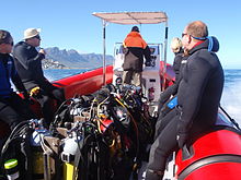
Peralatan
Peralatan standar
Sebagian besar lokasi penyelaman di wilayah ini relatif dangkal dan dapat dilakukan di udara dengan peralatan menyelam rekreasi biasa, yang meliputi:
- Pakaian selam lengkap dengan ketebalan minimal 5mm, tudung, sepatu bot, dan sarung tangan.
- Sebuah silinder dengan harness, regulator dan pengukur tekanan submersible.
- Perangkat kompensator daya apung (BCD).
- Masker dan snorkel.
- sirip.
- Sistem pemberat yang dapat dibuang dikalibrasi dengan benar untuk peralatan lainnya.
- Komputer selam atau pengukur kedalaman dan pengatur waktu dengan tabel dekompresi dan rencana penyelaman.
Untuk ini, Anda dapat menambahkan:
- Peralatan lebih lanjut yang Anda atau lembaga sertifikasi Anda mungkin anggap wajib, seperti regulator sekunder, inflator BCD tekanan rendah, pisau, dll.
- Peralatan apa pun yang Anda bawa atau gunakan sebagai pilihan pribadi, seperti kamera, alat pemberi sinyal, batu tulis di pergelangan tangan, setelan kering, pelampung penanda gulungan dan permukaan, pasokan gas alternatif, kompas, dll.
Rekomendasi
- Jika sirip Anda memiliki kantong kaki penuh (tumit tertutup), dan sepatu bot pakaian selam Anda memiliki sol yang lembut, mungkin Anda perlu memakai sepatu untuk mencapai titik masuk pada penyelaman pantai. Sirip tumit terbuka dan sepatu bot bersol keras direkomendasikan untuk sebagian besar penyelaman pantai di wilayah ini karena tanahnya cenderung kasar dan sepatu mungkin tidak berada di tempat Anda meninggalkannya saat Anda kembali dari penyelaman.
- Pelampung penanda permukaan standar tidak direkomendasikan di mana ada pertumbuhan rumput laut yang lebat, karena akan sering tersangkut dan menimbulkan gangguan yang tidak ada habisnya. Penanda permukaan yang dapat digunakan atau "tertunda" lebih baik di lokasi seperti itu dan selalu merupakan hal yang baik untuk dibawa saat menyelam dengan perahu.
- Meninggalkan salah satu item di atas adalah risiko Anda sendiri. Ada penyelam yang tidak akan memakai kerudung, atau sarung tangan, atau sepatu bot, atau merasa bahwa snorkel atau BC tidak diperlukan, atau mereka dapat menyelam dengan setelan 3 mm. Cobalah ini pada penyelaman yang mudah terlebih dahulu, di mana Anda bisa keluar dengan cepat. Ini mungkin berhasil untuk Anda – ada penyelam yang menangani setiap kasus ini, tetapi Anda telah diperingatkan.
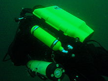
Peralatan tambahan

For each dive site there may be additional or alternative equipment required or recommended, which may improve the dive experience or improve safety at that site. The most commonly recommended items are:
- Compass
- Dry suit
- Light
- Nitrox
- Reel with DSMB
Use of a compass is recommended wherever it may be desirable to swim back to shore below the surface to avoid wind or boat traffic, or to keep below the kelp fronds. It is required for the compass navigation routes.
A dry suit is recommended for most dives on the Atlantic seaboard, or in general if the dive is deeper than about 20 m and the water is colder than 13°C. An appropriate undergarment is required for the dry suit, at this is what provides the insulation. With a suitable combination it is possible to enjoy an hour's dive in comfort at a water temperature of 8°C, when most of the divers in 7-mm wetsuits are cold after 30 minutes. If your face and head are particularly sensitive to cold, a full-face mask will keep your face warm.
Recommendations for a light are for daytime dives, as lights are considered standard equipment on night dives. Backup lights should be carried on night dives from a boat. Underwater flashers may not be well received by the other divers as they are extremely annoying. If you feel you must use one, warn the others and stay away from those divers who do not wish to have a light continually flashing in their peripheral vision and distracting them. A strobe which may be switched on in an emergency is another matter entirely, and is accepted as a valuable safety aid.
The equipment recommendations are for divers who are competent to use those items, and if you are not, you should consider whether your competence is sufficient to dive the site without this equipment.
No recommendations are made regarding equipment for wreck penetration dives and deep dives. If you do not know exactly what equipment is required and have it with you, or are not competent in its use, you should not do the penetration. Depth, wrecks and caves are nature’s tools for culling reckless divers.
Recommendations for gas mixtures are generic. You must choose the appropriate mixture based on your qualifications, competence and the dive plan. Nitrox mixtures are generally recommended to increase dive time without obligatory decompression stops, and Trimix to reduce narcotic effects. Nitrox is available from many of the dive shops, and charter operators will usually provide cylinders filled with the blend of your choice if given sufficient notice. Trimix is more difficult to arrange, as not many filling stations keep Helium in stock, so it may require a bit of shopping around.
Decompression dives should generally only be planned by divers who are familiar with the site, and are competent and properly equipped for the planned dive. Recommendations in this regard are outside the scope of this article, and it will be necessary to discuss any planned decompression dives well in advance with the dive operator, as only a few of them are competent and willing to support planned decompression dives, and those will usually require strong evidence of your competence to do the dive, and advance notice of your dive plan.
Exotic equipment

Diving equipment other than open circuit back mounted scuba with half mask and mouth-grip demand valve is considered to be exotic for this section.This would include surface supplied breathing apparatus and full face masks, used as standard equipment by commercial divers, and rebreathers, seldom used by commercial divers, but frequently used by military divers and gaining popularity with Technical recreational divers.
Also considered as exotic equipment is side-mount scuba and diver propulsion vehicles (scooters), as they are not used by many recreational divers.
Generally speaking, any use of surface supplied diving equipment will require special preparation and logistics, which are not available from the listed service providers, but are perfectly legal for use and technical support is available from the suppliers to the commercial diving industry in Cape Town.
Rebreathers are relatively uncommon, but are used by a few local aficionados, and sorb is available over the counter at a few suppliers. There is even one charter boat which regularly runs dives for mainly rebreather divers. Expect to be checked out for skills and certification before being allowed to join these dives, so it would be advisable to make prior arrangements. Technical support is available for a limited range and parts will usually only be available from overseas agencies. Most of the local dive sites do not really justify the expense and relative risk of rebreathers, and they are mostly used by divers who also use them in other places where they are more of an advantage, and by those who just enjoy the technology. They are not available for rental, except in some cases as part of a training package.
Full-face masks will not be a problem, provided you can show your ability to provide buddy support if diving with a partner (some charters will insist that you dive with a buddy). Technical support and parts are available from local agencies for most of the more popular models used for commercial and technical diving, but you may have to wait some time if parts are not in stock. The use of a full-face mask can be a particular advantage when the water is cold, and if you have one and prefer to use it, by all means bring it to Cape Town.
Side mount scuba is relatively uncommon in Cape Town, but there should be no problems if you chose to use it. Do not expect boat crews to know how to help you kit up, but they will probably respond well to explanations. There is a growing number of local side-mount aficionados, including several instructors for side-mount.
Diver propulsion vehicles (scooters) are rare but not unknown. Check with the charter boat whether will be space on board for your unit, and don't expect to find one for rental.
Decompression and bailout sets are not considered exotic, but are not easily available for rental. Bring your own, or ask around. Some of the service providers carry a small range of cylinders suitable for sling mount, but may not have the gas mixture you want in stock. Almost all the local divers that carry decompression or bailout cylinders routinely have their own equipment
Situs menyelam


The dive sites described in these articles include some which are well known favourites and have been dived frequently and by many divers for decades, and also newly described sites, which may only have been dived a few times, and by a few divers. There are also sites which have been known for years, but seldom dived due to their relative inaccessibility, and a few which are basically not particularly interesting, but have been included in the interests of completeness, as the information is available, and occasionally people want to know what they are like. With a few exceptions, the information provided is based on personal observation at the sites by Wikivoyagers. All photos of marine life and features of interest were taken at the listed site.
Geographical information is provided in as much detail as is available. Sites are geolinked, which allows them to be identified on various internet map systems. Positional accuracy is usually good. The maps provided should be usable, to scale, and accurate, but are not guaranteed either to be correct in all details or complete. Clicking on the thumbnail will open a link to a higher resolution image.
Atlantic coast of the Cape Peninsula

Introduction and some tips on diving the Atlantic coast.
This coastline from Table Bay to Cape Point is exposed to the south westerly swells generated by the cold fronts of the Southern Ocean. The continental shelf is narrow in this part of the coast and swells are not greatly influenced by the narrow band of shallow water, so they retain most of their deep-water energy. These swells pound this coast most of the winter, and to a lesser extent in summer, so diving in this region is mostly a summer activity, and the frontal weather patterns far to the south are more important than local weather for swell prediction.
North westerly winds are a feature of the approach of a cold front, and in winter they can be very strong for a few days before swinging to southwesterly as the front passes. These north westerly winter storms were responsible for many shipwrecks in Table Bay and other parts of the west coast, and the associated wind waves can be severe. However the fetch is short and these onshore wind waves do not last long after the storm. They do mess up the visibility though, and this effect lasts for some time after the waves have dissipated.
The south easterly winds are longshore to offshore in this area and tend to knock the swell down a bit. They also cause an offshore displacement of the surface water, which results in deeper water rising to take its place. This upwelling brings colder, initially cleaner water to the inshore areas, and can produce conditions of 20 m visibility and temperatures down to 8°C, though more usually 10° to 12°C. The diving is wonderful if you are sufficiently insulated. Out of the water, however, it is commonly fine and hot, with blazing sunshine high ultraviolet levels and air temperatures in the high 20 and 30° Celsius. This means you will be overheating until you get in the water, hence the comment that summer diving in Cape Town is one easy step from hyperthermia to hypothermia.
There is no escaping the need for a well-fitting, thick (preferably 7 mm), wet suit or a dry suit with an adequate undergarment for these conditions if you intend to stay for more than a few minutes. Carrying a bottle of water with your equipment to wet the outside of your suit before or after putting it on will help keep the temperature down due to evaporative cooling, specially on a windy day. Overheating after leaving the water is seldom a problem. The alternative option of kitting up at the water’s edge requires a shore party to look after your clothes, etc., while you dive, so it has become less common. Do not leave equipment unattended if you wish to see it again.
An upwelling is frequently followed by a plankton bloom, often called a red tide. This will reduce visibility considerably, particularly near the surface. Often the water will be much clearer below the surface layer, though the light levels may be a bit dim and the colour relatively green, or even brownish. The phytoplankton will bloom while the sun shines, so it is much more developed in summer.
The south-easter is an offshore wind at some sites, and besides its influence on temperature and visibility, it also affects the swim back to shore after the dive. The south-easter can appear seemingly out of nowhere on a previously cloudless and windless day, and build up to near gale force in the time you are underwater on a dive, though it is usually predictable, so take note of weather forecasts, and in any case, allow sufficient reserve air to swim back a few metres below the surface. A compass is extremely useful if you do this as it allows you to swim shallower, which is good for air consumption, decompression and warmth. A depth of 3 to 5 m is recommended for a long swim home. The strong south-easter in these cases produces a short, steep wind chop with white-caps which does not penetrate to any significant depth, but the constant slapping of waves and the spray in the air can make snorkelling unpleasant and difficult. There may also be a shallow offshore wind drift (surface current), but this takes some time to develop and gets rapidly weaker with depth and is not usually a problem below about a metre depth inshore. Further offshore the wind induced current can take you several hundred metres during a decompression stop, at a rate of about 0.5 to 1 kph.
When boat diving a deployable surface marker buoy (DSMB) is useful to both facilitate controlled ascent and accurate decompression or safety stop depth, and as a signal to the boat that you are on your way up. In strong wind conditions it will also improve your visibility on the surface, specially if your equipment is all black, so it is worth carrying even if only as a signalling device. Bright yellow has been shown to be best for all round visibility at sea, but orange and red are fairly good too.
Robben Island

These sites are all boat dives. There is no other practical way to get to them, as they are all several kilometres from the mainland across major shipping lanes.The waters around Robben Island were proclaimed a Marine Protected Area in 2019, so a permit is required to dive there. The boat operator will have to have a permit for the restricted area. Details of how this will be done are not yet known.
Local geography:Robben Island is a low, rocky shored island in the mouth of Table Bay. The island and surrounding reefs are rock of the Tygerberg series of the late Precambrian Malmesbury group. These are folded sedimentary rocks, frequently with very steep dip, which often weather to form rather jagged outcrops.
The sites include:
- 1 MV Treasure: S33°40.45' E018°19.95' (approximate)
- Wreck dive. Boat access only. Depth: 30 to 50 m
- On 23 June 2000 the damaged Panamanian registered bulk ore carrier sank off the coast of South Africa approximately 7 nautical miles north of Robben Island.
- The vessel lies upright on a fairly level bottom at about 50 m depth. The superstructure was removed shortly after the sinking by sawing it off at about 30 m depth with a cable towed by tugs as it was a hazard to shipping.
- 2 Robben Island steamer wreck: S33°49.886', E018°21.524' (approximate centre of wreckage)
- Wreck dive. Boat access only. Depth: 30 to 36 m
- Unidentified wreck of a steel steamship about 48 m long in reasonable structural condition.
- 3 MV Afrikaner: S33°50.012' E018°20.686'
- Boat access only. Deep wreck dive. Depth 43 to 50 m
- The 61 m fishing vessel struck Whale Rock in 1993 and sank while being towed away from the rock.
- 4 Whale Rock: S33°50.112' E018°22.858'
- Reef dive. Boat access only. Depth: Mostly less than 10 m
- A large shoal area of rocky reef, usually with a break over the pinnacle, which is the last resting place of a few ships.
- 5 SS Hypatia: S33°50.10’ E018°22.90’ (Turner 1988)
- Wreck and reef dive. Boat access only. Depth: Shallow, maximum probably about 15 m
- British Houston Line steamer of 5 728 tons, built in 1902. Wrecked on Whale Rock in Table Bay on 29 October 1929 in fog while on a voyage from Beira to New York with a cargo of blister copper and chrome ore.
- 6 MV Daeyang Family: S33°50.388' E18°23.133
- Wreck and reef dive. Boat access only. Maximum depth about 15 m
- A large Korean ore carrier which was wrecked on Whale Rock on 1 March 1986 when anchors dragged in heavy weather. The wreckage lies at a depth of about 15:nbsp;m
Table Bay

- 7 MV Winton: S33°52.1514' E18°29.1828 (Engine block)
- Wreck dive. Boat access, though shore access is feasible. Close to surf line. Maximum depth about 6 m.
- Wreck of a small steel freighter on a flat sand bottom.
- 8 MV Gemsbok: S33°53.0' E018°20.5'
- Boat access only. Deep wreck dive. Depth about 57 m on the sand.
- The 50 m 313 tonne buoy tender MV Gemsbok capsized and sank about 4 km from Green Point Lighthouse on 2 Seprember 1975 while transferring an anchor chain of a cargo vessel. The chain snagged and the weight of the chain caused the vessel to capsize and sink within minutes. The wreck lies on its starboard side.
- 9 Highfields: S33°53.13’ E018°25.83’ (Bow)
- Wreck dive. Boat access only. Close to major shipping lane at harbour mouth. Maximum depth 24 m.
- Wreck of a steel barque which sank after a collision in 1902.
- 10 SS Cape Matapan: S33°53.233' E018°24.533' About a kilometer north of Granger Bay harbour
- Wreck and reef dive. Boat access only. Maximum depth 25 m. The wreck is close to the shipping lane and there are no landmarks nearby.
- Wreck of a steel fishing boat which was sunk in a collision in 1960 in heavy fog.
- 11 RMS Athens: S33°53.85’ E018°24.57’
- Wreck and reef dive. Shore or boat access. Maximum depth about 7 m
- Union Company iron steam screw barque of 739 tons, built in 1856. Wrecked between Mouille Point and Green Point on 17 May 1865 during a north-west gale while trying to steam out of Table Bay. The site can be identified by the remains of the engine-block, which is visible above the water.
- 12 SS SA Seafarer: S33°53.80’ E018°23.80’
- Wreck and reef dive. Boat access recommended. Depth: Fairly shallow. Mostly between 5 and 9 m.
- The 8000-ton Safmarine freighter SS South African Seafarer was wrecked in a north westerly gale on 1 July 1966, and lies in front of the Green Point lighthouse.
- 13 Two Oceans Aquarium: S33°54.476’ E018°25.074’
- Shore access only. Confined water. Maximum depth 6 m
- Visitors may dive in the Predator tank, which is a large oval tank, or the Kelp Forest tank, which is roughly square. There are large windows, almost full height on one side, through which you can observe the other visitors watching you if you get bored with the fish.
Sea Point

Local Geography:There is a narrow coastal plain at the base of Signal Hill and Lion’s Head. The contact zone between the intrusive granites of the Semenanjung pluton and the sedimentary greywackes and shales of the Tygerberg formation of the Malmesbury series is in this area.The northern sites are on the Tygerberg rocks, which are steeply dipped and form parallel ridges and gullies, while Bantry Bay is on the granite, and has the characteristic corestone topography of rounded boulders and outcrops with sand bottom in deeper areas.
The sites include:
- 14 Three Anchor Bay: S33°54.36’ E018°23.85’
- Reef dive. Shore access. Depth: Shallow
- A small sand bottomed bay with reef to both sides. Easy access.
- 15 Sea Point Ridge Pinnacles: S33°54.905' E018°21.421'
- Reef dive. Boat access. Depth: 17 to 27 m
- An isolated pair of corestone pinnacles on a low granite ridge.
- 16 Bantry Bay: S33°55.56’ E018°22.65’
- Reef dive. Shore or boat access Depth: Less than 10 m
- This little bay is at the southern end of Sea Point, towards Clifton.
Clifton

Clifton Rocks is generally considered a shore dive, but the Paws are quite a distance offshore and are only dived from boats. Parking in Clifton is often a problem, particularly in the kind of weather in which you may wish to go diving. Weekdays will be better and early morning will help. The offshore dives avoid this problem by using boats from Oceana Power Boat Club slipway, which has its own parking problems, though not quite as serious.
Local geography:The suburb of Clifton is built on the rather steep slopes of the base of Lion’s Head above Clifton Bay. There are four beaches in the bay which are famous for white sand, shelter from the south easter and cold water. North Paw is offshore of the headland to the north, and South Paw is offshore from Clifton Rocks, on the south headland. Access to the area by road is from Sea Point to the north and Camps Bay to the south.
The reefs of Clifton are granite corestones of the Semenanjung pluton. In this area the granite base of the mountain extends to approximately the height of Signal Hill, and is capped by sandstones of the Graafwater and Table Mountain formations. Occasional rounded granite outcrops can be seen on the mountainside, which is mostly deeply weathered granitic saprolite, with some sandstone scree.
The sites include:
- North Lion’s Paw: S33°55.854’ E018°21.849’ (Exposed Rock)
- Reef dive. Boat access only. Depth: 15 to 23 m.
- A spectacular site in good conditions. A popular part of the site is the cave rock, which is slightly offshore from the exposed rocks.
- 17 North Lion’s Paw Northern Pinnacles
- 18 North Lion’s Paw Monty's Pinnacles
- 19 North Lion’s Paw Eastern Pinnacle
- 20 North Lion’s Paw Barry's Pinnacles
- 21 North Lion’s Paw Cave Rock
- 22 North Lion’s Paw Main Reef
- 23 South Lion’s Paw: S33°56.308’ E018°21.890’
- Reef dive. Boat access only. Maximum depth about 20 m.
- An extensive reef of granite corestones marked by the large outcrop which extends above the water.
- 24 Clifton Rocks: S33°56.346’ E018°22.222’
- Reef dive. Shore or boat access. Maximum depth about 14 m.
- A large area of granite corestones, bounded to the north by sand bottom. The reef extends to seaward from the shoreline at the point.
- 25 Cleeve's Tunnel: S33°56.540' E018°21.894'
- Reef dive. Boat access. Maximum depth about 20 m.
- A large corestone pinnacle with a long low tunnel
Camps Bay
Local geography:Camps Bay is in the corner made by Lion’s Head and Table Mountain. Access is over Kloof Nek from the city bowl, and round the coast from Sea Point via Clifton to the north, and from Hout Bay via Oudekraal to the south
The reefs of this area are like those of Clifton.
The sites include:
- 26 Bakoven Rock: S33°57.555’ E018°22.204’
- Reef dive. Shore or boat access. Maximum depth 17 m.
- This site is generally considered a shore dive. Parking is limited so it is most conveniently dived during the working week when there is less competition for space, otherwise get there early.
Oudekraal

This area includes some of the best and most popular shore dive sites on the Atlantic seaboard. Most can also be dived from a boat, and this is of particular importance to divers with restricted mobility on shore, as there is generally a rugged bit of coast to negotiate and in some cases a long climb. There is also a moderate to long swim at some of the sites, and at some states of the tide, heavy kelp inshore.
Local geography:The coastline at the base of the Twelve Apostles range just south of Table Mountain is steep, and south of Camps Bay, virtually undeveloped. Fortunately for divers, the coastal road is not far above sea level in the north of this area, and though there are not many off-road parking areas, the road is wide enough to park along the side.
This is an area of pale grey Semenanjung Granite corestone outcrops and boulders with some Table Mountain Sandstone boulders which have rolled down the mountainside to the water’s edge. The mountainside below the sandstone cliffs is deeply weathered granite saprolite with occasional corestone outcrops. The cuttings at the roadside display the granular yellow-brown saprolite with a thin soil covering. The underwater topography is almost entirely corestones exposed by erosion, surrounded by samd, and is a continuation of the granite boulders and outcrops at the water’s edge.

North Oudekraal
The sites include:
- 27 Terumbu Gimbal: S33°58'22.05" S18°21'42.59"
- Reef dive. Boat access. Depth: 1.5 to 20 m.
- A relatively new site. First survey 30th January 2010. This granite ridge peaks about 1.5m from the surface at low tide, but the tip is small and seldom breaks. Bottom on low granite at about 20m. Colourful and diverse invertebrate cover, and notable for the relatively large colonies of Dreadlock hydroids.
- 28 Geldkis Blinder: S33°58.67’ E018°21.62’
- Reef dive. Boat or shore access. Maximum depth about 20 m.
- A relatively infrequently dived site. The highest rock on the reef is a blinder beyond Geldkis rock which occasionally breaks the surface at low tide. Huge boulders and outcrops, and a few swimthroughs.
- 29 Batu Strawberry: S33°58.725’ E018°21.658’ (approximate)
- Reef dive. Shore or boat access. Maximum depth about 15 m.
- The two smaller rocks to the north of Geldkis rock. Several small caverns and swimthroughs.
- 30 Geldki: S33°58.73’ E018°21.61’
- Reef dive. Shore or boat access. Maximum depth about 15 m.
- A large group of rocks with lots of overhangs, swimthroughs and chimneys. The Dutch East Indiaman Het huys te Craijestein was wrecked on the rocks in the bay at Oudekraal on 27 May 1698 in thick mist. Three chests of treasure disappeared and the name "Geldkis" (money-chest) appears on maps of the area and is now applied to the offshore rocks.
- 31 Boardroom: S33°58.761’ E018°21.151’
- Reef dive. Boat access, though possible from shore. Maximum depth about 21 m near the pinnacle, but deeper water nearby. about 10 m on top.
- A very large boulder with a large swimthrough cave and a large overhang in an area of high profile boulder reef.
- 32 Het Huis te Kraaiestein: S33°58.85’ E018°21.65’
- Wreck and reef dive. Shore access. Maximum depth 10 m.
- Remnants of the Dutch East Indiaman Het Huis te Kraaiestein of 1,154 tons, which was wrecked in the bay at Oudekraal on 27 May 1698 in thick mist while trying to find the way into Table Bay. Some cannon, anchors and a few baulks of timber are all that are usually visible above the sand.
- 33 puncak jamur: S33°58.781’ E018°21.521’
- Reef dive. Shore or boat access. Maximum depth 17 m.
- A submerged granite tor (stacked group of large corestones) between Geldkis and Justin’s Caves. The pinnacle is surrounded by lower outcrops separated by sandy gullies.
- 34 teluk berpasir: S33°58.90’ E018°21.65’
- Reef dive. Confined waters. Shore access. Maximum depth 4 m
- A shallow sheltered cove at Oudekraal, suitable for open water training exercises, refresher courses and testing equipment when you don’t need depth. Entry area for several other sites.
- 35 Gua Justin: S33°58.85’ E018°21.50’
- Reef dive. Shore or boat access. Maximum depth about 13 m.
- A group of big granite corestone outcrops and boulders with several swimthroughs, overhangs, caves and deep narrow gaps between the rocks. Spectacular in good visibility, colourful reef life.

Central Oudekraal
The sites include:
- 36 Antipolis: S33°59.06’ E018°21.37’ (Bow section)
- Wreck and reef dive. Shore or boat access. Maximum depth about 10 m.
- The tankers "Romelia" and "Antipolis" were under tow on 28 July 1977 during a north westerly gale when the tow cable to the "Antipolis" snagged on the sea bed. In the ensuing confusion the cables broke and the two ships were driven aground by the wind. The "Antipolis" ran aground at Oudekraal and was later cut down to water level.
- 37 Klein Pannekoek: S33°58.91’ E018°21.09’
- Reef dive. Boat or shore access. Maximum depth about 15 m.
- A group of large fairly low and flat rocks visible offshore to the west of the "Antipolis" and north of Coral Gardens.

South Oudekraal
The sites include:
- 38 Groot Pannekoek: S33°59.13’ E018°20.75’
- Reef dive. Boat or shore access. Maximum depth about 15 m
- A large flattish outcrop of granite, which extends a short way above the sea level at all tides. Some overhangs, crevices and small caves.
- Taman Karang (Oudekraal): S33°59.270' E018°20.782' (The pinnacles)
- Reef dive. Shore or boat access. Maximum depth 17 m
- A spectacular dive in good conditions. Huge granite boulders in groups with open patches between them. There are overhangs, small caverns, a few swimthroughs, and many deep gaps and crevices. Extensively covered in colourful reef life. Possibly the best shore dive on the Atlantic side of the Cape Peninsula on a good day.
- 39 Taman Karang
- 40 Coral Gardens Lepas Pantai Pinnacle
Llandudno

These sites can be accessed from the shore or by boat. Parking is limited, but the area is reasonably secure. Some walking is required, but no serious climbing as the parking is near the sea level.
Local geography:The small residential suburb of Llandudno is built on the moderately steep slopes of the Cape Peninsula below the peak of Klein-Leeukop, where the coast road (M6 – Victoria Drive) from Camps Bay crosses over the neck to Hout Bay. There is only one way into Llandudno by road, which is from the M6 near the top of the pass.This is an area of granite corestone reefs with sand bottom.
The sites include:
- 41 Rasul ke-13: S33°59.486' E18°19.922'
- Reef dive. Boat access. Depth: 10 to 24 m.
- A large granite pinnacle on an area of low granite reef with occasional sand patches.
- 42 Llandudno Reef: S34°00.037' E18°19.897'
- Reef dive. Boat access. Depth: 10 to about 30 m, on sand
- An unsurveyed granite reef, with several pinnacles, outcrops and gullies.
- 43 Teluk Logies: S34°00.25’ E018°20.53’
- Reef dive. Shore access. Maximum depth probably about 10 m.
- A small rocky cove to the north of Llandudno beach.
- 44 MV Romelia: S34°00.700’ E018°19.860’ approximately
- Wreck and reef dive. Shore or boat access. Maximum depth about 24 m.
- The tankers Romelia and Antipolis were under tow on 28 July 1977 during a north westerly gale when the tow cable to the Antipolis snagged on the sea bed. In the ensuing confusion the cables broke and the two ships were driven aground by the wind. Itu Romelia ran aground at Sunset Rocks, Llandudno, where its back was broken by the heavy surf and the ship split in two. Later the bow section sank, leaving the stern mostly above sea level on the rocks. Over the years the stern section has also broken up and is no longer visible above the water.
Oude Schip headland
Local geography:Oude Schip headland lies at the foot of the Karbonkelberg between Sandy Bay to the north and Leeugat to the south, It is a low rocky headland of Peninsula granite, with several reef dives and one known wreck. It is a fairly exposed section of coast but protected from the south easterly winds by the mountain. The sites are only accessible by boat as there is no road access to this part of the shore, and most are too far offshore to safely swim.
This is an area of granite bedrock of the Semenanjung pluton, The reefs are exposed corestone outcrops and boulders, with sand patches in the deeper areas
The sites include:
- 45 Langkah: S34°01.330’ E018°18.600’
- Reef dive. Boat access only. Maximum depth about 20 m.
- An area of high granite reef with deep gullies. Not actually in Leeugat, but just north of Oude Schip headland.
- 46 MV Harvest Capella: S34°01.600’ E018°18.750’
- Wreck dive. Boat access only. Maximum depth about 15 m.
- An area of mostly flattish granite reef with a few ridges and some wreckage of a steel motor fishing vessel, some of which has washed up onto the point and is visible from a distance. Not actually in Leeugat, but on the north shore of Oude Schip headland.

The Blue Flash Reefs
- 47 Rachel's Reef: S34°01.431' E018°18.151'
- Reef dive. Boat access only. Depth between about 3 and 21 m.
- Rachel's Reef is a compact granite pinnacle with surrounding high profile reef.
- 48 Humpback Ridge: S34°01.548' E018°18.142'
- Reef dive. Boat access only. Depth between about 4 and 21 m.
- A fairly massive granite pinnacle in the middle of a more extensive north-south ridge rising to about 12 m. Humpback whales have been seen near these reefs on several occasions.
- 49 Wilhelm's Wall: S34°01.502’ E018°17.931’
- Reef dive. Boat access only. Depth between about 12 and 31 m.
- A granite ridge somewhat more than 50 m long with sheer faces to the north and south, a flattish bottomed gully to the south, and another, more broken ridge south of the gully. Colourful sessile invertebrates on the sides and seaweeds on top.
The Middelmas reefs:
- Hakka Reef (Middelmas): S34°01.747’ E018°18.328’
- Reef dive. Boat access only. Maximum depth about 21 m.
- 50 Die Middelmas is a rock that projects several metres above the water at all tides, to the west of the Oude Schip peninsula.
- 51 Hakka Reef Southeast pinnacles is off this rock.
- 52 Hakka Reef Sven's Caves pinnacles is nearby at a set of pinnacles near a sand patch.
- 53 Twin Towers: S34°01.920’ E018°18.330’
- Reef dive. Boat access only. Depth about 20 m at the tops of the pinnacles to 34 m on the sand.
- A small but tall double-peaked granite pinnacle on a narrow base reef and surrounded by sand.
Leeugat (Maori Bay)

.jpg/220px-Gelderland_(1).jpg)
Although several of the sites are quite close inshore, this area is in practice only accessible by boat, as the distance to the nearest parking is too far to carry dive gear (about 3 km as the crow flies, more on foot).
Local geography:Leeugat, also known to divers as Maori Bay, lies at the foot of the Karbonkelberg, between the northern headland of Oude Schip, and Duikerpunt to the south. It is a small bay, but fairly deep close inshore, which in combination with the partial barrier afforded by the reefs at the headlands, has provided the wrecks in Leeugat bay with better protection from wave action than those on more exposed parts of the coastline. This means that not only have they lasted well for their ages, but conditions are suitable for diving more often than for many other wrecks on the Atlantic seaboard of the Cape Peninsula.
This is an area of granite bedrock of the Semenanjung pluton, The reefs are exposed corestone outcrops and boulders, with sand patches in the deeper areas
The sites include:
- 54 MV Keryavor and the Jo May: S34°02.037’ E018°18.636’
- Wreck and reef dive. Boat access only. Depth: Not available, probably between 25 and 30 m.
- These two wrecks lie next to each other approximately between the Maori and the Gelderland. Itu Jo May sank first and not much of her wooden structure remains. Itu Ker Yar Vor was a steel lobster fishing vessel and several chunks of hull structure and twisted sections of plating remain.
- 55 SS Maori: S34°02.062’ E018°18.793’ (Machinery)
- Wreck and reef dive. Boat access only. Depth: 6 to 21 m
- SS Maori was a typical British steam cargo vessel of the early 1890s. The ship was wrecked in the bay between Oude Schip and Duikerpunt on 5 August 1909 in thick fog and drizzle while on a voyage from London to New Zealand.
- 56 SAS Gelderland: S34°02.070’ E018°18.180’
- Wreck and reef dive. Boat access only. Depth: 30 to 35 m
- The Ford class Seaward Defense Boat SAS Gelderland was scuttled on 21s ecember 1988, north west of Duiker Point, as demolition trials.
- The vessel was about 40 m long but the main part of the wreckage is now only about 20 m long as the bow and stern sections were blown right off.
- Plan B pinnacle is just to the south of the southernmost wreckage.
- 57 SS Oakburn / MV Bos 400: S34°02.216’ E018°18.573’
- Wreck and reef dive. Boat access only. Depth: Maximum 22 m
- The "Oakburn", a British cargo steamer of 3865 tons, was wrecked on the north side of Duikerpunt in fog on 21 May 1906, on a voyage from New York to Sydney. The Oakburn has pretty much fallen apart, and on 27 June 1994, the French pipe-laying crane barge Bos 400, broke its towline and stranded virtually on top of the older wreck. The Bos has started to break up, and two large sections have collapsed into the sea, though the main crane section is still firmly stuck on top of the rocks.
Outer Hout Bay


This area includes the dive sites between Duiker Point and Duiker Island and the extensive reefs to the south as far as Vulcan Rock and Tafelberg Reef. All of these are only accessible by boat. There are a number of sites being explored in this area: the reefs between Kanobi’s wall and Stonehenge, and a wreck of a lifeboat which was used to salvage materials from the Boss 400 and which lies between Stonehenge and Duiker Island are among these. There are several unexplored pinnacles in the region identified on the SAN charts as bakleiplaas, where the sea is often very lumpy due to the influence of the underwater topography on the swell.
Local geography:The suburb of Hout Bay lies in the valley between the Constantiaberg to the east and the peninsula formed by Karbonkelberg and its lesser peaks to the west. One of these peaks, the Sentinel, gives its name to a dive site at its foot. At the mouth of the valley is the business area of Hout Bay, with its small commercial fishing harbour and marina, and a public slipway used by dive charters and private dive boats for access to most of the southern peninsula dive sites on the Atlantic coast. The slipway is in good condition, wide and accessible, and has a large parking area, which on occasions can be crowded due to heavy use by commercial fishing skiboats.
The bedrock of this area is granite of the Semenanjung pluton, and most of the sites are on corestone reefs of this rock.
The sites include:
Duiker Point sites:
- 58 Die Perd: S34°02.282’ E18°18.324’
- Reef dive. Boat access only. Depth: Not available, maximum probably about 20 m
- This rock off Duiker Point extends above the water and is surrounded by rugged reefs of high outcrops and deep gullies.
- 59 Kanobi’s Wall: S34°02.365’ E018°18.138’
- Reef dive. Boat access only. Maximum depth about 25 m.
- This blinder off Duiker Point is a good site with rugged topography, good biodiversity and large depth variation. Huge boulders are stacked, with tunnels, overhangs and caves of various sizes, and lots of vertical walls, some probably 10 m or more in height.
- 60 SURG Pinnacles: S34°02.375' E018°18.015'
- Reef dive. Boat access only. Depth 9 to over 30 m.
- A group of steep granite corestone pinnacles, probably mostly huge boulders, with walls, overhangs and a swimthrough. Deep narrow cracks divide the pinnacles. Spectacular topography, covered with lots of sea urchins and vast numbers of hairy brittlestars, a moderate variety of sponges, noble corals, gorgonians, and patches of cauliflower soft coral. Red bait and Laminaria on the tops of the pinnacles. Surge can be strong when a long swell is running.
- Star Wall: S34°02.466' E18°18.087' (pinnacle)
- Reef dive. Boat access only. Depth: 6 to 32 m.
- This site has the tallest and longest wall known in the Cape Town area and is a dive site well worth visiting. A massive and continuous granite wall of about 25m almost vertical height, extending for a length of 100 m on the south face and 50 m on the south-east face. Very diverse and colourful invertebrate cover on the wall face. The sites are:
- 61 Star Wall
- 62 Star Wall - M&M Cave
- 63 Star Wall - Lollipop Pinnacle
- 64 Sunfish Pinnacle: S34°02.475' E18°18.290' (pinnacle)
- Reef dive. Boat access only. Depth: 7 to 26 m.
- A fairly large pinnacle on a rocky bottom on the way to Duiker Point from Hout Bay harbour, which has been picked up quite frequently on the echo sounders of dive boats passing over it. It has now been dived, and to some extent mapped. The site is quite pretty and should make a pleasant alternative site. Topography is rugged, with high vertical walls on two sides of the pinnacle.
Stonehenge sites:
- 65 Canyon: S34°02.595’ E018°18.073’
- Reef dive. Boat access only. Maximum depth about 35 m.
- The area is named for a gully between rows of pinnacles. Big boulders and rock outcrops cover an extensive area.
- Stonehenge: S34°02.838’ E018°18.316’
- Reef dive. Boat access only. Maximum depth about 22 m.
- The area is named for a group of tall rocks which break the surface. Big boulders and rock outcrops cover an extensive area. High profile in the deeper areas, with swimthroughs, holes and overhangs. Heavy kelp in some areas. Included in this area, Stonehenge Blinder, a pinnacle that approaches the surface and breaks in a large swell or at low tide.
- 66 Stonehenge Dusky Pinnacles - Coral Pinnacle
- 67 Stonehenge North
- 68 A-340 Pinnacle
- 69 Stonehenge Central
- 70 Stonehenge South
- 71 Stonehenge Blinder
- 72 Stonehenge Wreck
Seal Island sites:
- 73 Seal Island (Duiker island): S34°03.458’ E018°19.562’
- Reef dive. Boat access only. Kedalaman: Dangkal, sebagian besar kurang dari 6 m.
- Pulau kecil berbatu yang ditandai pada peta dan peta sebagai Duikereiland telah dikenal sebagai Pulau Anjing Laut karena koloni penduduk anjing laut yang telah menjadi daya tarik wisata. Seharusnya tidak bingung dengan Pulau Segel di Teluk Palsu.
Situs Vulcan Rock:

- 74 Retak Di: S34°03.855' E018°18.400' – Puncak 14m besar - batu besar di atas karang .Sekitar 300 m barat laut (328° magnet) Vulcan Rock
- Menyelam karang. Akses perahu saja. Kedalaman: 10 hingga 30 m.
- Penyelaman yang spektakuler jika visibilitasnya bagus. Banyak dinding dan overhang, kolam renang dan retakan yang dalam dan lebar. Tutupan invertebrata yang kaya. Situs yang bagus untuk fotografi pemandangan sudut lebar yang dramatis.
- 75 Batu Vulkan: S34°03.967’ E018°18.582’
- Menyelam karang. Akses perahu saja. Kedalaman maksimum lebih dari 25 m di dekat batu.
- Batuan vulkanik adalah titik tertinggi dari terumbu granit besar dan memecah permukaan pada beberapa keadaan pasang. Itu rendah dan datar di atasnya. Penyelaman yang spektakuler jika visibilitasnya bagus.
Situs Tafelberg Reef:
- 76 Karang Tafelberg: S34°04.22' E018°18.93'
- Menyelam karang. Akses perahu saja. Kedalaman: 8 hingga 30 m.
- Daerah yang luas dari singkapan granit kasar dengan relief tinggi dan dasar pasir sekitar 29 m ke arah barat. Celah dan parit yang dalam. Tidak banyak menjorok, tetapi banyak wajah vertikal. Topografi yang sangat kasar dan spektakuler dalam visibilitas yang baik.
- 77 Karang Tafelberg Klein (Mangkok salad, bangkai kapal pesiar): S34°04.442' E018°19.191'
- Menyelam karang. Akses perahu saja. Kedalaman: 14 hingga 36 m.
- Singkapan granit besar dengan batu-batu besar. Dasar pasir di daerah yang lebih dalam. Topografi yang kasar dan spektakuler. Puing-puing kapal pesiar GRP terletak di lekukan di sisi puncak. Dimungkinkan untuk melakukan penyelaman 40 hingga 45 m mulai dari pasir di sebelah timur karang, dan berenang ke atas karang dengan arah barat laut, tetapi kemungkinan diperlukan dekompresi jika Anda benar-benar mencapainya. puncak yang dangkal.
- Tafelberg Deep:
- Menyelam karang. Akses perahu saja. Kedalaman maksimum sekitar 40 m di atas pasir.
- Singkapan granit profil rendah hingga sedang, miring ke arah Tafelberg Deep Pinnacle selatan puncak di Klein Tafelberg Reef. Dimungkinkan untuk melakukan penyelaman 50 m dan berenang ke atas karang, tetapi beberapa dekompresi akan diperlukan.
- 78 Tafelberg Deep
- 79 Tafelberg Deep Pinnacle
Teluk Hout


Daerah ini termasuk situs antara Sentinel dan Chapmans Peak. Sebagian besar adalah penyelaman perahu. Satu-satunya pengecualian, Sentinel, dapat diakses melalui darat tanpa kesulitan besar, tetapi memiliki masalah keamanan.
The Sentinel adalah area khas garis pantai granit, dengan sejumlah besar batu besar di sepanjang pantai dan terumbu batu inti dengan profil bulat biasa. Bangkai kapal Aster dan Katsu Maru berada di dasar pasir datar, dan situs di Die Josie berada di granit yang relatif tidak lapuk di dasar tebing Lower Chapman's Peak
Situs-situs tersebut meliputi:
- 80 Penjaga:
- Menyelam karang. Akses pantai atau perahu. Kedalaman: Sebagian besar kurang dari 10 m.
- Ini adalah tempat di pantai Atlantik di mana kontur kedalaman 30 m paling dekat dengan pantai.
- Sentinel dianggap oleh beberapa orang sebagai area di bawah tebing vertikal, dan merupakan area terumbu datar dengan banyak rumput laut dan ubur-ubur kotak, dan beberapa batu besar.
- The Pinnacles adalah sekelompok batu di dekat pantai di luar pelabuhan Hout Bay, dekat tempat pembuangan limbah.
- 81 MV Aster: S34°03.891’ E018°20.955’
- Penyelaman kecelakaan. Akses perahu saja. Kedalaman maksimum 28 m.
- Kapal Penangkap Ikan Motor "Aster" 340 ton, panjang 27 m adalah kapal penangkap ikan lobster terdaftar Afrika Selatan yang disiapkan sebagai terumbu buatan ramah penyelam dengan membersihkan dan memotong bukaan ke dalam struktur dan ditenggelamkan di Teluk Hout dekat bangkai kapal "MV Katzu Maru" pada tanggal 9 Agustus 1997. Telah digunakan sebagai tempat pelatihan untuk penetrasi bangkai kapal. Kapal tegak di bagian bawah dan mulai pecah.
- 82 MV Katsu Maru: S34°03.910' E018°20.942' (di tengah bangkai kapal)
- Penyelaman kecelakaan. Akses perahu saja. Kedalaman maksimum sekitar 30 m.
- Kapal pukat Jepang "Katsu Maru #25" menabrak sebuah benda tak dikenal di laut dan berlubang di sisi pelabuhan. Saat diderek ke Teluk Hout, kapal itu kebanjiran dan tenggelam di teluk itu pada 7 Agustus 1978. Bangkai kapal itu terletak di sisi kanan di dasar pasir.
- 83 Mati Josie: S34° 04.497' E018° 21.256'
- Menyelam karang. Akses perahu saja. Kedalaman: 7 hingga 17 m.
- Terumbu dangkal di bawah Chapman's Peak, yang dekat dengan pelabuhan Hout Bay dan cocok untuk penyelaman malam hari. Salah satu dari sedikit daerah di mana granit tidak dibulatkan oleh pelapukan, seperti yang dapat dilihat dari tebing di atas situs.
Semenanjung Selatan Atlantik

Daerah ini mencakup semua pantai semenanjung selatan Noordhoek. Tidak sering menyelam untuk tujuan rekreasi karena jauh dari lokasi peluncuran yang bagus dan tidak banyak lokasi penyelaman yang diketahui. Ada beberapa bangkai kapal di daerah ini, terutama di Albatross Rocks/Olifantbospunt. Hanya beberapa bangkai kapal yang telah diidentifikasi secara positif.
Situs-situs tersebut antara lain:
- 84 SS Clan Monroe: S34°08.817' E18°18.949'
- Penyelaman kapal karam dan karang. Akses perahu saja. Kedalaman: 4 hingga 8 m.
- Hancur sedikit di utara mercusuar Slangkop di Kommetjie. Sangat jarang menyelam. Terumbu batu pasir datar dangkal, dengan puing-puing bertatahkan alga koral.
- SS Thomas T. Tucker:
- Penyelaman kapal karam dan karang. Akses perahu saja. Kedalaman: Dangkal
- Kapal ini terdampar tinggi di atas bebatuan, dan sebagian puingnya terlihat di pantai. Sebagian besar reruntuhan berada di perairan yang cukup dangkal.
- 85 Bintang Afrika:
- Penyelaman kapal karam dan karang. Akses perahu saja. Kedalaman: maksimum sekitar 27 m.
- 86 SS Bia: Bagian busur: S34°16.140' E018°22.812' Bagian utama: S34°16.217' E018°22.638'
- Penyelaman kapal karam dan karang. Akses perahu saja. Kedalaman: 3 hingga 8 m.
- 87 SS Umhlali: S34°16.435' E18°22.487'
- Penyelaman kapal karam dan karang. Akses perahu saja. Kedalaman: 5 hingga 8 m.
- 88 Batu Albatros: S34°16.495' E18°22.197'
- Menyelam karang. Akses perahu saja. Kedalaman: Mungkin kurang dari 15 m di dekat batu.
- Karang Barat Daya South:
- Menyelam karang. Akses perahu saja. Kedalaman: Tidak pasti.
- Area besar terumbu dangkal dan hamparan rumput laut di sebelah barat ujung semenanjung. Ini adalah tempat yang sering dikunjungi oleh spearfisherman dan penangkap udang karang dan belum dijelajahi dengan scuba.
Pantai False Bay di Cape Peninsula


Pengantar dan beberapa tips menyelam di pantai False Bay di Cape Peninsula (sisi Simon's Town)
Tidak seperti wilayah lainnya, sisi barat False Bay terlindung dari angin baratan musim dingin, tetapi sebagai imbalannya, wilayah ini menghadap ke arah Tenggara. Akibatnya wilayah ini biasanya tenggelam di musim dingin, ketika Tenggara jarang berhembus lama atau dengan kekuatan besar.
Badai frontal musim dingin di atas Samudra Selatan menghasilkan gelombang besar yang diperlambat oleh landas kontinen dan dibiaskan serta menyebar di sekitar Semenanjung Cape, sehingga sebagian besar menyebar sejajar dengan garis pantai, dan telah kehilangan banyak energinya pada saat mereka membelok ke arah pantai. Bentuk pantai yang tidak beraturan di sini juga melindungi beberapa daerah lebih dari yang lain. Secara umum, bagian pantai yang lebih mengarah ke barat laut ke tenggara lebih terlindungi dari gelombang barat daya daripada bagian utara ke selatan, sehingga pilihan lokasi penyelaman tergantung pada pola cuaca terkini.
Selama bulan-bulan musim panas ketika angin tenggara bertiup lebih sering, lebih lama, dan umumnya lebih keras, daerah ini tidak sering dapat menyelam, dan jarak pandang umumnya lebih buruk daripada di musim dingin bahkan ketika kondisi sebaliknya cocok.
Suhu air selama bulan-bulan musim dingin di daerah ini umumnya lebih hangat daripada pantai Atlantik di musim panas, yang merupakan kompensasi untuk siang hari yang lebih pendek dan cuaca yang sering dingin dan hujan.
Suhu air dapat bervariasi dengan kedalaman. Biasanya ada termoklin di musim panas, dan visibilitas dapat berubah secara signifikan di bawah termoklin. Permukaannya bisa 18 atau 19°C dengan 10 atau 11°C di bagian bawah, tetapi perbedaannya lebih mungkin 5 °C atau kurang. Kondisi di kedalaman tidak mudah diprediksi, dan mungkin lebih baik atau lebih buruk daripada di dekat permukaan. Mungkin ada plankton mekar di lapisan permukaan dan peningkatan visibilitas mendadak dari 3 m atau kurang menjadi lebih dari 10 m di dasar air yang dingin. Kedalaman termoklin juga tidak terlalu dapat diprediksi, tetapi telah diketahui antara 12 dan 20 m di akhir musim panas.
Di musim dingin air mungkin memiliki suhu yang sama dari atas ke bawah, dan karena sinar matahari lebih sedikit untuk memberi daya bagi fitoplankton mekar, visibilitas dan penerangan alami bisa lebih baik meskipun ada lebih sedikit cahaya.
Di antara front dingin dan hujan sering ada hari-hari dengan sedikit atau tanpa angin, dan sinar matahari ringan hingga hangat, ketika airnya datar dan jernih dan penyelamannya luar biasa, dan banyaknya lokasi membuat sulit untuk memutuskan ke mana harus pergi karena ada begitu banyak pilihan. Ini adalah kehidupan yang sulit di sini di ujung Afrika, tetapi seseorang harus melakukannya.
Suhu air selama musim dingin biasanya antara 13°C dan 17°C, meskipun diketahui turun hingga 11°C, jadi pakaian yang bagus juga diperlukan di sini. Di musim panas suhu bisa naik di atas 20°C, tetapi lebih mungkin sekitar 17°C hingga 19°C.
Sebagian besar penyelaman pantai relatif dangkal, dengan kedalaman maksimum 8 m hingga 15 m, meskipun dimungkinkan untuk melakukan penyelaman pantai 30 m jika Anda tidak keberatan berenang sejauh 700 m untuk sampai ke sana. Perairan dangkal membuat setelan kering kurang menguntungkan, tetapi keluar dari setelan basah di tengah angin dan hujan di malam hari mendorong setelan kering lagi sebagai pilihan yang diinginkan. Sangat menyenangkan memiliki pilihan, dan banyak penyelam lokal menukar pakaian basah dan kering tergantung pada rencana penyelaman.
Muizenberg ke Teluk Kalk

Situs-situs tersebut merupakan situs paling utara dari sisi barat False Bay. Mereka dangkal dan terkena angin dan ombak tenggara, jadi umumnya dianggap penyelaman musim dingin.
Geografi lokal:Ada sebidang tanah sempit antara lereng gunung dan laut yang ditempati oleh pinggiran St James dan Teluk Kalk, dan di ujung selatan ini ada sebuah bukit kecil yang disebut Trappieskop. Pada titik ini garis pantai melengkung ke False Bay sebelum kembali membentuk Fish Hoek Bay. Pelabuhan nelayan komersial kecil di Teluk Kalk dibangun di teluk ini.
Ini adalah daerah di mana garis pantainya adalah batupasir dari rangkaian Gunung Meja, dan kemiringannya hampir horizontal sekitar 7° ke selatan. Garis pantai yang dihasilkan umumnya berbatu, dengan beberapa daerah berpasir, dan sangat dangkal mengingat lereng gunung yang curam. Dasar pasir dimulai pada kedalaman sekitar 5 m di Dale Brook dan lebih dekat 9 m di pelabuhan.
Situs-situs tersebut meliputi:
- 1 Bangkai kapal pukat Muizenberg
- Penyelaman kapal karam, akses perahu. Kedalaman maksimum sekitar 18 m.
- Dua kapal pukat baja yang ditenggelamkan untuk latihan pengeboman pada tahun 1970-an atau sekitar itu. Mereka cukup terbuang, tetapi struktur lambungnya cukup utuh dan banyak ditumbuhi oleh invertebrata.
- 2 Dale Brook: S34°07.436’ E018°27.154’
- Menyelam karang. Akses pantai. Kedalaman maksimum sekitar 6 m.
- Situs ini terkenal dalam literatur ilmiah untuk keragaman besar kehidupan laut, dan telah menjadi zona perlindungan untuk waktu yang lama, tetapi jarang menyelam oleh penyelam olahraga. Tempat ini sangat ideal sebagai tempat snorkeling karena kedalamannya yang dangkal dan beragam kehidupan terumbu karang, dan merupakan penyelaman scuba yang sangat menyenangkan dalam kondisi tenang. Ini adalah situs terdekat untuk akses jalan dari sebagian besar kota di sisi timur semenanjung.
- 3 Tembok Pelabuhan Teluk Kalk: S34:07.787' E018:26.967'
- Menyelam karang. Akses pantai. Kedalaman maksimum sekitar 10 m.
- Dinding pelabuhan beton dengan pasir dan terumbu karang rendah di dasarnya. Relief bawah tidak terlalu tinggi. Terumbu rendah batupasir, tambalan kerikil dan pasir sekitar 8 sampai 9 m.
Fish Hoek dan Glencairn
Situs-situs yang relatif dangkal ini terkena angin tenggara dan gelombang besar dan umumnya dianggap sebagai penyelaman musim dingin. Semua dapat dilakukan sebagai penyelaman pantai, meskipun Fish Hoek Reef dan Quarry Barge biasanya dilakukan sebagai penyelaman perahu karena ada jarak berenang dari pantai. Hiu Putih Besar telah terlihat berlayar di daerah ini.
Geografi lokal:Lembah Fish Hoek yang letaknya rendah dan relatif datar dibatasi di sisi selatan oleh lereng curam Brakkloofrant dan Puncak Else, yang juga lereng curam ke laut di timur.
Fish Hoek Reef agak jauh dari pantai, dan lokasi menyelam lainnya di area ini berada di sepanjang garis pantai berbatu yang pendek ini. Jalan utama menuju Simon's Town, M4, dan jalur kereta api berbagi jalur pantai yang sempit. Ada ruang untuk beberapa rumah di Sunny Cove, dan hanya melewati Quarry, sungai Else telah memotong lembah yang lebih kecil dengan pantai Glencairn. Tambang yang dimaksud adalah tambang batu pasir bekas di lereng gunung di atas jalan tepat di sebelah utara lokasi penyelaman dengan nama tersebut.
Ini adalah area di mana patahan telah menyebabkan Gunung Meja Batupasir memanjang di bawah permukaan laut, Pemogokan umumnya timur-barat dan kemiringannya dangkal, dari sekitar 7° (selatan) di teluk Sunny hingga sekitar 10° (selatan) di Quarry. Namun jointing adalah sekitar barat laut / tenggara.
Situs-situs tersebut meliputi:
- 4 Karang Hoek Ikan:
- Menyelam karang. Akses perahu atau pantai. Kedalaman maksimum sekitar 15 m.
- 5 Teluk Cerah: S34°08.68' E018°26.30'
- Menyelam karang. Akses pantai. Kedalaman maksimum sekitar 11 m.
- Dinamakan setelah stasiun kereta api di situs. Relief sedang batuan batupasir, punggung bukit dan parit yang tersusun menjadi pasir pada ketinggian sekitar 10 m.
- 6 Tambang: S34°09.390' E018°26.157' (Lan masuk/keluar)
- Menyelam karang. Akses pantai. Kedalaman maksimum sekitar 10 m.
- Dinamakan setelah tambang batu pasir tua di lereng bukit di atas jalan sedikit ke utara. Punggungan batu pasir Table Mountain yang landai seperti lereng, kira-kira tegak lurus dengan garis pantai, dengan kantong berpasir sesekali. Profil tidak terlalu tinggi.
- 7 tongkang tambang: S34°09.395' E018°26.474' (perkiraan)
- Penyelaman kapal karam dan karang. Akses perahu atau pantai. Kedalaman 12 sampai 14 m.
- Bangkai kecil tongkang baja. Lambungnya cukup utuh dan terletak tegak di atas hamparan berpasir di antara terumbu karang. Dua pegangan terbuka untuk diakses dari atas dan overhead di sekitar sisinya sepele.
- 8 Taman Penggemar Glencairn: S34°09.418' E018°26.412' (perkiraan)
- Menyelam karang. Akses perahu. Kedalaman 12 sampai 14 m.
- Daerah yang cukup luas dari terumbu batupasir profil rendah sampai sedang dengan patch berpasir, dan sejumlah besar kipas laut gorgonian, sebagian besar kipas laut Palmate, tetapi juga sejumlah sedang kipas laut berliku dan beberapa penggemar Whip.
- 9 Kecelakaan P87: S34°09,570' E018°26.420'
- Penyelaman kapal karam, akses perahu. Kedalaman: Sekitar 15 m.
- Puing-puing kapal patroli angkatan laut kayu kecil. Posisinya ditunjukkan pada SAN1017 sebagai nm selatan-selatan-barat dari Quarry Barge dalam 15 m.
Kota Simon


Teluk kecil di sisi timur Semenanjung Cape yang dikenal sebagai Simon's Bay adalah bagian paling terlindung dari garis pantai False Bay dari gelombang barat daya, dan juga lebih terlindungi dari gelombang tenggara daripada tempat lain di bagian pantai ini. .
Karena penjangkaran utama Cape di Table Bay sangat terbuka terhadap badai musim dingin di barat laut, dan Hout Bay terbuka untuk gelombang barat daya, Simon's Bay adalah satu-satunya penjangkaran alternatif yang cukup aman dalam jarak yang wajar dari Cape Town, dan untuk alasan ini dipilih oleh Gubernur Belanda pertama di Tanjung, Simon van der Stel, sebagai pelabuhan musim dingin untuk Perusahaan Hindia Timur Belanda di Tanjung.
Kota yang berkembang di pelabuhan ini dikenal sebagai Kota Simon, dan pelabuhan itu berkembang menjadi markas besar dan galangan kapal untuk Angkatan Laut Kerajaan belahan bumi Selatan dan kemudian untuk Angkatan Laut Afrika Selatan, yang tetap ada hingga hari ini.
Akses darat ke kota ini relatif buruk, terdiri dari jalan utama yang berliku dan sempit di sepanjang pantai False Bay, dengan jalur paralel Boyes Drive dan jalur kereta api, Chapman's Peak drive yang lebih berliku di pantai Atlantik, dan Old Cape Road ( Ou Kaapseweg), sebuah lintasan yang cukup curam dan berkelok-kelok melintasi pegunungan di tengah semenanjung. Semua adalah rute yang indah, tetapi tidak ada yang benar-benar cocok untuk lalu lintas bervolume tinggi, dan dapat sangat padat selama jam sibuk. Semua berkumpul di jalan pesisir False Bay tepat sebelum mencapai Simon's Town.
Lokasi penyelaman cukup terlindung dari angin tenggara dan gelombang, lebih jauh ke selatan di Long Beach, dan dapat menyelam sebagian besar musim dingin dan beberapa waktu di musim panas.
Geografi lokal:Kota ini berada di dasar pegunungan pesisir, yang cukup curam dan memiliki sedikit tanah yang cukup datar di kaki lereng, namun teluknya dangkal dan sebagian besar memiliki dasar berpasir, dengan pantai berpasir yang panjang di sisi barat. Di sebelah timur galangan kapal Angkatan Laut, garis pantai menjadi berbatu lagi, dengan batu inti granit yang terbuka di Seaforth.
Daerah ini memiliki garis pantai batu pasir, mungkin Graafwater seri, tetapi tidak banyak terumbu yang tersingkap di lokasi penyelaman yang sebagian besar berada di dasar pasir.
Situs-situs tersebut meliputi:
- 10 Klan SS Stuart: S34°10.303' E018°25.842'
- Penyelaman kecelakaan. Akses pantai. Kedalaman maksimum 9 m.
- “Clan Stuart”, sebuah kapal uap turret Inggris seberat 3500 ton, kandas setelah menyeret jangkarnya dalam badai tenggara pada 21 November 1914. Blok mesin kapal masih pecah di permukaan.
- 11 Brunswick: S34°10.880' E018°25.607'
- Penyelaman kecelakaan. Akses pantai atau perahu. Kedalaman: 4 hingga 6 m.
- Orang India Timur Inggris seberat 1.200 ton, ditangkap oleh Laksamana Prancis Linois di Samudra Hindia dan dibawa ke Simon's Town. Terdampar di Simon's Town pada 19 September 1805 setelah kehilangan tiga jangkar selama badai tenggara. Tidak banyak yang tersisa dari reruntuhan.
- 12 HNMS Bato: S34°10.998' E018°25.560'
- Penyelaman kecelakaan. Akses pantai. Kedalaman: 3 hingga 4 m
- Kapal perang Belanda seberat 800 ton dan 74 meriam. Kapal itu telah digunakan sebagai baterai terapung di Simon's Bay selama beberapa tahun. Dibakar dan ditenggelamkan di Long Beach, Simon's Town, pada tanggal 8 Januari 1806, hari yang sama ketika Pertempuran Blaauwberg dimulai. Tidak banyak dari reruntuhan yang tersisa.
- 13 Pantai Panjang: S34°11.239' E18°25.559'
- Penyelaman kecelakaan. Rute navigasi bawah laut. Akses pantai. Kedalaman maksimum sekitar 9 m.
- Dinamakan untuk bentangan panjang pantai berpasir. Sekilas terasa hambar, namun penyelidikan yang cermat akan mengungkap kehidupan yang menarik dan beragam. Ini adalah tempat untuk pergi ketika kondisi buruk di tempat lain. Situs pelatihan yang sangat populer, dan bagus untuk menyelesaikan konfigurasi peralatan baru.
- Ada beberapa bangkai kapal kecil yang dapat dikunjungi pada rute navigasi kompas.
- 14 Dermaga Kota Simon
- Penyelaman karang buatan. Akses pantai. Kedalaman sekitar 2 m.
- Dermaga kecil pada tiang pancang beton. Akses sangat mudah dan sangat terlindung.
- 15 Penambatan False Bay Yacht Club
- Penyelaman karang buatan. Akses pantai. Kedalaman maksimum sekitar 8 m.
- Marina klub kapal pesiar dengan karang kecil dan beberapa reruntuhan. Membentang sejauh tembok pelabuhan Simon's Town di mana beberapa bangkai kapal masih mengambang.
Terumbu karang di area Roman Rock

Penyelaman lepas pantai di sekitar Roman Rock relatif terekspos ke gelombang tenggara, tetapi lebih dalam, sehingga efeknya tidak terlalu parah begitu Anda berada di kedalaman. Angin tenggara yang kuat dan hentakan dapat membuat perjalanan perahu tidak nyaman, sehingga situs ini tidak sering menyelam di musim panas, ketika jarak pandang sering buruk.
Geografi lokal:Dasar laut sebagian besar adalah pasir yang sangat landai di daerah ini, dengan singkapan granit besar, yang merupakan lokasi penyelaman. Pasir cenderung cukup halus jauh dari terumbu, dengan pasir bercangkang kasar di dekat dasar bebatuan.
Situs lepas pantai di Roman Rock, Rambler Rock, dan Castor Rock adalah batu inti granit besar di Semenanjung pluton.
Situs-situs tersebut meliputi:
- 16 Terumbu Sasaran S34°10.619' E018°27.226'
- Menyelam karang. Akses perahu saja. Kedalaman 6 hingga 22 m
- Granit kecil dan puing-puing karang dengan pangkalan target meriam angkatan laut beton bekas.
- 17 Terumbu Batu Hidup: S34°10.605' E018°27.571'
- Menyelam karang. Akses perahu saja. Kedalaman 14 hingga 23 m
- Terumbu batu inti granit berukuran sedang dengan relief yang baik dan invertebrata yang beragam.
- Terumbu Castor Rock: S34°10.74' E018°27.61'
- Menyelam karang. Akses perahu saja. Kedalaman: 4 hingga 20 m
- Terumbu granit yang luas. Pada dasarnya singkapan yang sangat besar dengan daerah tinggi sesekali, selokan kecil, batu-batu besar, celah-celah kecil dan overhang. Bagian atas terumbu memiliki relief sedang, dengan parit berpasir yang relatif dangkal, bongkahan kecil dan bongkahan batu besar, dan memiliki beberapa daerah curam di tepinya.
- 18 Castor Rock - Puncak Utara berada di celah sempit beralas pasir di sebelah utara terumbu utama.
- 19 Castor Rock - Puncak Tengah berada di karang utama.
- 20 Puncak Keajaiban berada di sisi barat lobus selatan Castor Rock.
- 21 Istirahat Romawi berada di ujung timur lobus selatan Castor Reef
- Terumbu Karang Romawi: S34°10.87' E018°27.60'
- Penyelaman karang. Akses perahu saja. Kedalaman maksimum 21 m.
- Daerah ini terdiri dari sekelompok singkapan granit yang dipisahkan oleh dasar pasir, di mana mercusuar terbesar berdiri.
- 22 Batu Romawi Utara: Hamparan karang yang cukup besar tetapi relatif rendah kira-kira di barat laut mercusuar, tidak diketahui minat khusus. Titik paling dangkal sekitar 11 m, dan sekitar 18 m di atas pasir ke arah barat laut.
- 23 Batu Romawi: Situs menyelam yang mudah ditemukan karena ditandai oleh mercusuar dengan nama yang sama di lepas Pelabuhan Kota Simon. Terumbu granit besar dengan kedalaman berkisar antara 20 m di ujung timur hingga permukaan di sekitar bebatuan mercusuar.
- 24 Terumbu Kepiting Laba-laba: Dua karang paralel kecil di sebelah barat Roman Rock, naik dari pasir sekitar 21 m hingga 16 m di titik paling dangkal. Mereka dipisahkan oleh celah pasir yang sempit dan dapat dilihat satu sama lain dalam jarak pandang yang wajar.
- 25 Batu Romawi Selatan: Bagian kecil terumbu yang sejajar dengan terumbu utama sekitar 100 m di barat daya mercusuar yang menjulang dari pasir sekitar 21 m hingga mungkin sekitar 18 m di atasnya.
- 26 Tivoli Pinnacles. S34°10.892' E018°27.765': Sekitar 250 m membawa magnet 301° ke Mercusuar Roman Rock.
- Menyelam karang. Akses perahu saja. Kedalaman 10 sampai 22 m.
- Terumbu karang yang padat dan berprofil tinggi tidak jauh dari timur Roman Rock.
- Friskies Pinnacles
- Menyelam karang. Akses perahu saja. Kedalaman 12 hingga 22 m
- Dua karang kecil dengan puncak tinggi tidak jauh di sebelah timur karang Castor Rock.
- 27 Friskies Puncak: S34°10.778’ E018°27.822’, semakin besar dan dangkal, ke selatan, dan
- 28 Puncak Friskies Utara yang lebih kecil dan lebih dalam, ke utara.
- Terumbu karang Rambler
- Menyelam karang. Akses perahu saja. Kedalaman 10 sampai 22 m.
- Terumbu granit tinggi di sebelah timur mercusuar Roman Rock di lepas Simon's Town Harbour. Ada empat kelompok besar batuan di situs ini.
- 29 Rambler Rock Puncak barat laut: S34°10.924' E018°27.899'
- 30 Rambler Rock Terumbu timur laut: S34°10.916' E018°27.996'
- 31 Rambler Rock Puncak Selatan: S34°11.011' E018°27.918'
- 32 Puncak Hotlips: S34°11.145' E018°28.091' (Hotlips Pinnacle)
- 33 Batu Kubah: S34°11.119' E018°27.776' (Puncak Batu Kubah)
- Menyelam karang. Akses perahu saja. Kedalaman 16 sampai 25 m.
- Terumbu granit padat di selatan mercusuar Roman Rock, dan di barat bagian selatan terumbu Rambler Rock.
- Karang Batu Acak
- Menyelam karang. Akses perahu saja. Sekelompok kecil terumbu di selatan Rambler Rocks.
- 34 Batu Acak Rudy: S34°11.329' E018°28.037' (Puncak di ujung selatan) Kedalaman 21 hingga 26 m. Terumbu granit kompak.
- 35 Karang Tanpa Nama (puncak kecil): S34°11.365' E018°28.055' (Pinnacle) Terumbu yang disurvei sebagian dengan luas yang tidak diketahui, mungkin cukup kecil.
Seaforth ke Froggy Pond


Situs-situs ini berada di timur dan selatan galangan kapal Angkatan Laut di Simon's Town. Mereka cukup dangkal dan terkena angin tenggara dan membengkak, sehingga umumnya dianggap penyelaman musim dingin.
Geografi lokal:Situs-situs ini adalah semua area terumbu batu inti granit, meskipun mungkin ada batu-batu besar batu pasir sesekali.
Situs Seaforth meliputi:
- 36 Tongkang amunisi: S34°11.408' E018°26.985'
- Penyelaman kecelakaan. Akses perahu atau pantai. Kedalaman: 8 hingga 10 m.
- Dua tongkang baja kecil di sebelah barat kawanan Phoenix. Mereka sangat ditumbuhi dan cukup rusak.
- 37 kawanan phoenix: S34°11.388' E018°26.898'
- Penyelaman karang dan bangkai kapal. Akses perahu atau pantai. Kedalaman maksimum 10 m.
- "Phoenix" adalah kapal Inggris berbobot 500 ton, dibangun pada tahun 1810. Kapal itu hancur sedikit ke arah laut dari Phoenix Shoal di Simon's Bay pada 19 Juli 1829. Beberapa pemberat besi dapat dilihat di karang, dan batangnya terletak terkubur dalam pasir.
- Bahtera Nuh dan Bangkai Batu Bahtera: S34°11.533' E018°27.232'
- Kapal karam dan penyelaman karang. Akses perahu atau pantai. Kedalaman maksimum 14 m.
- Dinamakan untuk batu besar dengan nama yang sama di tangga lagu SAN. Ada bangkai kapal tongkang di selatan batu, bangkai kapal kecil bertenaga uap di barat dan kapal besi atau baja yang lebih besar, mungkin "Parana", yang karam pada tahun 1862, di barat laut. Puing-puing dalam bentuk ketel terisolasi dari kapal uap atau kapal uap yang tidak diketahui dapat ditemukan di selatan dan timur bangkai kapal tongkang. Ada juga susunan pilar beton yang tersisa dari rangkaian degaussing angkatan laut bekas di selatan, dan reruntuhan baja kecil lainnya di timur batu.
- 38 Batu Bahtera Nuh
- 39 Bangkai kapal tongkang Ark Rock
- 40 Bangkai Bahtera Batu Boiler #1
- 41 Bangkai Bahtera Batu Boiler #2
- Bangkai Bahtera Batu Boiler #3a
- 42 Bangkai Kapal Ark Rock #3b
- 43 Bangkai kapal Parana, bagian utama
- 44 Bangkai kapal Parana, bagian kecil
- 45 Bahtera Nuh - Dua baris pilar beton
- 46 Bahtera Nuh - Satu baris pilar beton
- 47 Bahtera Nuh - Bangkai kapal Timur
- 48 Bahtera Nuh - Penukar panas
- 49 Bahtera Nuh - Tongkang kembar
- 50 titik pinguin (Boulders): S34°11.889' E018°27.254'
- Menyelam karang. Akses pantai. Kedalaman maksimum 8 m.
- Dinamakan untuk suaka penguin. Ini adalah titik dan terumbu karang di ujung tenggara Pantai Boulders di Seaforth.
- Terumbu Batu Maidstone: S34°11.581' E018°27.466'
- Menyelam karang. Akses perahu Kedalaman: 8 hingga 27 m.
- Dinamakan untuk terumbu yang ditunjukkan pada grafik Angkatan Laut SA. Situs-situs tersebut adalah Maidstone Rock, Anchor Reef dan Ammo Reef
- 51 Batu Pembantu
- 52 Terumbu Jangkar
- 53 Amunisi Terumbu
- 54 Karang Fotografer (JJM Reef): S34°11.839' E18°27.434'
- Menyelam karang. Akses perahu atau pantai. Kedalaman 3 sampai 14 m.
- Terumbu karang ini ditandai sebagai karang Fotografer di tangga lagu SAN. Hal ini juga dikenal oleh penyelam yang menyelam di tahun 1980-an sebagai JJM Reef. Terumbu bawah di selatan adalah JJM junior. Ada beberapa terumbu lain yang terisolasi di daerah tersebut, sebagian besar kecil, cukup rendah dan tidak diberi nama.
- 55 Terumbu Obor: S34° 11.700' E018°27.960'
- Menyelam karang. Akses perahu saja. Kedalaman: 20 hingga 30 m.
- Ini adalah karang kecil di sebelah timur karang Fotografer. Pada salah satu penyelaman pertama yang tercatat di situs ini, seorang penyelam kehilangan obornya, dan namanya tertempel.
- 56 Terumbu Fotografer Luar: S34°11.778' E018°27.898'
- Menyelam karang. Hanya akses perahu Kisaran kedalaman 20 hingga 30 m.
- Sebuah singkapan granit besar yang terisolasi di sebelah timur Photographer's Reef sekitar 140 m barat daya dari Torch reef. Bagian atasnya datar dan berdinding tipis.

- Kincir Angin Terumbu Lepas Pantai
- Penyelaman karang. Hanya akses perahu Kisaran kedalaman 12 hingga 30 m.
- Sejumlah besar kelompok singkapan granit tersebar. Jarang menyelam, sedikit diketahui. Sebagian besar belum disurvei. Yang sebagian telah disurvei adalah:
- 57 Doug Reef yang Berbahaya
- 58 Terumbu Renda
- 59 Kincir Angin Lepas Pantai
- 60 Kincir Angin Luar
Situs Windmill Beach dan Froggy Pond meliputi:
- 61 Pantai Kincir Angin: S34°12.06' E018°27.40'
- Menyelam karang. Akses pantai. Kedalaman maksimum sekitar 8 m.
- Penyelaman pantai dengan area masuk dan keluar pantai yang sangat terlindung. Dasar pasir dengan singkapan granit besar dan bongkahan batu besar, beberapa dengan relief sangat tinggi, memanjang dari pasir datar hingga dekat atau di atas permukaan. Perlahan-lahan merapikan pantai. Situs pelatihan populer.
- 62 Kolam katak: S34°12.22’ E018°27.40’
- Menyelam karang. Akses pantai Kedalaman: Lebih dangkal dari 10 m.
- Teluk kecil ini sebenarnya disebut Kolam Kodok di peta dan bagan resmi daerah tersebut. Terlepas dari namanya, ini adalah penyelaman laut, dan tidak akan ada katak. Pantai berpasir dengan batu-batu besar di air dangkal. Rak yang cukup curam di garis pantai. Terumbu karang di kedua sisi.
- 63 Pantai Nelayan: S34°12.357' E018°27.497'
- Menyelam karang. Akses pantai. Kedalaman: Lebih dangkal dari 10 m.
- Teluk berikutnya di selatan Froggy Pond. Memiliki pantai yang jauh lebih panjang.
Titik Oatlands

Oatlands Point adalah titik pertama di selatan area Froggy Pond. Ada sekelompok kecil rumah di sisi jalan utama ke arah laut, dan lebih banyak lagi rumah di lereng gunung. Hal ini mudah dikenali oleh batu granit besar dengan puncak datar di lepas pantai.
Geografi lokal:Oatlands Point berada di kaki puncak Swartkop, pada ketinggian 678 m, titik tertinggi di semenanjung selatan. Sisi gunung cukup curam, dan rumah-rumah berada di jalur yang cukup sempit di sepanjang pantai. Ini adalah bagian dari False Bay di mana isobath 30 m berada pada titik terdekatnya ke pantai dan di mana aksesnya bagus untuk penyelaman pantai.
Situs-situs ini adalah semua area terumbu batu inti granit, meskipun mungkin ada batu-batu besar batu pasir sesekali. Batu-batu kecil di sepanjang pantai sering kali merupakan batu pasir yang telah bergerak menuruni lereng gunung selama bertahun-tahun dan telah dibulatkan dalam ombak.
Situs-situs tersebut meliputi:
- 64 Sebuah bingkai (Titik Oatlands): S34°12,484' E018°27,662'
- Menyelam karang. Akses pantai. Kedalaman maksimum sekitar 10 m
- Dinamakan untuk beacon tripod yang kini telah diganti dengan pos sederhana. Suar merupakan salah satu penanda batas suaka laut. Situs ini juga ditandai dengan singkapan granit besar yang memanjang beberapa meter di atas air. Di sebelah utara adalah dasar pasir dengan terumbu rendah dan batu-batu besar, beberapa memecah permukaan, dan beberapa swimthroughs. Punggungan dengan ketinggian sedang melampaui batu besar dengan puncak di ujung ke arah laut. Di selatan ada lebih banyak singkapan, dan area luas dari batu-batu kecil yang tersebar dan singkapan dengan dasar pasir di antaranya, semakin berbatu ke arah pantai.
- 65 Bingkai-D (Oatlands Reef, Wave Rock): S34°12.378' E018°27.996'
- Menyelam karang. Akses pantai. Kedalaman: 15 hingga 30 m.
- Ini adalah titik di sisi barat False Bay dimana kontur 30 m paling dekat dengan pantai. Penyelam yang ingin melakukan penyelaman pantai sejauh 30 m dapat melakukannya di sini.
- Terumbu karang terdiri dari beberapa singkapan granit besar dengan dasar pasir di antaranya. Ada satu titik yang naik sekitar 4 m dari permukaan dengan penurunan hampir vertikal hingga 14 m di kedua sisi. Sebagian besar bagian tidak setinggi ini. Terumbu selatan memiliki singkapan batu yang menjorok yang dikenal sebagai "Batu Gelombang".
Titik Rocklands

Di selatan Oatlands Point, pantai semakin curam, dan tidak banyak rumah. Jalan berkelok-kelok di sepanjang garis pantai, naik sedikit ke arah Miller's Point. Rocklands Point dikenali dari jalan oleh Spanish Rock. batu granit berukuran cukup besar sekitar 100 m di lepas pantai, dan batu terbesar yang terlihat di daerah tersebut.
Pantainya agak curam di Rocklands Point, dan tidak ada rumah di sekitarnya. Ada area luas terumbu berbatu dangkal di pantai Rocklands Blinder dan Spanish Rock. South of Spanish Rock, dan memanjang hingga ke bagian selatan yang dikenal sebagai Stern Reef, adalah area terumbu granit yang tersebar, sebagian besar rendah, tetapi dengan beberapa singkapan yang cukup tinggi. Daerah ini kompleks dan belum dipetakan.
Seperti situs di utara dan selatan, ini adalah area batu inti granit di dasar pasir, meskipun batu pasir sering ditemukan di tepi air.
Situs-situs tersebut meliputi:
- 66 karang gila: S34°12.817' E018°28.044'
- Menyelam karang. Akses perahu. Kedalaman: 2 hingga 14 m.
- Singkapan batu inti granit besar dan bongkahan batu besar di dasar pasir yang cukup rata. Terumbu karangnya cukup kecil dan pecah-pecah, tetapi padat, dan semua batunya berdekatan. Ada batu besar di ujung utara yang ditopang pada singkapan untuk membentuk kolam kecil di dasar pasir dengan sekitar 4 pintu masuk.
- 67 Rocklands Blinder (Koloni Anjing Laut): S34°12.9' E018°28.0'
- Menyelam karang. Akses pantai atau perahu. Kedalaman: 3 hingga 13 m.
- The main reef is large outcrops of granite rising from about 13 m on the sand to the north east, to about 3 to 4 m depth on top. The inshore side slopes down more gradually to lots of small boulders and low outcrops. The smaller second reef is high and on a sand bottom.
- 68 Spaniard Rock: S34°13.03’ E018°28.03’
- Reef dive. Shore or boat access. Maximum depth 13 m.
- Spaniard rock is a high pinnacle on a sand bottom which extends a couple of metres above the water. Contiguous low reef lies to the north. To the west is another pinnacle comprising a group of big corestone outcrops and boulders, one of which breaks surface occasionally.
- 69 Alpha Reef (Outer Spaniard): S34°12.987’ E018°28.184’
- Reef dive. Boat access. Depth 2 to 15 m.
- The site was previously known as Outer Spaniard, but Alpha reef now seems to be more common usage. The reef is an outcrop of granite corestones in two main sections divided by an east-west gulley.
- 70 Omega Reef: S34.21426 E018.47412
- Reef dive, Boat access. Depth 15 to 25 m.
- A granite corestone reef about 220 m long from NW to SE, and about 80 m wide. Not often dived.
- 71 Stern Reef: S34°13.164’ E018°28.032’
- Reef dive. Shore or boat access. Maximum depth about 14 m.
- An extensive area of high to low relief granite corestone outcrops on a sand bottom, marked by a rock which breaks the surface at some states of the tide.

Poin Miller

Local geography:This part of the peninsula coastline is a steep mountainside below the Swartkopberge. The mountainside is quite steep close to the shore, but on reaching the sea, the slope flattens out dramatically. The small rocky peninsula of Miller’s Point juts out rather abruptly into the bay and provides a sheltered site for the slipway from which most of the boat launches in this area are made. There is sufficient reasonably level ground for extensive parking areas off the main road, including boat trailer parking.
This area is characterised by large areas of granite corestone reef interspersed with sandy patches, and relatively flat sand bottom further out. There are also sandstone boulders along the shoreline. Many of the reefs are fairly large areas of massive outcrops with ridges, gullies and boulders on top, some of which are very large.
The sites include:
- 1 SAS Pietermaritzburg: S34°13.303’ E018°28.465’
- Wreck dive. Boat access only. Maximum depth 22 m.
- This 1330 tonne minesweeper was launched in 1943 as HMS Pelorus, and was sold in 1947 to the South African Navy and renamed HMSAS Pietermaritzburg. It was scuttled by explosive charges on 12 November 1994 to form an artificial reef. The wreck lies upright on the sand and is slowly collapsing.
- Caravan Reef including PMB Pinnacles, North Caravan, Central Caravan, South Caavan, Inner Caravan.
- Reef dive. Boat access only. Depth: 3 to 22 m
- This site is offshore of the caravan park at Miller’s Point, which may be the origin of its name. Extensive granite reefs on sand bottom. The reef may extend continuously to Miller's Point.
- 2 Caravan Reef - PMB Pinnacles
- 3 Caravan Reef - North Caravan
- Caravan Reef - Caravan Central
- 4 Caravan Reef - South Caravan
- 5 Caravan Reef - Inner Caravan
- Poin Miller: S34°13.822’ E018°28.411’ (Slipway)
- Reef dive. Shore access. Depth: Shallow inshore.
- Fairly shallow rocky reef of granite outcrops and boulders, some smallish swimthroughs and quite a few overhangs and holes under boulders.
- 6 Miller's Point slipway
- 7 Miller's Point tidal pool
- 8 Miller's Point - Rumbly Bay
- 9 Murphy's: S34°13.958' E018°28.988'
- Reef dive. Boat access. Depth: 14 to about 20 m.
- Small pinnacle with medium profile adjacent reef of boulders and outcrops over a fairly large area.
- 10 Boat Rock (Bakoven Rock): S34°14.05’ E18°29.05’
- Reef dive. Boat access only. Maximum depth 22 m.
- Coarse shelly sand bottom at about 14 m with big granite boulders and reef. The rock that gives the site its name extends a few metres above sea level. High relief and a lot of small holes under rocks, mostly too small to swim through.
Castle Rocks

This has been a marine sanctuary area for many years and as a result is one of the best sites for fish. There are several excellent dive sites accessible from a very limited amount of roadside parking, or by a short boat ride from Miller's Point.
Local geography:This part of the peninsula coastline is a steep mountainside below the Swartkopberge. There is very little ground along this strip which is not steep, but on reaching the sea, the slope flattens out and the small rocky peninsula of Castle Rocks juts out into the bay. There is sufficient reasonably sloped ground for a few houses above and below the main road.
This area is characterised by granite corestone reefs with sandy patches between them, and almost flat sand bottom further out. There will occasionally be the odd sandstone boulder which has made its way a short distance offshore with the assistance of wave action and gravity, and a lot of the smaller shoreline boulders are sandstone. Many of the reefs are fairly large areas of massive ridges, gullies with occasional loose boulders on top, and some of these boulders are huge.
The sites include:
- 11 Fan Reef: S34°14.165 E18°29.260
- Reef dive. Boat access only. Depth: 25 to 30 m.
- A low granite outcrop at about 30 m maximum depth, with a large number of sea fans.
- 12 Shark Alley: S34°14.21’ E018°28.60’ Estimated
- Reef dive. Shore or boat access. Maximum depth about 12 m.
- Named for the Cowsharks often seen at the site. Big granite boulders and outcrops with sand patches. Shark Alley is between the kelp forests on near-shore reef and the reef surrounding Pyramid rock.
- Pyramid reef
- Reef dive. Shore or boat access. Maximum depth about 12 m.
- Named for the pointed rock that marks the site. It projects above the water at all tides and is easily identified. Large granite boulders and outcrops with sand around them in deep areas and at the bottom of some gullies. Several small tunnels, caves and overhangs. Lots of fish.
- 13 Pyramid Rock: S34°14.225’ E018°28.698’
- 14 Castle Pinnacles: S34°14.356’ E018°28.826’ — A group of fairly tall pinnacles along the edge of the sand. One of them has a large swimthrough under it.
- Sansui Reef An area of picturesque small ridges and boulders on a rippled white sand bottom near the Castle Pinnacles.
- Castle Rocks and Parson’s Nose:
- Reef dive. Shore access. Maximum depth about 18 m.
- Castle Rocks applies to the point as a whole and the offshore rocks to the south east. The point is a small rocky peninsula that can be an island at high tide.
- The small headland just to the south of Castle Rocks is known as Parson’s Nose. Castle Pinnacles is actually part of the Pyramid Rock reef, though if dived from the shore, the Castle Rocks north entry is likely to be used,
- 15 Castle Rocks North SideS34°14.322’ E018°28.65’
- 16 Castle Rocks Point Reefs (Outside Castle) S34°14.4’ E018°28.8’
- 17 Inner Castle (South Castle) S34°14.46’ E018°28.674’
- 18 Phone reef: S34°14.225’ E018°29.202’
- Reef dive. Boat access. Depth 15 to about 24 m.
- A small patch of granite reef east of Outer Castle and north of Giant's Castle. There is a compact group of tall outcrops to the east of the reef, with the top of the pinnacle at about 15 m depth, The reef is surrounded by sand bottom. There is some unsurveyed reef to the south.
- 19 Giant's Castle: S34°14.362’ E018°29.225’
- Reef dive. Boat access. Depth 17 to about 30 m.
- A small patch of granite reef east of Outer Castle. The main feature is a compact group of tall outcrops with the top of the pinnacle at about 17 m depth, Below 24 m and the reef extends mainly to the east, and it is surrounded by sand bottom. There is a small low outlier to the north and Zigzag Reef reef is a short distance to the east.
- 20 Zigzag Reef: S34°14.362’ E018°29.275’
- Reef dive. Boat access. Depth 20 to about 33 m.
- A small patch of granite reef east of Giant's Castle. The main feature is a tall and massive but compact outcrop with the top of the pinnacle at about 20 m depth, Below 24 m the low reef extends mainly to the north-east, and it is surrounded by sand bottom.
- Pie Rock reefs:
- Reef dive. Boat access only. Depth: 5 to 25 m.
- Large granite corestone outcrops and boulders. There is a pinnacle to the east of the site, where it is generally deepest. Spectacular site in good visibility, and there are usually lots of fish.
- 21 Outer Castle (Blindevals): S34°14.320’ E018°29.002’ — Depth: about 3 to 33 m. A blinder off Castle Rocks, which breaks if there is much swell. It is marked on the SAN charts as “blindevals”. The main feature of the site is a huge granite boulder on a rock base standing on four points with a swimthrough gap underneath and a small air trap overhang. Part of the Pie Reef area.
- 22 North Pie Rock Reef: S34°14.375' E018°29.090' — Two adjacent groups of pointy pinnacles rising to about 9 m
- 23 South Pie Rock Pinnacles: S34°14.445' E018°28.985' — A group of pinnacles on a lobe of reef extending southwards between two sand tongues.
- 24 West Pie Rock Reef: S34°14.396' E018°28.943' — A lobe of reef extending in a southwesterly direction.
Titik Finlay ke Titik Partridge
The stretch of coastline south of Castle Rocks to Smitswinkel Bay is not really accessible from the road, partly due to the higher altitude of the road in this area and partly due to the rather steep mountainside, so these dive sites, though mostly close to the shore, are almost always dived from a boat.
The stretch of coastline south of Castle Rocks to Smitswinkel Bay is not really accessible from the road, partly due to the higher altitude of the road in this area and partly due to the rather steep mountainside, so these dive sites, though mostly close to the shore, are almost always dived from a boat.
Local geography:There are two small points along this relatively straight coastline at Finlay’s Point and Partridge Point, where some very large granite corestones form reefs which extend some distance into the bay. A few of these project quite high above the water and are easy landmarks for the dive sites.
The shoreline is consistently rocky in this section, and is made up of granite corestones with sandstone boulders which have found their way down the mountainside over the years. Above the waterline, the lower mountainside is granitic saprolith with dense vegetation cover.

The Finlay's Point area sites include:
- 25 Finlay’s Point (Jenga Reef): S34°14.959' E018°28.611'
- Reef dive. Boat access. Shore access is possible but rather athletic. Maximum depth about 15 m.
- The last big boulders north of Partridge Point. Bottom is mostly low to moderate rocky reef of outcrops and boulders of assorted sizes, some pretty big, in chaotic arrangement. Directly off the big corestones of the point is an area of big boulders and rugged reef, with small patches of sand.
- Graeme's Spot and The Jambles
- Reef dive. Boat access only. Depth 9 to 24 m.
- Large granite outcrop and huge boulders on an extensive area of granite corestone reef bordered by sandy areas to the west, north and east, and Carnaby Street Pinnacle tom the south. Good biodiversity and reef cover and spectacular topography.
- 26 The Jambles: S34°14.885' E018°28.890' —
- 27 Graeme's Spot: S34°14.9029' E018°28.9170' —
- 28 Finlay's Pinnacle: S34°14.970' E018°28.780'
- Reef dive. Boat access only. Depth 9 to 18 m.
- Large granite outcrop and boulders on an extensive area of granite corestone reef bordered by a sandy strip to the south. Contiguous reef extends to The Jambles to the north and Carnaby Street Pinnacle to the east.
- 29 Carnaby Street Pinnacle: S34°14.980' E018°28.920'
- Reef dive. Boat access only. Depth 9 to 24 m.
- Large granite outcrop and large boulders on an extensive area of granite corestone reef bordered by sandy areas to the south and east, Graeme's Spot to the north, and Finlay's Pinnacle to the west.
- 30 Finlay's Deep (Mont Blanc): S34°15.005' E018°29.194'
- Reef dive. Boat access only. Depth: 20 to 30 m.
- This is a small granite outcrop reef on a sand bottom directly offshore from Finlay's Point on the 30 m depth contour. Rich in Gorgonian sea fans.
- 31 Atlantis Reef: S34°15' E018°29'
- Reef dive. Boat access only Depth 4 to 27 m.
- A pair of huge granite pinnacles (The Pillars of Hercules), on an extensive area of high and low profile reef. Excellent diversity of reef cover, shoals of fish and some exceptionally dense groups of gorgonian sea fans.
The Partridge Point area sites include


- 32 Sherwood Forest: S34°15.190' E18°29.010' (Pinnacle) between Atlantis and Partridge Point.
- Reef dive. Boat access only. Maximum depth about 30 m.
- Reported on Underwater Cape Town as newly discovered site on 3 May 2012. Lots of sea fans.
- 33 Fish Tank: S34°15.229’ E018°28.930’ (Pinnacle)
- Reef dive. Boat access only. Maximum depth about 21 m.
- Compact granite reef, Lots of sea fans.
- Partridge Point
- Reef dive. Boat access only. Maximum depth 26 m.
- The site known as Partridge Point includes the Big Rock group of rocks to the south, while Seal Rock (or Deep Partridge) is the reef offshore of the low rock to the east of the point. Peter's Pinnacle is the reef inshore and slightly south of the Big Rock. Very large granite boulders and outcrops, some extending above the surface by several metres.
- 34 Seal Rock: S34°15.3370' E018°28.8920' — A fairly large flattish rock used as a haulout rock by seals with fairly shallow reef around it.
- 35 Deep Partridge: S34°15.3500' E018°29.0000' — A lobe of high profile reef sloping down to a sandy bottom at about 27 m.
- 36 Dave's Caves: S34°15.3780' E018°28.7040' — An exposed rock with a little cave under it in a kelp forest
- 37 Partridge Point - Big Rock: S34°15.4650' E018°28.7880' — A large exposed rock marking a moderate depth area of high profile reef with a large swimthrough and a small air-trap overhang. Maximum depth about 21 m on the sand to the south and east.
- 38 Peter's Pinnacles: S34°15.5150' E018°28.6870' — A group of shallow pinnacles with a swimthrough cave. Sand depth about 15 m
Teluk Smitswinkel

The wrecks of Smitswinkel bay are among the best known and most popular boat dives of the Cape Town area. The water is deep enough to reduce surge significantly and shallow enough for recreational divers. The wrecks are easy to find, large and sufficiently intact to be recognisable, and have also developed a thriving ecology which includes a few relatively rare organisms.
Local geography:Smitswinkel Bay is a moderately large bay on the east side of the Cape Peninsula. The coast road gains altitude as it winds along the mountainside south of Simon’s Town and turns inland at Smitswinkel Bay.
To the north of the bay, the exposed rock at sea level is Semenanjung granite, but on the south side the Graafwater sandstone extends below sea level. The bottom of the bay is flat sand.
The sites include:
- 39 SAS Transvaal: S34°15.956’ E018°28.778’ (Bow)
- Wreck dive. Boat access only. Depth 27 to 34 m.
- Loch class frigate "HMSAS Transvaal" F602 was launched at Belfast on 2 August 1944. The ship was sold for scrap and scuttled by explosive charges in Smitswinkel Bay to form an artificial reef on 3 August 1978. The wreck lies upright on a sand bottom and has partly collapsed.
- 40 MFV Orotava: S34°16.023’ E018°28.796’ (bow)
- Wreck dive. Boat access only. Depth 23 to 34 m.
- The "MFV Orotava" was built in 1958. The trawler was donated to the False Bay Conservation Society along with the Princess Elizabeth by Irvin and Johnson. In August 1983 the vessels were towed out to Smitswinkel Bay and scuttled. Itu Orotava is the larger of the two trawlers and lies on the sand heeled to port about 20°.
- 41 Good Hope Reef: S34°16.049’ E018°28.899’
- Reef dive. Boat access only. Depth 30 to 35 m.
- A small granite reef with lots of gorgonian sea fans.
- 42 MFV Princess Elizabeth:S34°16.060’ E018°28.816’(bow) S34°16.068’ E018°28.839’ (stern)
- Wreck dive. Boat access only. Depth 22 to 36 m. Itu Princess Elizabeth was built in 1961. The trawler was badly damaged by a fire and was donated to the False Bay Conservation Society along with the Orotava by Irvin and Johnson. In August 1983 the vessels were towed out to Smitswinkel Bay and scuttled. Itu Princess Elizabeth is the smaller of the two trawlers and lies on the sand with a slight list to starboard.
- 43 SAS Good Hope: S34°16.80’ E018°28.851’ (midships)
- Wreck dive. Boat access only. Depth 27 to 36 m.
- The Loch class frigate "HMSAS Good Hope" was launched in 1944. The vessel saw service as a convoy escort during the closing stages of World War II and was for many years the flagship of the SA Navy. The ship was sold for scrap and scuttled by explosive charges in Smitswinkel Bay to form an artificial reef on 18 June 1978.
- 44 MV Rockeater: S34°16.135’ E018°28.855’ (Bow)
- Wreck dive. Boat access only. Maximum depth 34 m
- The 65 m "MV Rockeater" was built in New Orleans in 1945 as a coastal freighter for the United States Navy. The ship was bought by Ocean Science and Engineering (South Africa) in 1964 to be used for marine prospecting. The Rockeater was towed to Smitswinkel Bay on 15 December 1972 and scuttled.
- Smits Swim
- Wreck dive. Boat access only. Depth 22 m to maximum of 36 m
- It is possible to visit all five wrecks on a single no-decompression dive. This is occasionally organised for people who want to have been there and done that.
Daerah Batsata

A small group of dive sites just to the south of Smitswinkel Bay. They are inaccessible by land due to the steep cliffs along the shore and lack of nearby roads.
Local geography:These sites are at the foot of Judas Peak, the mountain peak on the south headland of Smitswinkel Bay. Their position at the base of the steep cliffs gives them protection from south westerly winds and swell, but they will catch some of the north westerly wind which comes through the gap above Smitswinkel Bay. They are exposed to south easterly winds and waves.
The shoreline and shallow reef at Smits Cliff is Gunung Meja Sandstone, probably Graafwater series, while the offshore reefs at Smits Reef and Batsata Rock are Semenanjung Granite. The unconformity is near sea level in this area.
The sites include:
- Smits Reef
- Reef dive. Boat access only. Depth 6 to 27 m.
- This is a very large area of granite reef extending north from near the Batsata Rock into the mouth of Smitswinkel Bay. It is a huge outcrop rising from coarse shelly sand bottom at about 27 m at the east side to 5 m on top. The reef has gradually sloping low areas and vertical walls, narrow deep gullies and ledges along jointing lines. Kreef Reef is a fairly large, relatively low profile outlying reef to the north.
- 45 Kreef Reef: S34°16.360’ E018°28.780’ — A fairly large, relatively low profile outlying reef to the north.
- 46 Horseshoe Reef: S34°16.410’ E018°28.940’ — The pinnacle on the northeastern ridge.
- 47 Smits Reef: S34°16.4860’ E018°28.9290’ — The top of the main reef at about 5 m depth.
- 48 Smits Reef - Batsata Maze: S34°16.5170’ E018°29.0170’ — A group of huge boulders clustered together on the bedrock forming several small caves, gullies and swimthroughs.
- 49 Smits Reef - West Pinnacle: S34°16.495’ E018°28.863’ — A group of pinnacles rising to about 6 m at the south end of a large but relatively low outcrop to the west of the main reefs.
- 50 Smits Cliff (Hell’s Gate): S34°16.48’ E018°28.41’
- Reef dive. Boat access only. Maximum depth about 16 m.
- The cliffs at the south side of Smitswinkel Bay are marked on the charts as Hell’s Gate. The site is not dived very often as there are more popular sites which are more accessible. As a result it is mostly unexplored and has not been mapped. The reef appears to be mostly sandstone.
- Batsata Rock Reefs
- Reef dives. Boat access only. A large area of mostly granite reef.
- 51 Batsata Blinder: S34°16.553' E018°28.840' — The half-tide rock north of the exposed rock.
- 52 Batsata Rock: S34°16.602’ E018°28.830’ — Sandstone reef with granite substrate at greater depth. Fairly shallow around the exposed rocks, maximum depth not known.
- 53 Banging Rocks Reef: S34°16.775’ E018°28.830’ — Granite corestone reef, depth 6 m on top of the pinnacle, 19 m on sand patch a few metres to the east. Maximum depth about 24 m.
Teluk Buffels
This site is inside the Cape Point National Park area. Access is controlled by the Parks Board and various fees are charged. A slipway at Buffels Bay is also controlled by Parks Board, and the facilities are usually in good condition, It would probably be more popular if access was allowed after 6 pm.
Local geography:Buffels Bay is the closest place to Cape Point where there is road access to a place sufficiently sheltered for a slipway to be viable.
The shoreline is sandstone in this area.
The sites include:
- 54 Bordjiesrif: S34°18.99’ E018°27.83’
- Reef dive. Shore access. Depth: Fairly shallow.
- Shallow sandstone reef in the Cape Point National Park area.
- 55 Teluk Buffels: S34°19.217' E018°27.73'
- Reef dive. Shore access. Depth: Fairly shallow, less than 10 m.
- Shallow sandstone reef in the Cape Point National Park area.
False Bay Offshore Bay


Introduction and some tips on diving the Central False Bay sites.
All the sites in this area are fairly far offshore, and can only be done as boat dives. They are also relatively deep and because of the long boat trip and exposed positions, generally only dived when conditions are expected to be good.
This area is exposed to the same south westerly swells as the Atlantic coast, but they must travel over a much wider continental shelf, much of which is less than 100 m deep, so there is a significant dissipation of wave energy before it reaches the shoreline.
During summer the strong south easterly winds have sufficient fetch to produce sea states which are unpleasant and though the wave action may not produce a great deal of surge at the bottom, the surface conditions may be unsuitable for diving, and in winter the north-wester can have a similar effect.
As the area is affected by the winds and wave systems of both winter and summer, there is less seasonal correlation to suitable conditions, and it is simply dived when conditions are good, which is not very often, but may be more often than previously thought, and at some reefs the visibility may be better than inshore.
It is quite common for the surface visibility offshore to be poor, with better visibility at depth, but the reverse effect can also occur. These effects are often associated with a thermocline, which is associated with midsummer to autumn.
Water temperature can differ with depth in summer from 20°C on the surface to 9°C at the bottom at 28 m, sometimes with a distinct thermocline, though usually there is less of a change, and in winter the temperature may be nearly constant at all depths. A dry suit is recommended for any of these dives, but they are also often done in wetsuits.
There is often a surface current associated with wind at the offshore sites, which generally sets to the right of the wind direction.
Terumbu Karang


These sites are not dived as frequently as the inshore reefs, as they are further from the launch sites and therefore take considerably longer to get to. They are also more exposed to the weather from all directions, so the trip is often bumpy. However, as they are relatively deep, and far offshore, the visibility can be very good, and may well be better than inshore areas at any given time, particularly with an onshore wind and swell. Unfortunately this is not reliably predictable.
Local geography:The topography of the reefs differs according to the geology of the area. As a result the character varies enormously.
Seal Island, Whittle Rock, Anvil Rock and Bellows Rock are granite outcrops, probably all part of the Semenanjung Tanjung pluton. Steenbras Reef is sedimentary rock, thought to be Tygerberg formation of the Malmesbury series, but looks more like sandstone than shale, and Rocky Bank is sandstone, probably of the Gunung Meja kelompok.
The sites include:
- 1 Choirboys Reef: S34°08.005' E18°45.270'
- Reef dive. Boat access only. Depth 20 to about 26 m
- Hard sedimentary rock reef, in moderate to low profile ridges and gullies.
- 2 Seal Island: S34°08.25’ E018°34.95’
- Cage dive. Boat access only. Depth shallow — the cages are only about 2 m deep.
- These dives are for one purpose only: to see sharks. Other fish may be attracted to the bait, but that is not what you do this dive to see. Cage dives must be done through a licensed Shark Cage Diving charter.
- 3 East Shoal: S34°08'54" E18°38'47"
- Reef dive. Boat access only. Depth probably about 2 to 25 m.
- The reef is said to be Gunung Meja sandstone. A seldom dived site due to distance from launch sites, with an astonishing density of echinoderms.
- 4 Drop Zone: S34°08.561' E18°45.829'
- Reef dive. Boat access only. Depth probably from about 12 to 25 m.
- The moderate profile but extensive reef is sedimentary rock, either Malmesbury series or Gunung Meja sandstone. It was only dived by charter boats beginning in 2014. Colourful invertebrates, including large numbers of gorgonian sea fans.
- 5 Moddergat: S34°09.150' E18°49.650'
- Reef dive. Boat access only. Depth probably from about 13 to 16 m.
- The moderate to low profile but extensive reef is sedimentary rock, either Malmesbury series or Gunung Meja sandstone. It was only dived by charter boats beginning in 2014. Colourful invertebrates, including quite large numbers of nudibranchs. Also known as a fishing spot, but not many fish seen of a size worth catching.
- 6 Sterretjies Reef: S34°09.364' E18°45.039'
- Reef dive. Boat access only. Depth 16 to about 30 m
- Hard sedimentary rock reef, in moderate to low profile ridges and gullies.
- 7 York Shoal: S34°09.367', E018°35.583'
- Reef dive. Boat access only. Depth is between 4 and about 28 m.
- The reef is a hard sedimentary rock. It is near Seal Island where Great White sharks are a tourist attraction.
- Steenbras Deep Reef
- Reef dive. Boat access only. Depth 17 to 30 m.
- This site is at the southern end of a long ridge towards the east side of False Bay. The southern pinnacle is irregular in shape, with a large number of cracks, grooves and indentations, mostly not very deep. Sand is coarse and shelly with lots of bryozoan detritus at the edge of the reef. There is also a northern pinnacle, though both are relatively flat.
- 8 Steenbras Deep - North Pinnacles: S34°12.15’ E018°45.57’
- 9 Steenbras Deep - South Pinnacles: S34°12.642’ E018°45.498’
- 10 Off-Whittle Ridge: S34°14.364' E18°34.847'
- Reef dive. Boat access only. Depth 19 m to more than 30 m.
- An area of granite corestone reef nearly 2 km to the west-northwest of Whittle Rock. The pinnacle is in the form of a ridge running roughly north-south with a cluster of large boulders to the northeast, and is quite small. The topography is rugged in the ridge area, with a wall down to about 25 m on the west side.
- Whittle Rock
- Reef dive. Boat access only. Depth 4 m to more than 36 m.
- This is a large area of granite corestone reefs surrounded by sand. The topography varies considerably as it is such a large area. The top of the shallowest pinnacle is at about 4 m depth, and the surrounding sand is around 30 to 40 m.
- 11 Kelly's Anchor: S34°14.668' E18°33.646'
- 12 Riaan and Sven's anchor: S34°14.735' E18°33.590'
- 13 North-west corner pinnacles: S34°14.750' E18°33.482'
- 14 JJ's anchor: S34°14.756' E18°33.720'
- 15 September anchor: S34°14.762' E18°33.575'
- 16 Whittle Rock North-west Pinnacle: S34°14.765’ E018°33.622’
- 17 Euphrates anchors: S34°14.776' E18°33.801' and S34°14.783' E18°33.795'
- 18 Little anchor: S34°14.785' E18°33.666'
- 19 Whittle Rock West Pinnacle: S34°14.844’ E018°33.682’
- 20 Whittle Rock: S34°14.846’ E018°33.714’ — (Shallowest pinnacle)
- 21 Whaleback Pinnacles: S34°14.850' E18°33.508'
- 22 Whittle Rock Western Reef Pinnacle: S34°14.856' E18°33.269' (inside the MPA)
- 23 Whittle Rock South-east Pinnacle: S34°14.887’ E018°33.775’
- 24 Whaleback Rock: S34°14.900' E18°33.635'
- 25 South-east pinnacle chain (Neptune's bath plug): S34°14.917’ E018°33.753’
- 26 Flash pinnacle: S34°14.931' E18°33.718'
- 27 Georgina's anchor: S34°14.935' E18°33.784'
- 28 M&M Tower (the Spark plug): S34°14.043’ E018°33.549’
- 29 Whittle Cave Complex: S34°14.943’ E018°33.616’
- 30 Bus Stop (the Gnarly wall): S34°14.945' E18°33.573'
- 31 Wreckless Rock and the Little Labyrinth: S34°14.949' E18°33.707'
- 32 Table Top pinnacle: S34°14.968' E18°33.668'
- 33 Grant's Spike: S34°14.991' E18°33.450' (South-western pinnacles)
- 34 Labyrinth: S34°15.004’ E018°33.580’
- Anvil Rock
- 35 Anvil Rock 3 m pinnacle: S34°22.218' E18°31.090'
- 36 Anvil Rock caves: S36°22.244' E18°31.068' — Approx 20 m deep, area of nice caves/swim-throughs:
- Reef dive. Boat access only. Depth 3 m to more than 20 m.
- The reef is Peninsula granite corestone.
- Bank Rocky
- 37 36 m Pablo's steps drop: S34°25.160’ E018°35.571’
- 38 32 m drop: S34°24.994’ E018°35.463’
- 39 30 m drop: S34°24.957’ E018°35.473’
- 40 25 m drop: S34°24.906’ E018°35.478’
- 41 22 m drop: S34°24.820’ E018°35.473’
- Reef dive. Boat access only. Depth 22 m to more than 50 m on the south side.
- The reef is said to be Gunung Meja sandstone. It is a beautiful site with bright colourful reef invertebrates, but is seldom dived due to the distance from the nearest launch site. Visibility is often better than inside the bay.
Bangkai

There are a number of wrecks in central False Bay. Only the ones that are identified and dived are listed here. Exploration of previously undived wrecks occurs sporadically and the list is sure to increase over time. Most of these wrecks are relatively deep, and are all too far offshore to dive from the shore. Some of them are considered among the best dive sites of the Cape Town area, at least partly because of the difficult access and rarity value.
Local geography:The "Lusitania" is on a site where the granite reef is ruggedly spectacular and the boat trip provides a magnificent view of Cape Point. Itu General Botha, Bloemfontein dan Fleur are on the flat sand bottom of the bay and in these cases, only the wreck is of much interest. Itu Godetia is relatively shallow and on a mixed sand and sedimentary rock reef bottom.
The sites include:
- 42 ST Godetia: S34°6’ E018°44’
- Wreck dive. Boat access only. Depth: 15 to 17 m.
- SS Godetia was a steam trawler operated by Irvin and Johnson that was sunk for target practice by the SA Air Force. The wreck is very broken up and lies on a bottom of small patches of rocky reef and sand at a maximum depth of about 17 to 18 m. The single scotch boiler and engine block are the most prominent artifacts, and stand on top of a small section of reef, surrounded by fragments of various sizes. The propeller shaft and propeller extend slightly to the west.
- 43 SAS Fleur: S34°10.832’ E018°33.895’
- Wreck dive. Deep dive. Boat access only. Depth: 35 to 41 m.
- The SAS Fleur was a 'Bar' class boom defence vessel, formerly HMS Barbrake. The wreck lies almost level embedded in the bottom as if floating in sand with the weather deck at about 35 m. Hull structure is collapsing.
- 44 SATS General Botha: S34°13.679’ E018°38.290’
- Wreck dive. Deep dive. Boat access only. Depth: 47 to 54 m.
- The River-Class cruiser HMS Thames was built in 1886 and later purchased from the Royal Navy and donated to the South African Government as a training ship for seafarers. The vessel was renamed the "South African Training Ship (SATS)General Botha".
- Itu General Botha was scuttled by gunfire from the Scala Battery in Simon’s Town on 13th May 1947. The hull is substantially intact from the ram bow to some metres abaft amidships, approximately level with the aft gun sponsons.
- 45 SAS Bloemfontein: near S34°14.655’ E018°39.952’
- Wreck dive. Deep dive. Boat access only. Depth: 47 to 55 m.
- The SAS Bloemfontein M439 was a sister ship to the SAS Pietermaritzburg and has similar dimensions and layout. This Algerine class Minesweeper was built as HMS Rosamund, and was scuttled on 5 June 1967.
- The ship lies upright on a flat sand bottom and is substantially intact.
- 46 SS Lusitania: S34°23.40’ E018°29.65’
- Wreck dive. Deep dive. Boat access only. Depth: 35 to 40 m.
- Portuguese twin-screw liner of 5557 tons, built in 1906. Wrecked on Bellows Rock off Cape Point on 18 April 1911 in fog while on a voyage from Lourenco Marques (Maputo). The granite reef slopes down from Bellows Rock to the east, and drops off almost vertically from about 15 m to about 33 m, where the broken wreckage lies between the wall and some boulders further east. The wreck is very easy to find, and spread over a fairly large area down to 40 m.
- 47 Batu Bellow
Pantai Teluk Palsu Timur


Introduction and some tips on diving the Eastern False Bay coast from Gordon’s Bay to Hangklip.
This coast is exposed to the same south westerly swells as the Atlantic coast, but they must travel over a much wider continental shelf, much of which is less than 100 m deep, so there is a significant dissipation of wave energy before it reaches the shoreline. There are other influences, as some of the swells must pass over the shoal area known as Rocky Bank in the mouth of False Bay, and this tends to refract and focus the wave fronts on certain parts of the shore, depending on the exact direction of the wave fronts. As a result there is a tendency for some parts of the coast to be subjected to a type of “freak wave” which appears to be a combination of focused wave front, superposition sets and the effects of the local coastal topography. There are a number of memorial crosses along the coast to attest to the danger of these waves, though the victims are generally anglers, as divers would not attempt to dive in the conditions that produce these waves.
This area, like the Atlantic coast, is a summer diving area, though there will occasionally be conditions suitable for a winter dive.Even in milder conditions there tend to be more noticeable sets than on the Atlantic coast, and it is prudent to study the conditions for several minutes when deciding on an entry or exit point, as the cycle can change significantly over that time. Timing is important at most of these sites, and often when returning to the shore it may seem that the conditions have deteriorated dangerously during the dive. If this happens, do not be in a rush to exit, hang back for at least one cycle of sets, and time your exit to coincide with the low energy part of the cycle, when the waves are lowest and the surge least. When you exit in these conditions, do not linger in the surge zone, get out fast, even if it requires crawling up the rocks on hands and knees, and generally avoid narrow tapering gullies, as they concentrate the wave energy.
The local geology has produced a coastline with much fewer sheltered exit points on this side of the bay, adding to the difficulty, but there are a few deep gullies sufficiently angled to the wave fronts to provide good entry and exit points in moderate conditions. The most notable of these is at Percy’s Hole, where an unusual combination of very sudden decrease in depth from about 14 m to about 4 m, a long, narrow gully with a rocky beach at the end, and a side gully near to the mouth which is shallow, wide, parallel to the shoreline, and full of kelp, results in one of the best protected exits on the local coastline. As a contrast, Coral Garden at Rooi-els, which is about 1.7 km away, has a gully that shelves moderately, with a wide mouth and very small side gullies, which are very tricky unless the swell is quite low.
There is no significant current in False Bay, and this results in relatively warmer water than the Atlantic coast, but also there is less removal of dirty water, so the visibility tends to be poorer. The South-Easter is an offshore wind here too, and will cause upwelling in the same way as on the Atlantic coast, but the bottom water is usually not as clean or as cold, and the upwelled water may carry the fine light silt which tends to deposit in this area when conditions are quiet, so the effects are usually less noticeable. These upwellings are more prevalent in the Rooi-els area, which is deeper than Gordon’s Bay.
As in the Atlantic, a plankton bloom frequently follows an upwelling. This will reduce the visibility, particularly near the surface. It is quite common for the surface visibility offshore to be poor, with better visibility at depth, but the reverse effect can also occur, particularly inshore. These effects are often associated with a thermocline.
Surface water temperature on this side of the bay can range from as high as 22°C to as low as 10°C, and the temperature can differ with depth, sometimes with a distinct thermocline.
Teluk Gordon

This area includes some of the best and most popular shore dive sites in the east side of False Bay. All can also be dived from a boat, and this is of particular importance to divers with restricted mobility on shore, as there is generally a rugged bit of coast to negotiate and in some cases a long climb. There are also sites which are only dived from boats as the shore access is too difficult or dangerous. The dive sites are all close inshore, as sand bottom is quite close to the shore in most cases, There is little or no kelp at these sites.
Local geography:The coastline from Gordon’s Bay to just north of Steenbras River mouth lies approximately north east to south west along the foot of the Hottentot’s Holland mountain range. This is a steeply sloping area with low cliffs along the shoreline and no level ground. The southern part of the Gordon’s Bay urban area is perched along the northern end of this strip above the Faure Marine Drive (R44), which is the access road for all shore dives in this area except Bikini Beach.
The dive sites from Bikini Beach to Lorry Bay are along this part of the coast, and are more sheltered from south westerly swell than sites further to the south as a result of the orientation of the coastline approximately parallel to the swell direction.
Further south the coastline curves to the south east, so the sites are more exposed to the swell. By Rocky Bay the swell approaches the coastline almost perpendicularly, which makes it relatively rough in any south westerly swell.
The shoreline topography of this area is generally low rocky cliffs with occasional wave-cut caves, gullies and overhangs. The underwater profile is usually quite steep with the flat sand bottom quite close to the shoreline. Maximum depth increases from north to south, reaching just over 20 m at Rocky Bay, where the rocky bottom extends much further out than at the more northerly sites.
The coastal formation in this area is mostly light grey to yellow brown quartzitic sandstones of the Graafwater pembentukan. This directly overlays the greywackes of the Malmesbury group which form the coastline further north from Gordon’s Bay to the Strand. Higher up the mountainside are the rocks of the Semenanjung formation, which are light grey quartzitic sandstone, with thin siltstone, shale and conglomerate beds. The strike is roughly parallel to the coastline, approximately ENE, and the dip is steep SSW, nearly vertical in places.
The sites include:
- 1 Pantai Bikini: S34°09.923 E18°51.492
- Reef dive. Shore access. Maximum depth about 3 m.
- Pantai renang yang populer di Gordon's Bay, umumnya tidak dianggap sebagai tempat menyelam, tetapi cocok untuk latihan jika ombaknya tidak terlalu besar. Lereng pantai cukup curam di zona selancar, kemudian dasar pasir datar dengan terumbu dari batu-batu bulat kecil yang tersebar.
- 2 tepian: S34°10.193' E018°50.726'
- Menyelam karang. Akses perahu. Kedalaman maksimum sekitar 9 m.
- Dinamakan untuk langkan di pantai tepat di atas air yang tinggi, yang merupakan tengara dari sisi ke arah laut. Ada juga singkapan batu yang tinggi di ujung timur laut langkan di mana para penggemar melompat ke air dari beberapa meter ke atas. Dasarnya cukup datar dengan batu-batu kecil dan kadang-kadang pasir di antaranya.
- 3 Vogelsteen: S34°10.302' E018°50.355'
- Menyelam karang. Akses pantai atau perahu. Kedalaman maksimum sekitar 12 m.
- Dinamakan untuk batu besar yang disukai oleh burung laut dan sedikit dilapisi guano. Relief sedang dekat dengan pantai, tetapi cukup datar dengan hanya batu-batu kecil dan singkapan. Terkenal karena lapisan kerikil, lanau, dan cangkang antara zona pantai berbatu dan dasar pasir datar lebih jauh di lepas pantai, di mana sejumlah besar False Bay Burrowing Anemone (Cerianthid) dapat ditemukan.
- 4 Sapi dan Anak Sapi: S34°10.310' E018°50.263'
- Menyelam karang. Akses pantai atau perahu. Kedalaman maksimum sekitar 13 m.
- Dinamakan untuk terumbu kembar di lepas pantai yang mendekati dan terkadang memecah permukaan, dan yang mengingatkan pada sapi paus dan anak sapi. Terumbu batu pasir kasar dengan urat kuarsit. Punggungan kira-kira sejajar dengan garis pantai. Dasarnya adalah bebatuan dan bongkahan batu berukuran sedang hingga kecil dengan kerikil, pasir, dan cangkang di celah-celahnya. Juga:
- 5 Anjing Batu
- 6 Puncak: S34°10.468' E018°49.981'
- Menyelam karang. Akses pantai atau perahu. Kedalaman maksimum sekitar 14 m.
- Dinamakan untuk puncak batu yang memecah permukaan lepas pantai di sebagian besar keadaan pasang.
- Area terumbu batu pasir termasuk puncak tinggi, gua kecil, banyak selokan dan punggung bukit dan banyak batu besar. Keragaman besar invertebrata untuk area kecil.
- 7 Terumbu Tony: S34°10.565' E018°49.745'
- Menyelam karang. Akses perahu. Kedalaman maksimum sekitar 14 m.
- Terumbu karang yang cukup terjal dengan punggungan sedang hingga besar dan singkapan yang melandai cukup curam ke zona kerikil berbatu dan akhirnya dasar berpasir.
- 8 Teluk Troglodyte (Gully Gully): S34°10.828' E018°49.509'
- Menyelam karang. Akses pantai atau perahu. Kedalaman maksimum sekitar 14 m.
- Situs ini dinamai gua di kepala inlet yang menunjukkan tanda-tanda tempat tinggal baru-baru ini dalam bentuk sampah dan peralatan yang dibuang. Punggungan terumbu batu pasir kira-kira sejajar dengan formasi pantai, dan mencapai 9 m sangat dekat dengan tepi luar garis pantai, kemudian menurun secara bertahap hingga 14 m, pada saat itu merupakan pasir halus. Ada beberapa singkapan yang cukup besar dan bongkahan batu setinggi sekitar 3 m, dan beberapa menjorok di dekat garis pantai, terutama di inlet.
- 9 Teluk truk: S34°10.955’ E018°49.312’
- Menyelam karang. Akses perahu. Kedalaman maksimum sekitar 10 m.
- Dinamakan untuk potongan-potongan kendaraan bermotor yang masih ditemukan di teluk. Beberapa kendaraan telah keluar dari jalan di atas teluk selama bertahun-tahun dan berakhir di air. Dasar datar, berpasir sekitar 10 m. Dasar gelombang batu bulat di teluk. Lebih kasar dan curam di dekat sisi.
- 10 Teluk Phil: S34°11.199' E018°49.133'
- Menyelam karang. Akses perahu. Kedalaman maksimum sekitar 14 m.
- Dasar pasir sekitar 14 m, kemudian relief karang sedang dari batuan batupasir dan punggung bukit dengan celah berpasir yang kurang lebih sejajar dengan garis pantai. Mendapat lebih kasar lebih dekat ke pantai, dan cukup dalam dekat pantai.
- Teluk Rocky dan Karang Mulia: S34°11.585' E018°49.035'
- Menyelam karang. Akses pantai atau perahu. Kedalaman maksimum lebih dari 20 m.
- Ini sebenarnya bukan teluk sama sekali. Garis pantai memiliki kurva cembung di sepanjang lokasi penyelaman ini. Resor di pantai disebut Rocky Bay, dan nama situs mengikuti dari itu. Karang Mulia adalah punggung bukit di barat laut daerah Rocky Bay.
- Garis pantai sangat curam dan memantulkan gelombang daripada memecah, sehingga jangkar sangat bergelombang dalam gelombang besar. Lebih jauh ke luar bagian bawah secara bertahap miring, dengan punggungan dan singkapan berukuran sedang. Lebih jauh ke lepas pantai umumnya menjadi lebih datar dengan terumbu berbatu rendah dan kerikil dan batu-batu kecil dan punggungan yang kadang-kadang lebih tinggi.
- 11 Teluk Rocky: S34°11.585' E018°49.035'
- 12 Karang Mulia Rocky Bay: S34°11.332’ E018°49.123’

Rooi-els
Area ini mencakup beberapa situs penyelaman pantai terbaik dan terpopuler di sisi timur False Bay. Semua juga dapat menyelam dari perahu, meskipun ada akses terbatas untuk peluncuran di area tersebut, dan jaraknya jauh dari Gordon's Bay. Di banyak situs ini ada sedikit pantai yang sulit untuk dinegosiasikan dan dalam beberapa kasus pendakian yang panjang. Lokasi penyelaman sebagian besar dekat dengan pantai, tetapi dalam beberapa kasus meluas ke jarak yang cukup jauh. Biasanya ada rumput laut di daerah yang lebih dangkal di situs ini. Babun bisa menjadi gangguan di Rooi-els, meskipun di sini mereka tidak begitu bermasalah seperti di selatan Simon's Town. Jangan biarkan makanan terbuka tanpa pengawasan, dan jangan memberi makan babun karena hal ini akan mendorong untuk menjadi lebih mengganggu.
Geografi lokal:Situs di utara Teluk Rooi-els berada di kaki Rooielsberg (636m), yang lerengnya agak curam di sisi barat laut, tetapi memiliki kemiringan yang lebih bertahap tepat di sebelah utara muara sungai Rooi-els, di mana terdapat adalah pantai berpasir yang terlindung dengan baik dari gelombang barat daya. Namun, topografi bawah laut jelas bertentangan dengan ini, karena situs di Bloukrans lebih dangkal dan lebih landai daripada di Percy's Hole, di mana kedalamannya turun menjadi sekitar 12 m dalam jarak yang sangat pendek dari garis pantai.
Singkapan batuan gelap dari Tygerberg formasi di Bloukrans, dengan batupasir Gunung Meja seri lebih jauh ke selatan. Strike terletak sekitar timur laut di Rooi-els, dengan kemiringan sekitar 25° tenggara.
Situs-situs tersebut meliputi:
- 13 blouklip (Bloukrans): S34°16.439' E018°50.163'
- Menyelam karang. Akses pantai atau perahu. Kedalaman maksimum 17 m.
- Dinamakan untuk punggungan batu gelap Tygerberg formasi di titik masuk. Pegunungan di belakang situs ini dikenal sebagai Blousteenberge, dan puncak tepat di atasnya adalah Rooielsberg.
- Terumbu di pantai adalah bongkahan batu dan singkapan berukuran sedang. Lebih jauh, mereka semakin rendah sampai pada 10 m ada lapisan kerikil yang cukup datar. Lebih jauh keluar lebih banyak singkapan, beberapa terumbu serpih datar, lebih banyak lapisan kerikil dan lebih banyak singkapan. Ada juga beberapa bidang kecil pasir di antara bebatuan dan kerikil.
- 14 Blousteen Ridge: S34°16.497' E018°49.924'
- Menyelam karang. Akses perahu saja. Kedalaman maksimum tidak tercatat, mungkin sekitar 18 m.
- Situs ini terletak beberapa ratus meter di barat daya Blouklip. Itu memanjang ke garis pantai, tetapi akses dari jalan curam dan sulit dan tidak ada parkir tersedia di dekatnya.
- 15 Teluk Pusaran Air: S34°16.97' E018°49.55' (perkiraan)
- Menyelam karang. Akses pantai atau perahu. Kedalaman maksimum sekitar 24 m.
- Dinamakan untuk kesenjangan turbulen antara kelompok batu dan ujung selatan teluk yang menghasilkan beberapa pusaran mengagumkan dalam gelombang yang kuat. Tren dasar menurun secara bertahap dalam rangkaian punggungan dan parit batu pasir paralel, dengan berbagai ukuran tetapi kemiringan dan tumbukan yang konsisten.
- 16 Lubang Percy: S34° 17.350' E018°49.377'E.
- Menyelam karang. Akses pantai atau perahu. Kedalaman maksimum sekitar 23 m.
- Ini adalah salah satu situs paling terkenal dan paling menarik di daerah Rooi-els. Selokan masuk turun hingga 14 m di antara kepala, ada dinding berundak ke selatan, dan terumbu berbatu profil tinggi yang luas di utara dengan berenang melalui pantai dari puncak batu yang terbuka (Seal Rocks). Ke arah laut dari terumbu-terumbu tinggi ini, bagian bawahnya miring hingga 23 m dengan dasar pasir, dan di sebelah utara adalah sebuah gua kecil. Ini adalah situs dengan fitur topografi yang bervariasi dan keanekaragaman ekologi yang kaya.
- 17 Kruis (Salib): S34°17.431' E018°49.304
- Menyelam karang. Akses pantai atau perahu. Kedalaman maksimum sekitar 22 m.
- Dinamakan untuk salib yang didirikan untuk mengenang J.F. Marais, Rektor Gimnasium Stellenbosch, yang tenggelam di sekitarnya. Inlet miring ke bawah secara bertahap ke barat laut di atas area yang luas dari terumbu profil rendah yang lebih dalam dengan beberapa tambalan pasir hingga mencapai dasar pasir. Ke arah laut dari celah masuk ada karang yang cukup besar dan cukup dangkal yang turun tajam ke karang yang dalam.
- 18 Titik Rooi-els: S34°17.8' E018°48.8'
- Menyelam karang. Akses pantai atau perahu. Kedalaman maksimum sekitar 20 m.
- Titik di Rooi-els tampaknya merupakan tempat yang jelas untuk situs menyelam. Ada patahan yang memanjang ke utara dari titik yang menunjukkan karang yang memanjang. Terumbu karang ini merupakan kelanjutan dari terumbu karang di Coral Gardens di utara dan sangat mirip dalam banyak hal. Punggungan dan parit batu pasir kasar, sebagian besar cukup rusak, dan dengan ketinggian bervariasi pada kedalaman dasar yang cukup konsisten.
- 19 Taman Karang (Rooi-els): S34°18.144' E018°48.795'
- Menyelam karang. Akses pantai atau perahu. Kedalaman maksimum lebih dari 25 m.
- Dinamakan untuk gorgonian yang melimpah, kipas laut dan karang lunak yang ditemukan di daerah tersebut. Pegunungan berbatu membentang kira-kira timur laut ke barat daya. Singkapan besar dan batu-batu besar membuat relief kasar dan menyediakan habitat bagi berbagai macam invertebrata. Ada tiga puncak besar di sepanjang lepas pantai terjauh dari pegunungan tinggi. Bagian paling selatan dari pegunungan ini memiliki fitur lengkungan tepat di sebelah selatan titik tinggi. Punggungan utara memiliki gua/swimthrough di bawah batu besar.
- 20 Andre se Gato: S34°18.25' E018°48.76' (perkiraan)
- Menyelam karang. Akses pantai atau perahu. Kedalaman maksimum dilaporkan sebagai 25 m.
- Situs ini digunakan untuk pelatihan dan sebagai tempat menyelam rekreasi umum beberapa tahun yang lalu.
- 21 Balkon: S34°18.454' E018°48.911'
- Menyelam karang. Akses pantai. Kedalaman maksimum sekitar 10 m.
- Situs ini sebagian besar digunakan sebagai tempat pelatihan atau ketika kondisi sedang marjinal. Tidak terlalu dalam dan terumbu karangnya tidak terlalu spektakuler, tetapi lebih terlindungi dari ombak daripada kebanyakan situs di daerah tersebut. Terumbu batupasir rendah sampai sedang melandai cukup curam ke dasar pasir.
- 22 Anker: S34°17.350' E018°49.377'
- Menyelam karang. Akses pantai. Kedalaman maksimum sekitar 20 m.
- Dinamakan untuk rumah asli yang berdiri di atas teluk, yang dihancurkan dan dibangun kembali pada tahun 2003. Ini adalah situs dengan area masuk dan keluar yang relatif terlindung.
- 23 Poin Mike: S34°18.75' E018°48.72' (perkiraan)
- Menyelam karang. Akses pantai atau perahu. Kedalaman maksimum sekitar 20 m.
- Ini adalah kelanjutan dari terumbu karang yang membentang ke selatan dari Ankers, di tanjung utara Container Bay. Situs ini jarang menyelam dan belum dipetakan.
- 24 Teluk Kontainer (Teluk Mike): S34°18.75' E018°49.05' (perkiraan)
- Menyelam karang. Akses pantai atau perahu. Kedalaman maksimum sekitar 14 m.
- Situs ini dinamai dari sebuah wadah yang terdampar beberapa tahun yang lalu, dan yang hampir sepenuhnya berkarat. Hal ini tidak sering menyelam di scuba. Aksesnya relatif baik.
Pringle Bay dan Hangklip
Daerah-daerah ini sebagian besar menyelam oleh spearfisher, tetapi diketahui telah menyelam dengan scuba. Sayangnya tidak ada informasi yang tersedia pada tahap ini.
Situs-situs tersebut meliputi:
- Menyelam karang. Akses pantai.
- Menyelam karang. Akses pantai atau perahu.
- Punggungan Hangklip:
- Menyelam karang. Akses perahu.
Tempat menyelam air tawar


Hanya ada satu situs air tawar yang perlu diperhatikan di wilayah ini yang terbuka untuk umum. Ini adalah Blue Rock Quarry di dasar Sir Lowry's Pass, dekat Gordon's Bay,
Situs-situs tersebut meliputi:
- tambang batu biru: S34°07.536' E18°54.066'
- Penyelaman tambang. Akses pantai saja. Kedalaman maksimum setidaknya 47 m, mungkin lebih. Sebagian besar lebih dangkal dari 30 m.
- Dinamakan untuk agregat bangunan yang digali di sini di masa lalu, yang berwarna biru-abu-abu tua. Tambang ditutup dan sekarang dibanjiri dan digunakan untuk olahraga air termasuk menyelam dan ski air menggunakan sistem kabel di atas kepala.
- 1 Ujung Dalam Tambang Batu Biru
- 2 Dermaga Terapung Blue Rock Quarry
- 3 Tambang Batu Biru West End
- 4 Pojok Penyelaman dan Petualangan Blue Rock Quarry
Menghormati
Menyelam di terumbu berbatu
Sebagai aturan umum, hindari kontak dengan organisme hidup. Ini jelas tidak mungkin dilakukan di hutan Kelp, jadi untungnya bambu laut dan rumput laut split-fan keduanya cepat tumbuh dan tangguh. Bahkan dianjurkan bahwa jika Anda perlu untuk memantapkan diri dalam gelombang, Anda menggunakan bagian bawah rumput laut stipes sebagai pegangan dalam preferensi untuk organisme lain jika tidak ada substrat yang jelas untuk pegangan. Mereka umumnya sangat melekat pada substrat karena mereka harus menahan pukulan keras dalam badai, sehingga penyelam yang sesekali berpegangan tampaknya menjadi beban yang ringan. Dalam beberapa kasus, tanaman rumput laut kecil dapat dicabut dalam gelombang yang kuat. Anda akan belajar mengenali kapan hal ini mungkin terjadi dan kemudian harus membuat rencana lain.
Kerusakan yang dilakukan oleh penyelam di ekologi laut lokal kita tampaknya sebagian besar disebabkan oleh organisme yang relatif rapuh yang tumbuh lambat di bawah zona selancar. Karang palsu (Bryozoa) tampaknya termasuk yang lebih rapuh, dan semua kontak dengan karang palsu yang bergulung, berpori, dan staghorn harus dihindari. Karang keras, karang lunak, anemon, dan kipas laut juga harus diperlakukan sebagai sangat sensitif. Spons mungkin kurang sensitif untuk disentuh, tetapi umumnya tidak terlalu kuat dan dapat dengan mudah robek, dan tidak cocok untuk dipegang.
Umpan merah (penyemprotan laut besar yang sangat umum dan produktif Pyura stolonifera) tampaknya tangguh dan tangguh, dan dapat digunakan sebagai pegangan tangan, karena tampaknya tidak menimbulkan bahaya yang nyata, Ini tidak berlaku untuk semua ascidia, sebagian besar jauh lebih halus. Umpan merah juga sering menjadi substrat untuk organisme lain yang lebih halus, dalam hal ini, perlakukan dengan hati-hati sesuai dengan spesies yang lebih halus.
Menendang karang dan mengaduk dasar pasir dengan sirip Anda dianggap sebagai bentuk yang buruk dan tanda penyelam yang tidak terampil. Hindari ini dengan mempertahankan daya apung netral dan menyadari posisi Anda relatif terhadap lingkungan Anda, menjaga gerakan kaki dan lengan moderat, rapikan diri Anda untuk memungkinkan orientasi tubuh yang sesuai, dan hindari peralatan yang menggantung, yang dapat membentur karang atau tersangkut pada benda-benda dan menyebabkan kerusakan langsung atau tidak langsung. Sebagai aturan umum, orientasi horizontal dengan sirip terangkat di atas batang tubuh adalah tepat dan memungkinkan manuver dengan menggunakan sirip tanpa menendang karang atau mengaduk awan pasir.
Beberapa fotografer tampaknya telah mengembangkan kebiasaan buruk untuk mengubah keadaan agar sesuai dengan komposisi gambar yang diinginkan. Ini sangat tidak bertanggung jawab dan tidak boleh dilakukan, karena penanganannya dapat berakibat fatal bagi beberapa organisme. Ini juga ilegal di Kawasan Konservasi Laut, meskipun dalam praktiknya, hampir tidak mungkin untuk ditegakkan.
Pengumpulan organisme laut adalah ilegal tanpa izin yang sesuai. Jika Anda membutuhkan organisme untuk tujuan yang sah, dapatkan izinnya. Jika tidak, biarkan mereka tidak terganggu, dan jangan mengganggu organisme tetangga lainnya jika Anda mengumpulkannya.
Ada kekhawatiran mengenai dampak olahraga menyelam terhadap ekologi terumbu karang. Beberapa di antaranya mungkin sah, dan studi lebih lanjut diperlukan untuk menguji apakah ini masalah nyata. Jumlah penyelaman di wilayah ini telah meningkat secara signifikan selama bertahun-tahun, tetapi tidak ada data numerik yang tersedia. Jumlah situs juga meningkat, sehingga frekuensi penyelaman di sebagian besar situs tidak akan meningkat secara proporsional. Sayangnya departemen pemerintah yang sebelumnya dikenal sebagai Manajemen Kelautan dan Pesisir, sekarang menjadi bagian dari Departemen Pertanian, Kehutanan dan Perikanan, telah melihat peluang untuk mengganggu kegiatan olahraga dan telah memanfaatkan survei terumbu karang tropis untuk mendukung upaya pengendalian. olahraga menyelam di terumbu beriklim sedang di sekitar Semenanjung Cape. Tidak ada survei terumbu beriklim sedang yang dapat dilakukan untuk membenarkan klaim mereka dan tampaknya tidak mungkin bahwa campur tangan mereka akan menguntungkan baik ekologi maupun industri menyelam.
Kawasan Konservasi Laut


Sebagian besar lokasi penyelaman Cape Town berada di Kawasan Konservasi Laut Taman Nasional Gunung Table atau Kawasan Konservasi Laut Pulau Robben.
Izin diperlukan untuk menyelam di KKP mana pun. Izin tersebut berlaku selama satu tahun dan tersedia di beberapa cabang Kantor Pos. Izin sementara, berlaku selama satu bulan, mungkin tersedia di toko alat selam atau dari operator kapal selam. Izin tersebut berlaku untuk semua KKP Afrika Selatan.
Batas tabel Kawasan Konservasi Laut Taman Nasional Gunung ditunjukkan pada gambar, yang juga menunjukkan Zona terlarang, di mana secara teori, tidak ada kegiatan penangkapan ikan atau pemanenan yang diperbolehkan. Ini tidak menghentikan pemburu liar, dan jika Anda memiliki kepentingan politik, tampaknya Anda bisa mendapatkan izin penangkapan ikan komersial untuk beberapa zona terlarang.
Kawasan Konservasi Laut Pulau Robben juga memiliki beberapa penyelaman bangkai kapal yang cukup populer, dan Kawasan Konservasi Laut Helderberg berada di False Bay, tetapi tidak ada lokasi penyelaman rekreasi yang diketahui dari area tersebut.
Menyelam di sekitar Cape Peninsula dan False Bay
Menyelam di bangkai kapal di Afrika Selatan adalah kegiatan yang populer, dan bangkai kapal bersejarah dilindungi secara hukum dari vandalisme dan penyelamatan tidak sah dan arkeologi ekstraktif. Sebuah konsekuensi yang menarik, meskipun tidak terlalu logis dari undang-undang tersebut, adalah bahwa setiap bangkai kapal secara otomatis menjadi bangkai kapal bersejarah 60 tahun setelah tanggal penghancuran, dengan efek bahwa tumpukan sampah berkarat, yang siapa pun dapat membuangnya sesuka hati, dalam semalam dapat menjadi reruntuhan. artefak sejarah yang berharga dan tak tergantikan dan merupakan bagian dari Warisan Nasional. Tampaknya ada efek serupa pada penyelam, yang akan dengan tekun mengais-ngais di dalam bangkai kapal, dengan harapan menemukan artefak yang tidak akan mereka membungkuk untuk mengambilnya jika tergeletak di jalan.
Namun demikian, penyelaman bangkai kapal memiliki daya tariknya sendiri, dan perairan Cape Peninsula dan False Bay memiliki banyak bangkai kapal. Alasan untuk ini adalah pertama karena salah satu rute pelayaran utama dunia melewati Cape Point, dan kedua karena cuaca dan kondisi laut di wilayah ini bisa sangat buruk. Jangkar di Table Bay menyediakan sedikit perlindungan jika angin dari barat laut, yang biasa terjadi di musim dingin, dan banyak kapal telah didorong ke darat di dan dekat Table Bay selama badai musim dingin ketika jangkar terseret atau kabel putus, dan kapal tidak bisa mengalahkan lee shore. Ini lebih jarang terjadi karena kapal-kapal bermotor, tetapi setiap beberapa tahun kapal lain terdampar di Table Bay karena kerusakan atau ketidakmampuan.
Daftar bangkai kapal itu panjang, tetapi daftar bangkai kapal di daerah yang nyaman untuk menyelam jauh lebih pendek, dan sejumlah besar bangkai kapal yang mungkin berada di daerah yang nyaman, belum ditemukan. — Mencatat posisi yang tepat saat kapal tenggelam sering kali tidak menjadi prioritas utama bagi awak kapal, bahkan jika hal itu mungkin dilakukan. Akibatnya, eksplorasi dan pencarian bangkai kapal terus dilakukan oleh para pecinta kapal karam yang sudah diketahui perkiraan posisinya, dan ada beberapa operator yang dengan iri menjaga pengetahuan mereka tentang lokasi bangkai kapal agar mereka dapat memiliki akses eksklusif.
Banyak kapal tenggelam dalam jarak yang signifikan di luar titik di mana mereka rusak, dan banyak di air yang terlalu dalam untuk menyelam atau tepat di pantai, di mana mereka kemudian hancur berkeping-keping oleh aksi gelombang. Lainnya telah memburuk ke titik di mana penyelam rekreasi rata-rata tidak akan mengenali mereka sebagai sisa-sisa kapal. Sebagai akibat dari faktor-faktor ini, jumlah bangkai kapal yang merupakan lokasi penyelaman populer adalah sebagian kecil dari jumlah total yang diketahui, dan banyak di antaranya awalnya ditenggelamkan, baik sebagai latihan target angkatan laut, atau sebagai terumbu buatan. Bangkai kapal ini cukup sering menyelam, jika kondisinya memungkinkan.
Mendapatkan bantuan
Dalam keadaan darurat
| catatan: National Hyperbarics telah ditutup tanpa batas waktu mulai Januari 2011. Tidak ada ruang dekompresi yang tersedia untuk kecelakaan menyelam rekreasi di area Cape Town. Sampai pemberitahuan lebih lanjut, hubungi DAN atau Metro Rescue. |
Dalam kasus di mana ada kebutuhan untuk bantuan hidup selama evakuasi, hubungi salah satu layanan paramedis seperti Netcare 911.Jika penyelam adalah anggota DAN, setidaknya cobalah untuk menghubungi DAN (Jaringan Peringatan Penyelam) selama evakuasi, karena mereka akan membuat pengaturan lebih lanjut. Untuk anggota non-DAN hubungi layanan paramedis atau Metro Rescue langsung.
Jika Anda perlu mengangkut sendiri korban, pergilah ke Unit Medis Darurat Rumah Sakit Claremont pertama, di mana personel mengetahui tentang kecelakaan menyelam dan dapat memberikan bantuan hidup dan perawatan yang tepat.
Sangat disarankan bahwa seseorang dari kelompok penyelam harus menemani korban di dalam ambulans, sebaiknya dengan ponsel sehingga mereka dapat menjawab pertanyaan tentang kejadian tersebut. Komputer selam korban harus diangkut bersama korban, dan akan sangat membantu jika orang yang menemani korban mengetahui cara mengekstrak riwayat penyelaman dari komputer.
- DAN Afrika Selatan hotline 24 jam, ☏ 27 82 810-6010, 27 10 209-8112, bebas pulsa: 0800 020 111.
- Jaringan 911, ☏082 911 (dalam negeri). Penyelamatan laut, helikopter, ambulans, ruang hiperbarik, racun, dan saluran saran darurat medis.
- Penyelamatan Metro, ☏10177 (dalam negeri).
- 1 Unit Gawat Darurat Rumah Sakit Claremont (akses dari jalan utama), ☏ 27 21 670-4333.
- Institut Penyelamatan Laut Nasional, ☏ 27 21 449-3500.
- Penyelamatan Gunung, ☏ 27 21 937-1211.
- Api, ☏107 (dalam negeri).
- Layanan Polisi S.A, ☏10111 (dalam negeri).
- Dalam kasus kesulitan dengan panggilan darurat, ☏1022 (dalam negeri).
Temukan
- Grup Penelitian Bawah Laut Selatan (SURG), ✉[email protected]. Untuk identifikasi kehidupan laut dan buku panduan lapangan. Kirim foto ke SURG dan mereka akan mencoba mengidentifikasi organisme tersebut.
- iAfrika selatan yang naturalis. Untuk identifikasi tumbuhan dan hewan. Unggah foto pengamatan dan lokasi ke iNaturalist dan salah satu kontributor dapat mengidentifikasi organisme tersebut. Anda juga dapat berbagi pengetahuan dengan mengidentifikasi subjek foto Anda sendiri dan foto orang lain.
- Afrika bawah laut. “CPR menyelam”: Konservasi, promosi dan representasi. Underwater Africa berusaha untuk melayani anggotanya dengan mengidentifikasi isu-isu kunci yang mempengaruhi pertumbuhan dan keberhasilan penyelaman rekreasi. Ini adalah suara bersatu yang berbicara atas nama olahraga dan fungsi operasionalnya adalah untuk membuat program terfokus yang secara positif mempengaruhi penyelaman rekreasi dan lingkungan bawah laut. Khususnya, jika Anda mengalami kesulitan mendapatkan izin menyelam dari Kantor Pos dengan paspor asing, atau untuk orang di bawah usia 16 tahun, Underwater Africa akan mencoba menyelesaikan masalah Anda, karena beberapa staf Kantor Pos tidak cukup mengetahui aturan tersebut. .
- Arkeolog Maritim di SAHRA, PO Box 4637, Cape Town, ☏ 27 21 462-4502, fax: 27 21 462-4509, ✉[email protected].
Dapatkan layanan
Belajar
Lihat Direktori layanan untuk rincian kontak.
Sekolah selam:
- Pusat Menyelam Alfa
- Pusat Menyelam Cape Town
- Aksi Menyelam
- Menyelam dan Petualangan
- Dive Inn Cape Town
- Suku Menyelam
- Pusat Menyelam Scuba Indigo
- ke dalam biru
- Hanya Scuba Afrika
- Belajar Menyelam Hari Ini
- Klub Bawah Air Maties
- Pengalaman Laut
- Oceanus Scuba
- Industri Orca
- Penyelam Pisces
- Sekolah Scuba
- Penjelajah Bawah Air (Hanya teknologi)
Membeli
Lihat Direktori layanan untuk rincian kontak.
Toko selam:
Dealer ritel yang mengkhususkan diri dalam peralatan menyelam terdaftar. Toko perlengkapan olahraga lainnya mungkin juga menyediakan peralatan menyelam dalam jumlah terbatas.
- Pusat Menyelam Cape Town
- Aksi Menyelam
- Pusat Menyelam Scuba Indigo
- ke dalam biru
- Industri Orca
- Penyelam Pisces
Isi silinder scuba:
Dealer yang terdaftar akan mengisi silinder untuk masyarakat umum. Beberapa penyedia layanan lain akan mengisi untuk anggota saja atau untuk siswa mereka sendiri atau pelanggan charter. Lihat direktori untuk lebih jelasnya.
- Pusat Menyelam Alpha: Udara.
- Pusat Menyelam Cape Town: Air, Nitrox
- Aksi Menyelam: Udara, Oksigen
- Perlengkapan Keselamatan Eksekutif (ESS): Udara.
- Orca Industries: Udara, Udara yang kompatibel dengan Oksigen, Nitrox (tekanan kontinu dan parsial semua persentase), Oksigen.
- Pusat Menyelam Scuba Indigo: Udara.
- Ke Biru: Udara.
- Penyelam Pisces: Udara, Udara yang kompatibel dengan Oksigen, Nitrox (tekanan parsial semua persentase), Oksigen
- Unit Penyelaman Penelitian: Udara, Udara yang kompatibel dengan oksigen, Nitrox (tekanan kontinu dan parsial).
- Sekolah Scuba: Udara hingga 300 bar, Nitrox
Menyewa
Lihat Direktori layanan untuk rincian kontak.
Beberapa operator selam akan menyewakan Anda peralatan saat Anda menyelam bersama mereka. Periksa saat melakukan pemesanan. Operator yang terdaftar menyewakan peralatan selam lengkap. Sebagian besar kapal sewaan akan menyediakan silinder penuh berdasarkan permintaan.
- Pusat Menyelam Cape Town
- Aksi Menyelam
- Menyelam dan Petualangan
- Dive Inn Cape Town
- ke dalam biru
- Menyelam Pisces
- Sekolah Scuba
Melakukan
Lihat Direktori layanan untuk rincian kontak.
Sewa kapal selam:
Kapal menyelam dari kapal selam spesialis. Biasanya satu kali menyelam per perjalanan, terkadang dua kali. Pemesanan penting. Beberapa operator menyediakan divemaster, beberapa akan menyewa peralatan, yang lain hanya menyediakan transportasi. Penyelaman dapat dibatalkan hingga menit terakhir jika kondisinya memburuk. Jika perjalanan dibatalkan, Anda dapat mengharapkan pengembalian uang. Beberapa operator akan membatalkan jika mereka pikir penyelaman tidak akan bagus, yang lain akan meluncurkan kecuali terlihat terlalu berbahaya. Periksa ketentuan sebelum memesan.
Daftar ini adalah operator yang memiliki dan menjalankan kapal. Sebagian besar toko selam dan sekolah yang tidak menjalankan kapal mereka sendiri akan memesankan kapal selam untuk klien di kapal ini. Ini biasanya cara yang harus dilakukan jika Anda perlu menyewa peralatan atau membutuhkan transportasi. Pemesanan langsung sesuai jika Anda memiliki peralatan sendiri. Sebagian besar charter menyelam akan menyewa silinder.
- Hewan Laut Animal
- Blue Flash (ramah teknologi)
- Dive Action (ramah teknologi dan rebreather)
- Menyelam dan Petualangan
- Pusat Menyelam Scuba Indigo
- Belajar Menyelam Hari Ini
- Pengalaman Laut
- Penyelam Pisces
- Penjelajah Bawah Air (ramah teknologi)
Penyelaman pantai berpemandu:
Penyelaman pantai dipimpin oleh seorang Divemaster. Biasanya satu kali menyelam per perjalanan. Pemesanan biasanya diperlukan. Sebagian besar operator menyewa peralatan, beberapa menyediakan transportasi ke lokasi dari area perakitan tertentu, biasanya toko alat selam. Periksa ketentuan sebelum memesan
- Pusat Menyelam Alfa
- Tanjung RADD
- Pusat Menyelam Cape Town
- Aksi Menyelam
- Dive Inn Cape Town
- Pusat Menyelam Scuba Indigo
- ke dalam biru
- Hanya Scuba Afrika
- Belajar Menyelam Hari Ini
- Pengalaman Laut
- Penyelam Pisces
- Sekolah Scuba
Klub selam:
Tempat para penyelam berkumpul untuk mengisi silinder, minum dan berdiskusi tentang menyelam. Klub juga umumnya menawarkan pelatihan dan penyewaan peralatan kepada anggota, dan kadang-kadang mengisi Nitrox dan Trimix. Hanya klub selam yang tidak secara eksklusif berafiliasi dengan sekolah selam atau toko selam yang terdaftar di sini. Beberapa klub menyambut pengunjung ke acara menyelam klub, tetapi non-anggota biasanya harus menyediakan peralatan mereka sendiri.
- Klub Aquaholic
- Klub Bawah Air Bellville
- Klub Scuba Tanjung
- Klub Bawah Air False Bay
- Klub Bawah Air Maties (Klub Bawah Laut Stellenbosch)
- Klub Sub Aqua Tua Mutual
- Klub Bawah Air Universitas Cape Town
Penyelaman Kandang (hiu)
Sejumlah kecil operator berlisensi menawarkan penyelaman keramba perairan terbuka untuk melihat dari dekat hiu putih besar di lingkungan mereka sendiri. April hingga September adalah waktu puncak untuk melihat Ikan Putih Besar di Afrika Selatan. Ada perjalanan pagi dan sore ke Pulau Seal, di mana Anda dapat melihat hiu Putih Besar yang terkenal melanggar False Bay serta menyelam kandang, terkadang semuanya dalam satu perjalanan. Tidak semua cage diving dilakukan dengan scuba — bahkan sebagian besar dilakukan dengan breathhold. Periksa saat memesan.
- Piagam Ekologi Hiu Afrika African
- Ekspedisi Hiu Puncak
- Petualangan Hiu
- Penjelajah Hiu
Memperbaiki
Lihat Direktori layanan untuk rincian kontak.
Servis dan perbaikan peralatan selam:
- Pusat Menyelam Alfa
- Pusat Menyelam Cape Town
- Aksi Menyelam
- Pusat Menyelam Scuba Indigo
- Orca Industri.
- Penyelam Pisces.
Inspeksi dan pengujian silinder scuba:Sebagian besar toko selam akan membawa silinder untuk diservis oleh fasilitas pengujian, yang tercantum di sini melakukan pengujian yang sebenarnya.
- Sistem Keselamatan Eksekutif. Pengujian hidrostatik dan inspeksi visual
- Orca Industri. Pengujian arus eddy "Visual plus" dari silinder Aluminium dan pembersihan layanan Oksigen berdasarkan permintaan.
Servis dan perbaikan jas kering:
- Flash Biru.
- Ikan pari.
Perbaikan jas basah dan pemasangan khusus:
- Pakaian Selam Karang.
- Pakaian Selam Karang.
Direktori layanan

- 2 Piagam Ekologi Hiu Afrika African, Toko WC13, Simon's Town Boardwalk Centre, St Georges St, Simon's Town, ☏ 27 21 785-1941, 27 82 674 9454 (ponsel), ✉[email protected]. Kantor: 9AM-6PM. Penyelaman kandang hiu putih. Penyelaman sangkar hiu putih besar R1450-1750.
- Petualangan Laut Hewan Laut, Operasi seluler - tidak ada kantor, ☏ 27 79 488-5053, ✉[email protected]. Tersedia kapan saja di email atau ponsel. Snorkeling anjing laut, safari laut, penyewaan perahu, lari sarden, dan ekspedisi fotografi spesialis. Penyelaman perahu lokal R200 tidak termasuk peralatan, minimal 2 orang.
- 3 Pusat Menyelam Alfa, 96 Jalan Utama, Strand (seberang stasiun kereta api), ☏ 27 21 854-3150, fax: 27 86 551 0702, ✉[email protected]. M-F 7:30AM-6PM, Sa Su 7:30AM-2PM-2. pelatihan NAUI, PADI dan DAN; penjualan dan penyewaan peralatan; mengisi udara; servis regulator dan BC; perahu dan penyelaman pantai (Gordon's Bay).
- 4 Ekspedisi Hiu Puncak, Gedung Quayside, Toko no 3, Main Rd, Simon's Town, ☏ 27 21 786-5717, 27 79 051-8558 (ponsel), ✉[email protected]. Penyelaman kandang hiu putih.
- 5 Klub Bawah Air Bellville, Jack Muller Park, Frans Conradie Drive, di seberang DF Malan High School, ✉[email protected]. Malam klub Rabu, 19:00 hingga 23:00. pelatihan CMAS-ISA, dan IANTD; klub menyelam hampir setiap hari Minggu; pengisian udara dan nitrox untuk anggota; klub sosial untuk penyelam rekreasi dan teknis.
- 6 Flash Biru, 5 Glenbrae Ave, Tokai, ☏ 27 73 167-6677, ✉[email protected]. Layanan jas kering, perbaikan dan penyesuaian; baru (Cape Gear) dan penjualan pakaian kering bekas; charter menyelam rekreasi dan teknis; perjalanan perahu berkecepatan tinggi dan wisata bahari; eksplorasi bangkai kapal dan terumbu karang baru (Cape Peninsula). Buletin email mingguan dapat berlangganan di situs web. Penyelaman perahu lokal R400 tidak termasuk peralatan.
- 7 Pusat Menyelam Cape Town, 122 Main Road, Glencairn Simon's Town, 7975 Western Cape, ☏ 27 84 290 1157, ✉[email protected]. 09:00-16:30 (kadang-kadang lebih lama). Pelatihan PADI dan temukan pengalaman scuba diving. Bagi mereka yang sudah bersertifikat, peluncuran kapal dan penyelaman pantai. Penjualan dan penyewaan peralatan selam, serta servis dan perbaikan peralatan.
- Klub Scuba Tanjung, ✉[email protected]. Pertemuan sosial mingguan. Cape Scuba Club adalah klub scuba diving berbasis keluarga yang menyenangkan. Anggota mendapatkan: Diskon pengisian udara, diskon sewa perahu, dukungan dari penyelam scuba berpengalaman, penyelaman akhir pekan di Cape Town yang dipimpin oleh penyelam berpengalaman, termasuk penyelaman malam hari, penyelaman bangkai kapal, penyelaman kapal dan entri pantai, dan perjalanan scuba diving akhir pekan.
- 8 Pakaian Selam Karang, 60 Hopkins Street, Sungai Garam, ☏ 27 21 447-1985, fax: 27 21 448-8249, ✉[email protected]. Stok dan pakaian selam khusus. Penjahitan dan perbaikan pakaian selam.
- 9 Aksi Menyelam, 22 Carlisle St, Paarden Eiland., ☏ 27 21 511-0800, ✉[email protected]. M-F 08:30-17:30, Sa 8:30-13:00. Pelatihan PADI dan IANTD (NAUI berdasarkan permintaan); charter menyelam rekreasi dan teknis (Cape Peninsula); penjualan dan penyewaan peralatan; pengisian udara, nitrox, oksigen dan trimix; servis regulator dan BC; re-breathing mengisi dan menyerap. Perjalanan dan wisata perahu berkecepatan tinggi. Penyelaman perahu lokal R350 tidak termasuk peralatan.
- Menyelam dan Petualangan, Teluk Gordon, ☏ 27 83 962-8276, ✉[email protected]. pelatihan CMAS-ISA; sewa peralatan; sewa kapal selam (Gordon's Bay); mengisi udara; pelatihan nakhoda perahu kecil.
- 10 DiveInn Cape Town (Carel van der Colff), ☏ 27 84 448-1601, ✉[email protected]. Pelatihan scuba dive PADI & RAID pribadi, spesialis pemburu Nudibranch, kursus pertolongan pertama yang disetujui Departemen Tenaga Kerja melalui DAN, penyewaan peralatan, tur pribadi ke Cape Winelands, kota Cape Town, Cape Peninsula, penyelaman perahu, penyelaman scuba pribadi melalui pantai, Penyelaman pantai termasuk beban dan udara R380.
- 11 Layanan Keselamatan Eksekutif (E.S.S.), 4 Dorsetshire St, Paarden Eiland, ☏ 27 21 510-4726, fax: 27 21 510-8758, ✉[email protected]. M-Th 8AM-4PM, F 8AM-3PM. Inspeksi visual silinder scuba dan pengujian hidrostatik; Layanan katup pilar; Udara mengisi hingga 300bar.
- 12 Klub Bawah Air False Bay, Di bawah jembatan jalan Wetton, Wynberg (Pintu masuknya ada di jalan Belper, di luar jalan Kildare), ✉[email protected]. Malam klub Rabu, 19:00 hingga 23:00. Pelatihan CMAS-ISA, SSI dan IANTD; klub menyelam hampir setiap hari Minggu; pengisi udara, nitrox dan trimix untuk anggota; klub sosial untuk penyelam rekreasi, teknis dan ilmiah, Spearos dan hoki bawah air.
- 13 Pusat Menyelam Scuba Indigo, 16 Bluegum Avenue, Teluk Gordon, ☏ 27 83 268-1851 (Seluler), ✉[email protected]. M-F 9AM-5PM, Sab Min 08:30-14:00. pelatihan SSI; penjualan dan penyewaan peralatan; pengisian udara, servis peralatan. perahu dan penyelaman pantai. Sewa kapal selam & safari laut
- 14 ke dalam biru, Jalan Utama 88b, Titik Laut (Tepat di seberang Pick 'n Pay di Sea Point Main Road), ☏ 27 21 434-3358, 27 71 875-9284 (ponsel), ✉[email protected]. M-Sa 9AM-6PM. pelatihan PADI. Sewa peralatan. Penyelaman pantai 7 hari per minggu kondisi memungkinkan. Perahu menyelam W, Sa dan Su. Pemesanan dan transportasi menyelam hiu. Transportasi disediakan dari pusat kota. Penyelaman kapal R280, sewa peralatan lengkap R360/hari.
- 15 Hanya Scuba Afrika, Unit 17, The Old Cape Mall, 33 Beach Rd, Teluk Gordon (Sudut Jalan Sir Lowry. Toko ada di belakang mal.), ☏ 27 82 598 1884, ✉[email protected]. M-F 08:00-18:00, Sa-Su 08:00-13:00. Pelatihan PADI, penyelaman pantai dan perahu, perjalanan perahu di pulau Seal Penyelaman pantai mulai R300 termasuk silinder, penyelaman perahu mulai R450 tidak termasuk silinder.
- 16 Belajar Menyelam Hari Ini, 5 Corsair Way, Sun Valley, Cape Town, ☏ 27 76 817-1099, ✉[email protected]. Pelatihan scuba SDI dan PADI, charter perahu dan kapal berpemandu dan penyelaman pantai. Penyewaan peralatan untuk pelajar. Anggota Bisnis DAN.
- 17 Klub Bawah Air Maties (Klub Bawah Air Stellenbosch), Lapangan olahraga Universitas Stellenbosch, Coetzenburg, Stellenbosch. Klub selam rekreasi keanggotaan terbuka. Scuba, Spearfishing, Hoki Bawah Air; Penyewaan peralatan dan pengisian udara untuk anggota.
- 18 Pengalaman Laut (LautX), V&A Waterfront, Toko 8, Quay 5, Cape Town, ☏ 27 21-418-2870, ✉[email protected]. Setiap hari 09:30-18:00. Pusat scuba dan freedive PADI 5*: Kursus scuba diving mulai dari try dives dan kursus pemula hingga tingkat profesional, kursus freediving dari tingkat pemula hingga mahir. Penyelaman dengan perahu dan masuk pantai. Boat dive charter trips out of the Cape Town V&A Waterfront on 8.5-m RIB or 40-ft catamaran. Snorkeling and scuba diving with Cape fur seals, scuba diving on shipwrecks, reefs and kelp forests. Adventure boat rides, Adventure combo packages with partner Cape Town Helicopters. Stand up paddle boarding lessons and trips in the V&A Waterfront Canals, Granger Bay & Windmill Beach. Surfing and Kitesurfing lessons.
- Oceanus Scuba, Mobile Operation (based in Tokai), ☏ 27795225903, ✉[email protected]. PADI training, guided dives (shore and boat), equipment rental & sales.
- Old Mutual Sub Aqua Club (OMSAC), Old Mutual head office in Pinelands. Thursday nights from 7PM. Air fills and equipment hire for members. Open membership recreational diving club.
- 19 Ollava, 122 Main Road, Glencairn, Simon's Town, 7975, ☏ 27 217861261, ✉[email protected]. PADI recreational and technical diver training, PADI emergency first response training, equipment sales and rental, Air and nitrox fills, equipment service See website.
- 20 Orca Industries, 3 Bowwood Road, Claremont, ☏ 27 21 671-9673, ✉[email protected]. M-F 8:30AM-5:30PM, Sa 8:30AM-1PM. Naui & CMAS-ISA training; equipment sales; air, nitrox and oxygen fills; regulator and BC servicing; scuba cylinder inspection and testing (Visual Plus); oxygen cleaning.
- 21 Pisces Divers, Goods Shed, Main Road Simon's Town, Cape Town, ☏ 27 21 7863799, 27 83 231-0240 (Mobile), fax: 27 21 7862765, ✉[email protected]. Tu-F 8AM-4:30PM, Sa Su 8AM-4PM, M closed. PADI training; dive charters (Cape Peninsula); equipment sales and rental; air and nitrox fills, regulator and BC servicing. Local boat dive R400 excluding equipment.
- 22 Reef Wetsuits, Royal Park, Percy Road, Ottery, ☏ 27 21 703-6662, fax: 27 21 703-6678, ✉[email protected]. M-Th 8AM-4:30PM, F 8AM-2:30PM. Stock and custom wetsuits, Wetsuit tailoring and repairs
- Shark Adventures, 11 Faure Street, Gordons Bay, 7150, ☏ 27 21 856-4055, 27 83 225-7227 (ponsel), fax: 27 86 627-0374, ✉[email protected]. White shark cage dives.
- Shark Explorers, ☏ 27 82 564-1904, ✉[email protected]. Shark, seal and kelp forest diving packages. Cage dives with Great Whites R1300 per person.
- The Scuba School, Western Cape, Independant, fax: 27 86 662-3989, ✉[email protected]. PADI recreational & technical diver training, EFR & DAN First Aid training, Sharklife training, air and nitrox fills, equipment rental, boat and shore dives.
- Underwater Explorers, PO Box 60604, Flamingo Square, 7439, Cape Town, ☏ 27 82 648-7261, ✉[email protected]. Rebreather diving and rebreather courses; Technical diver training; recreational and technical dive charters. DAN Diving Safety Partner. Local boat dive from R330 excluding equipment.
- 23 University of Cape Town Underwater Club (UCTUC), Lower Campus Sports Complex, off Woolsack Road, Rondebosch. Training, equipment rental and air fills to members.
Berkeliling

Transportation to shore dive sites or boat launching sites is best done by road. In most cases there is no other option. The public transport in the region is not diver-friendly. Trains do not stop near most of the sites, Buses are infrequent, and also usually do not pass near the sites, and Mini-bus taxis are geared to maximising the number of passengers. If you are visiting for a short period and do not wish to rent a vehicle, it may be possible to arrange transport through a local divemaster or charter organisation. Ask if they have facilities for fetching you from your accommodation when you arrange a dive. Not all will offer this service, but it can be a great convenience if available. Some will even fetch you from the airport.
If travelling in your own or a rented vehicle, bear in mind that many dive sites, particularly on the Cape Peninsula, are notorious for theft from parked vehicles. Do not leave any items that may attract unwanted interest in the front of the vehicle, and ensure that the luggage compartment is secure. Dive clubs will sometimes arrange for an attendant to watch over parked vehicles during club dives.
Itu Street Guide to Cape Town, published by MapStudio and available at most book shops in Cape Town, is recommended for finding your way around to any of the sites north of Miller’s Point on the peninsula, and north of Steenbras river mouth on the east side of False Bay. This is adequate for most divers.
The map shows the most useful main road routes for getting around the dive sites. Road signs for these routes are as good as any in the region. The National roads are indicated with white numbers on blue signs and the prefix tidak. Regional routes are white on green signs prefixed with R. Main routes in the greater metropolitan area are prefixed with an saya and are usually black on white signs.
Map links to Geocoded sites — Most of the dive sites, harbours and slipways featured in this guide are Geocoded . Look in the left hand sidebar 'toolbox' for a "Map" link. If you click on this a choice of on-line zoomable street maps will become available. The Google maps have the advantage that a photo-overlay is available as an option.
Penyelaman perahu
Perjalanan siang

Most of the dive charter boats of Cape Town are large rigid hulled inflatable boats powered by twin outboard engines. These boats are usually launched from a slipway for the day’s dives and are transported to the slipway on trailers. The boats are usually from 6 to 7.5 m in length and are licenced to carry from 8 to 12 divers.
Bookings are made by phone, e-mail or in the shop. If you are not known to the operator you will be asked to present certification, and usually to sign a disclaimer.
Many of the dive charter boats in this area are purely transport facilities, leaving the responsibility for safety during the dive to the divers. If you want a guided tour, or need a buddy, check whether this is provided before booking.
Equipment is usually loaded onto the boats before launching or at a jetty near the slip. Diving suits are generally put on before boarding and worn during the ride, though occasionally jackets may be carried and put on at the site if the weather and sea conditions are suitable. Ask your skipper.
If you dive with unusual or specialised equipment such as large twin cylinders, side mounts, rebreather or bulky video equipment it is recommended that you clear this with the operator before booking. Similarly if you wish to dive solo or do scheduled decompression this should be cleared before booking, as some charter boats do not cater for these procedures.
Liveaboards
There are no liveaboard dive boats based in Cape Town. However there are a number of large motor and sailing yachts that may be chartered, and there is no fundamental reason why they could not be chartered for a dive trip. Enquire about diving equipment and compressor rental when booking, as these will generally not be included.
Pelabuhan dan slipways


Atlantic seaboard:
There is a beach launching area behind the point reefs at Melkbosstrand which is sometimes used for dives to the Treasure. Adequate parking, Restaurants nearby, Security dubious but probably better than on the southern Peninsula.
- 1 Melkbosstrand launch site: S33°43.705' E018°26.330'
Most launches for the Table Bay and north Peninsula sites are from the Slipway Oceana Power Boat Club at Granger Bay, just west of the V&A Waterfront.
- 2 Slipway Oceana Power Boat Club: S33° 54.074' E018° 24.926'
The V&A Marina slipway near the Cape Grace hotel in the V&A Waterfront has also been used, but access is limited and parking can be a problem.
- 3 V&A Marina slipway: S33°54.570' E18°25.244'
The southern part of the Atlantic seaboard is served by the Hout Bay harbour and slipway
- 4 Slipway pelabuhan Hout Bay: S34°03'01.76" E018°20'42.97"
The launching area at Kommetjie is only for vessels less than 5.8 m long. This is a beach launch into a protected gully. Parking is usually adequate except in Rock lobster season. Security unknown. There is a public toilet about 200 m back along the road you come in on.
- 5 Kommetjie launch gully: S34°8.406' E018°19.314'
- 6 Kommetjie parking: S34°8.496' E018°19.455'
The Peninsula south of Noordhoek is also served by the Witsand slipway at the Crayfish factory near Scarborough.
- 7 Witsand slipway: S34°10.692' E018°20.684'
False Bay coast of the Cape Peninsula:
Western False Bay launches are from the slipway at Poin Miller or the slipway at the False Bay Yacht Club in Simon's Town.
- 8 False Bay Yacht Club slipway: S34°11'32.54" E018°26'0.22"
- 9 Miller's Point slipway: S34°13'49.63" E018°28'25.12"
The municipal jetty of Simon's Town is also used for diver pickups, but it has no launching facilities and parking is limited. Long Beach is also sometimes used for diver pickup and drop-off, as it has fairly extensive parking, but no slipway. Boats can be launched at the False Bay Yacht Club by members or prior arrangement, or at Miller's Point slipway.
- 10 Municipal jetty parking: S34°11'33.56" E018°25'56.49"
- 11 Municipal jetty: S34°11'31.49" E018°25'58.06"
There is a slipway at Teluk Buffels, but that is seldom used by divers.
- 12 Buffels Bay slipway S34°19'15.24" E018°27'40.29"
Gordon's Bay:
On the east side of False Bay, there are two good slipways in Gordon's Bay: at the Old Harbour and at Harbour Island.
- 13 Old Harbour slipway: S34°09'53.48" E018°51'33.90"
- 14 Harbour Island slipway: S34°09.132' E018°51.470'
Rooi-els:
There is a small and very shallow slipway at Rooi-els which can only be used by local residents who have permits, and is too small for the charter boats.
- 15 Rooi-els slipway: S34°17'56.27" E18°49'2.67"
Hangklip:
Lastly there is a slipway at Masbaai just east of Hangklip, which is open to the public, but is very shallow at low tide.
- 16 Masbaai slipway: S34°22'49.62" E18°49'51.70"
Tetap aman
The regional and local hazards are of the following main types:
Fitur topografi
Many of the local dive sites require some level of fitness and agility to access as shore dives. Research the site, ask the locals, but the final responsibility is with the diver to assess each site personally. Beware of loose rocks and slippery slopes.
Sea and weather conditions
These are variable, and even the experts get them wrong occasionally from forecasts and reports. You just have to estimate which area looks most promising, and go there to take a look. Be aware that a strong offshore wind can develop in a relatively short time, and plan accordingly. This is particularly prevalent in summer, when a strong South-easter can spring up from a quiet morning, and make a long surface return swim hard work.
Many of the shore dive sites have limited access areas, which may vary in suitability with changes in tide or weather conditions.
The air and water temperatures can also be considered as hazards, particularly in summer on the Atlantic coast, where on an extreme day it is possible for the air temperature to be over 30°C and the water below 10°C. Both hyperthermia and hypothermia are possible on the same dive outing.
Boats and shipping
Some areas are more heavily used by seaborne traffic than others. In this respect, shore dives are not generally a problem, except for a few of the deeper shore dives on the west side of False Bay, in the vicinity of Miller’s Point. It is recommended to tow a brightly coloured SMB with an Alpha flag if you dive Boat Rock, Outer Castle, Oatlands outer reefs, or Photographer’s Reef as a shore dive.
Bakoven is a launching site for the National Sea Rescue Institute, and divers are required to tow a SMB when diving there.
The Law requires all powerboats to be in the charge of a licensed skipper who is theoretically aware of the international regulations regarding divers in the water and keeping clear, but in reality there are a number of skippers who are either ignorant or don’t care. Look out for yourself and do not fasten the SMB to your equipment in an area of boat traffic, in case it gets hooked up on a boat and you get dragged up. Report incidences of dangerous boat-handling to Table Mountain National Park offices if in their jurisdiction, or to the nearest harbour master.
Incidences of dangerous or illegal boat handling can be reported to the SA Police Services Water Wing in Simon's Town, but it appears that they only work alternating weekends, so there is a 50% chance there will be no-one there, and the regular police charge office does not know how to deal with this class of offense. More action is likely if you report the problem to SAMSA, (South African Marine Safety Authority). Try to provide as much information as possible to identify the offenders. Ideally the registration number of the vessel should be included, and a photograph can be helpful.
Marine life forms


Itu Great White Shark is found in False Bay and is considered by some to be a danger to divers. This may be true, and it would be prudent to avoid them when possible. There are areas and seasons when they are more common. The west side of False Bay from Muizenberg to Simon’s Town seems to be the most popular inshore cruising ground, particularly in spring and summer, and Whittle Rock has also been reported to be a popular site for the sharks. Seal island is known as their main feeding area, and there are known cases of attacks on divers and close encounters of the terrifying kind from that area. If you want to see the sharks, do a cage dive with a licensed operator. If you do encounter one during a dive, try to avoid looking like a seal. Some divers suggest keeping close to the bottom, most recommend getting out quickly. Hanging around in mid-water or on the surface is not recommended by anyone. If there are Great Whites around, a safety stop may not be safe. On the other hand, if you do a cage dive, some cage operators will tell you that the noise of open circuit scuba keeps the sharks away, but this may be to save them money by not providing air and space on the boat for scuba equipment. Cow sharks are not kept away by scuba noise.
An analysis of sightings by shark spotter personnel has shown that some conditions are correlated to shark sightings:
- More sharks are seen in summer than in winter. This trend has been known for a long time, and is confirmed by the data.
- Sea surface temperatures of 16-20 °C increase the probability of a sighting — the probability of a shark sighting at Muizenberg is significantly higher when the water is warmer. This is thought to relate to the preferred temperature range of many of the shark’s prey species.
- There is a greater probability of shark sightings from 3 quarter (waning) to new moon than at full moon.
Bluebottles atau Portuguese Man o’ War are often seen in the bay, and can give an unpleasant sting, which may be dangerous to sensitive people. A wet suit is good protection. Avoid contact with your face; hands can be used to cover the exposed parts, or dive below the trailing tentacles, which can be quite long. Box jellyfish are also reputed to sting. The stinging cells of bluebottles and jellyfish may become attached to your gloves or other equipment by contact during a dive, and may later sting you if they come into contact with unprotected skin. The triangular shaped leafed succulent beach groundcover creeper the 'Sour Fig' provides excellent treatment. Rub some of the leaf`s juice on the sting. Ammonia also works well as does Meat Tenderiser.
Cape Fur Seals are not considered a hazard, though they make some people nervous. If they are relaxed, there are probably no Great Whites hunting nearby. If you ignore them they will typically get bored eventually and go away. They are big, strong, fast and have large teeth with strong jaws, so don't molest them.
Stingrays are theoretically a hazard. If you walk on one it may swipe you with its tail barb. This does not happen here, as we don’t walk on them. If you don’t try to grab hold or harass them they will not sting you.
Electric or Torpedo rays may shock you if you touch them. This is unlikely to happen as they are shy and usually avoid divers, but it could happen that you might touch one inadvertently when it is buried under the sand. This is highly unlikely, and will probably not do any lasting harm. Don’t worry about it, and don’t touch any yellowish brown disc-shaped ray that your buddy suggests you handle.
Sea urchin spines are a real but minor hazard. Surge or inattention may result in you getting spiked by these. If they bother you, get medical attention, but usually they will dissolve or if large may work their way out in time. A few spines is not usually considered a reason to abort a dive. There are so many sea urchins that it is only a matter of time before you get spiked by one. It is no big deal, the local urchins have fairly short and non-venomous spines, but they will go right through most suits and gloves.
There are various polychaete worms with bristles that may be an irritant. Avoid touching them. Gloves which are recommended as thermal protection will also protect against these bristles.
pasang merah have occasionally produced irritant aerosols which can affect the respiratory passages. More often they do not and merely cause poor visibility, but bear this in mind. If by some chance you find yourself diving in waters where the air on the surface seems to be an irritant, breathe off your scuba gear until clear of the water. Associated toxins in the water may also produce a skin rash in these conditions, so get out as soon as possible.
Terrestrial life forms
Most of the terrestrial life forms in the Western Cape are not ordinarily considered a hazard to divers, though theft from parked vehicles at dive sites puts people at the top of the list.
Baboons in the southern peninsula and Rooi-els areas have become an occasional nuisance as they have learned to steal food from tourists, and as they are quick and strong and are armed with large teeth, they should be taken seriously. Some have learned how to open car doors and break into houses. Do not feed them, do not let them see that you are carrying food, and do not leave food where they can get to it. If you do you may be prosecuted, and will certainly be contributing to a problem that may result in serious injury to people and the necessity to kill the offending baboons.
There are a few species of venomous snake in the area, but mostly they are shy and keep away from people.
At some sites it is necessary to walk through bush with overgrown paths. Some of the bushes may have thorns. They will not usually penetrate a wet-suit, but be careful.
Microbiological hazards
These are not generally considered a problem in the region. There are no endemic parasite-transmitted diseases. The area is free of Malaria, Bilharzia, Sleeping sickness and other tropical diseases. Aids can be avoided by the usual precautions, and municipal water supplies are safe to drink. Sewage is treated before discharge to the sea, and the greatest hazard is probably storm water runoff from the Cape Flats after heavy rains. Most of the dive sites are in areas well clear of major storm drainage, and if the water looks clear it should be fine.
Marine filter feeders should not be eaten after Red tides, but anything served in a restaurant should be safe.
Artificial hazards
Unfortunately some of our citizens and visitors are complete slobs and dispose of their garbage illegally, and broken bottles and similar hazards may be encountered. This can happen almost anywhere, but is most common at the roadside within throwing distance and along the paths where you need to walk. Some places are worse than others, and you will just have to be careful. Wet-suit boots are not always sufficient protection. Areas controlled by SAN Parks Board are usually better than those theoretically maintained by the City Council. Areas outside the municipal and Table Mountain National Park area appear not to be maintained at all.
Menghadapi
Most divers will drive to the meeting point by car. Public transport is very limited and does not usually get you where you need to go. Uber and other taxi services will get you there, but at a price. It may be cheaper to rent a car. Minibus taxis are cheaper, but crowded, and are restricted to a route. Some dive operators will collect visitors from their accommodation by arrangement, but this should be negotiated as early as possible during the booking process. Make sure you know exactly where the meeting point is when making a booking. For shore dives, it is sometimes possible to just drive along the coast until you find a suitable parking place and find yourself a path to the shore and a suitable entry and exit point, but a lot of effort can be avoided by consulting local knowledge through a dive shop, a local diver, or a website. There are several websites provided by local dive shops, but they tend to tell you almost nothing about doing your own thing, as they would prefer you to pay them to take you diving, which is fair enough - that is their business. The sites that are more likely to provide practical information are those of dive clubs and Wikivoyage, which is particularly detailed for the sites around Cape Town.
Hazards of the parking lot

Security at parking areas in South Africa is unfortunately a big problem, and some of the worst places are harbours nominally under the control of the Department of Agriculture, Forestry and Fisheries, who pay no apparent attention to security, since the local fishermen and poachers are too much for them to handle. If they do show themselves, it is usually to be officious and harass someone unlikely to fight back, like tourists and divers. Sad, but that’s how it goes.
Parking attendants may improve security. They are a mild equivalent to a protection racket, but not organised. They are usually unemployed and what they get in way of tips is their income. However if a couple of Rand can reduce the risk of having your car broken into and the contents stolen it is a bargain. Car guards who have some form of a uniform are usually semi-official at least, and are less likely to turn a blind eye on vandals and thieves as their income depends on satisfied customers, and they could lose their spot. Don’t leave your car unlocked unless you are watching it. Some dive charters employ a person specifically to guard the customers' cars.
Parks Board controlled parking areas are usually acceptably secure, and most areas where you pay to get through the gate are not too bad (Hout Bay harbour excepted).Some south peninsula parking areas have an added hazard: Baboons are intelligent and have learned how to open unlocked car doors, and will do so on the chance there may be food inside. They will not intentionally steal anything else, but may damage and befoul anything that happens to be in the wrong place at the time. They are very strong, and have large teeth. Do not attempt to get between them and the only escape route. They will go right over you.
Penyelaman pantai
Getting to the water for shore dives

Most Cape Town shore dives are from rocky shores, or from beaches with some surf. These entries can be more physically challenging than the actual dive. In some places the parking area is about 50 m above sea level, with a scramble over boulders to get to the water, and occasionally a further scramble over boulders in the water. In other places there may be a surf line to cross.
Entry and exit
When you plan a shore dive there are a few complications that must be considered.
One is that you need to find your way back to a suitable exit point. Often this is the same place as the entry point, but not always. There are places where it is easy and convenient to get in, but not to get out. Be sure you can recognise the exit point from the sea, and find your way to it after the dive.Ideally you should be able to find the exit point while underwater, but at an unfamiliar site this is seldom possible, so make sure you know the landmarks which will be visible from where you are likely to surface. They will look different from the sea. Check them out before you descend, and take a bearing. Keep track of your movements underwater if you swim a long way, and try to keep a picture in your mind of where you are in relation to where you will need to be later.Another complication is that the conditions may change at the exit point while you are underwater, and it may not be so suitable when you get there. Have an alternative planned where this can happen.
Notification
When you do a shore dive it is a good idea to let someone on shore know your dive plan, so that they can start things happening if you are not back on schedule. This can be a hassle, but if you end up drifting out to sea in the wind at the end of a dive, you will have some idea of when the search party is likely to be notified.The other side of this is that if you don’t report in at the expected time, you may be sitting in the pub looking out to sea and wondering what all the fuss is about. This will not be appreciated by the rescue teams.
Penyelaman perahu
The joys of rubber ducks (not the bath-time version)


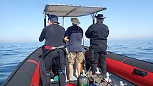
In South Africa, the standard dive boat is a large (6 to nearly 9 m) Rigid Inflatable Boat These are known as rubber ducks. Power is generally twin outboard motors, which may be two-stroke and smoky, but are increasingly often either four stroke, or the improved two-strokes which are cleaner and quieter.
These boats are generally powerful and fast, but speed is usually limited by sea state. They have a wet ride in a bumpy sea or if there is a crosswind. You travel in your dive suit, quite often with your hood on, and sometimes with your mask on to keep the spray out of your eyes. It has been known for the occasional diver to also use a snorkel to keep out heavy spray in rough conditions. If you wear a hat to protect your head from UV, make sure the hat is a tight fit, and preferably with a lanyard. The combination of cool sea air, wind, spray and high levels of UV can grill you in quite a short time, even in winter. Wear a good blockout or other method of keeping the sun from your skin. Unfortunately some blockouts wash off easily, and others sting your eyes if water gets into your mask and sloshes around a bit. A ski-mask is considered slightly eccentric, but it does the job.
Preparing for the dive.

If using all your own equipment, pack it as you find convenient, and check that everything is in good working order before leaving home. It will be wet on the way home, a waterproof bag or bin will keep the water off the upholstery. If using rental gear, get to the shop early to make sure it fits and works properly. If you are an unusual shape or size you may have difficulty finding a suit which fits well.At some places you will kit up at the side of the road or in a parking lot, and at others there will be changing rooms provided by the dive operator. If this is an issue, find out before the dive, You might want to take along a small mat or towel to stand on while putting on your suit, particularly if the ground is sandy or muddy.Some operators provide facilities at the dive shop for the customers to change into their dive suits and assemble equipment and load the boat before leaving for the launch site. In these cases the heavy equipment is usually loaded by staff, and the divers carry their light equipment to the boat. Where the boat collects divers from a jetty, the divers are expected to get their own kit to the boat. Actual loading will usually be done or supervised by the skipper.You will almost always be expected to wear your dive suit on the boat trip. There is no space to put it on during the ride, which may be wet.
What to take
- A small bag is useful to carry items like sunglasses, sunblock, hat, etc. Cell phones and car keys are usually kept in a waterproof bag or box by the skipper, and stored in the console. Large boxes for underwater cameras or video equipment should be negotiated before the dive, as there may or may not be space for them on board. In summer sunblock is advised for most skin types. UV factor is generally high and reflection from the water grills you from below. A peaked or brimmed hat may help if securely strapped on against the wind generated by boat speed.
- Kit bags for dive gear are not usually carried, but a medium sized soft bag to hold fins and mask, and other dive accessories like DSMB, reel, computer, dive light etc. is OK.
- On a long boat trip a small bottle of water or other suitable rehydration drink is nice to have, specially for after a deep or long dive. Similarly a small amount of high energy food may be welcome after a cold dive. In Cape Town, many dive boats supply a small chocolate bar or other sweet (candy) to each diver after the dive.
- A light waterproof windbreaker jacket is useful if the wind is strong, the weather or water is cold, or the trip is long. This can reduce wind-chill, particularly after the dive if you wear a wetsuit.
- A small emergency supplies (dive saver) kit of spare O-rings, fin strap, etc is acceptable.
What not to take
- Don’t take anything that you do not intend to use on the trip. (emergency equipment excepted).
- Don’t bring anything that must not get wet unless you have a watertight bag or box for it. A towel is usually a waste of time, as it will probably get wet. The same goes for dry clothing.
- Space is limited and must be shared by all. Do not annoy everyone by bringing a huge bin for your kit and fighting with the skipper at boarding time. No-one will have sympathy when you are evicted.
Loading kit and getting into the boat


The boat may loaded before launching, except where the water at the slipway is too shallow, when the boat is not taken out between dives, or when the slipway is not at the same place where the divers will be boarding.Loading of the boat is usually done by the skipper and divemaster. You are usually expected to transport your own equipment to the boat and hand it over to the person who will stow it for the trip. The standard arrangement is to stack scuba sets along a centreline rack, and tie them in place. You will usually sit at your scuba set, so if you want to do pre-dive buddy checks, ask for your gear and your buddy’s to be stowed together.Weight belts and pockets may be stacked on deck or in a box at the front or back of the rack. They are handed out when the boat gets to the site, so be sure you can identify your weights.
Fins and masks are usually stowed by the diver. There are often no special places reserved for this purpose, and fins are generally stowed either behind a handrope along the inner side of the pontoons, or between scuba sets along the rack. Be careful how you do this, as simply stacking them on top of the scuba sets can sometimes result in a fin or two being blown overboard by wind. This can ruin your dive, and is usually expensive. Masks are commonly stored in the foot pocket of a fin. The deck is not a good place for fragile items.Large cameras with strobe arms should be carried in the smallest plastic bin or crate that will hold them. There will often be several divers with camera boxes contending for the same limited storage space. Do not expect special treatment unless you have specifically organised it with the charterer.Some crews will carry your scuba set to the boat, but don’t count on it. If you need help, say so. If you are renting gear from the same organisation that runs the boat, they will usually load it for you. Make sure you can identify your rented gear and that it has all been loaded.
Slipway launches


Slipway launches are standard in the Western Cape
Where launching is from a slipway the procedure is fairly relaxed, and much depends on how far the slipway is from the parking area, and whether there is a convenient jetty.In some cases, usually at low tide, the water may be too shallow to launch the boat loaded with kit, but more often the boat is loaded with most of the dive gear, but not the divers, before launching. The boat is then launched with usually just the skipper on board, and the divers either get in from shallow water or from a jetty, as described above.Sometimes there may be commercial ski-boat fishermen launching at the same slipway. There are exceptions, but the lasting impression is of a mob of hooligans with no respect for anyone. They are generally a law unto themselves, and you will not gain brownie points by pointing out the error of their ways, and are likely to be given a brief introductory course in local invective at no charge.
Getting into the boat will depend on the launch site. In most cases the boat will be launched with only a skipper on board. Divers will board from the jetty or from the water.
Boarding from a jetty
Boarding from a jetty is usually easy, unless the step down to the boat is high. The crew will help where necessary and direct boarding. Follow their instructions. Do not leap down onto the deck, as it may not be designed to take this kind of shock load, and the sound of cracking glass fibre will not bring a smile to the skipper’s face. Also don’t leap down onto the pontoon, as this is likely to be followed by an inelegant face-plant onto the rack of scuba gear. The owners may be more concerned with damage to their equipment than your injuries.
The roll bar at the stern is a good place to hold if you can reach it. The radio antenna, plastic windscreen and engine control levers are not.Try to avoid getting parts of yourself between the boat and the jetty. The pontoons are fairly soft, but the jetty usually isn't, and may be decorated by barnacles and other abrasive material.
Boarding from shallow water
If boarding from standing in the water, try to get in where the water is not too deep, as most divers do not have the agility and upper body strength to boost themselves in without fins or a jump. Ask for help if you need it, but your fellow divers are more likely to be enthusiastic than skillful at pulling you in, Say goodbye to dignity, and hope for a reasonably comfortable landing.
The stern of the boat (blunt end) is usually lower and therefore easier to get into. This is often combined with it being in the shallowest water, so get in and out of the way of the people who have to hold the boat while the rest are getting in.
If you are a gymnast or acrobat you may safely ignore this advice.
Seating


Seating is almost exclusively on the pontoons, with your back to the water. This puts you in a position where losing your balance backwards will result in falling into the water, a manoeuvre most divers prefer to restrict to times when the boat is stationary at the dive site. To prevent unscheduled backward rolls, use the foot-straps and hand-ropes provided. As a general rule, sit opposite your scuba set, so you don’t have to move around when kitting up on site.
Occasionally there may be a seat across the stern in front of the motors. This will be the most comfortable place on the boat but may catch more spray in your face. The boat will bounce up and down as it hits waves. Bigger boats less so than small ones, and the part that bounces the least is the stern, so the most comfortable seating is as far back as you can get. This puts you close to the motors, and if they are two-stroke, closest to the exhaust smoke when the boat is not moving. You may not have much choice where you get to sit, but if you have a bad back or other disability which makes a rough ride a problem, mention this to your dive-master or the skipper as soon as possible. You will not be popular if the boat has to stop to re-arrange passengers. With practice it is possible to sit with one foot in a foot-strap (preferably the foot nearer the bow (pointy end)) and ride the bumps with very little effort. It is much like riding a horse, don’t fight the motion, absorb the bumps by relaxing a bit, and you will bounce less. A death-grip on the hand ropes will be exhausting if the ride is long.
Some boats have no footstraps. You will have to find something else to hold onto, or lean into the boat to keep more weight on your feet. Some divers may be seen comfortably sitting on the tubes, riding the waves with no obvious concern as the boat bounces along. They may not even need to hold on. They have done this before.
Moving around in the boat
If possible, don’t move around while the boat is moving, unless asked to trim the boat. You will be expected to sit where directed by the skipper, and unless there is a good reason not to, do as requested. Standing up when the boat is moving and there is nothing to hold onto can result in a fall and possible injury if the boat hits a wave or moves in an unexpected direction. If equipment comes loose under way, shout to the skipper, who will stop if it is safe, so that the equipment can be re-stowed.There may be cables and pipes in places on the deck. These are usually routed through areas where they are reasonably protected, but as a rule don’t stand on them or use them to hold on to. Batteries are often stored in plastic boxes near the transom, to keep the wires short. The lids are not usually load bearing structures, do not use them as steps.
Getting out of the boat

Getting into the water is usually done by a synchronised backward roll – falling into the water alongside your neighbour, neither on top nor underneath. Generally all the divers or a nominated group will roll off together, on a countdown from the skipper or divemaster. It is important to all roll together, as if you do not, the later divers may fall on top of the earlier ones, possibly casing injury or equipment damage. If you are not ready, or are not happy with this procedure, wait until the others are in and the boat is clear of them. The skipper will then let you roll in clear of the others, but you may have to fin a bit to get to them. This can be a problem if diving in a current. Some divers may not wish to backward roll with a large camera setup. Mereka dapat meminta nakhoda untuk memberikan kamera kepada mereka saat berada di dalam air. Dalam hal ini mereka harus tetap dekat dengan perahu dan sebaiknya memegangnya sampai kamera mereka diturunkan.
Pelampung peluru dan penanda

Kebanyakan menyelam di Cape Town adalah di karang atau bangkai kapal. Biasanya menandai posisi dengan shotline sebelum menyelam agar penyelam dapat turun ke tempat yang tepat. Jika ada sedikit arus di permukaan, garis tembakan akan melayang melawan arah angin untuk mengatasi kendurnya. Dalam hal ini, biasanya pelampung masuk ke air dalam jarak pendek, dan memulai penurunan segera setelah garis terlihat melalui air, untuk meminimalkan kerja renang melawan arus. Melayang sampai ke pelampung berarti Anda harus berenang kembali melawan arus. Shotline bukanlah jangkar. Jika Anda menarik diri Anda ke bawah garis pelampung, itu mungkin menyeret tembakan, dan Anda akan berakhir di bawah situs, seperti halnya orang lain di belakang Anda. Jika garis tembakan terlalu pendek, tembakan mungkin terangkat oleh pelampung dan melayang keluar dari lokasi, jadi perlu sedikit kelonggaran. Arus mungkin tidak mengalir langsung melawan arah angin. Bahkan ketika itu adalah arus yang diinduksi angin, gaya Coriolis akan mengimbanginya berlawanan arah jarum jam dari arah angin di belahan bumi selatan, dalam efek yang dikenal sebagai transportasi Ekman. Efeknya sekitar 45° di permukaan, lebih banyak saat Anda masuk lebih dalam, tetapi dengan kecepatan yang lebih sedikit.
Anda dapat memilih untuk muncul di shotline atau menjauhinya. Jika Anda tidak mengetahui situsnya, mungkin sulit untuk menemukan jalan kembali. Ini biasanya tidak menjadi masalah, dan sebagian besar penyelam Cape Town akan naik ke mana pun mereka berada di akhir penyelaman, tetapi dalam kasus ini sangat disarankan untuk menggunakan DSMB dan permukaan pada pelampung Anda sendiri, atau pelampung teman Anda. DSMB akan menunjukkan keberadaan seorang penyelam sehingga perahu di area tersebut dapat tetap bersih, dan agar kapten kapal selam Anda dapat melacak di mana kemungkinan pelanggannya akan muncul.

Jika ada kemungkinan besar untuk muncul ke permukaan jauh dari garis tembak di area dengan banyak lalu lintas kapal, penyelam dianjurkan, atau mungkin diminta, untuk membawa DSMB dan memasangnya sebelum naik ke permukaan. Lokasi lain di mana penyelam mungkin diharuskan membawa DSMB adalah lokasi yang jauh di lepas pantai, atau kapan pun menurut nakhoda mungkin sulit untuk menemukan penyelam karena kondisi laut. Untuk penyelaman rekreasi, pilihan warna dan ukuran untuk DSMB pribadi terserah pada penyelam. Kuning, oranye, dan merah adalah yang paling umum, tetapi merah muda cerah juga kadang-kadang terlihat, dan kecuali Anda secara eksplisit memberi tahu nakhoda arti khusus untuk suatu warna, akan dianggap bahwa tidak ada arti khusus selain menandai posisi Anda. Tidak ada yang akan peduli seberapa besar itu selama bisa dilihat dari jarak yang wajar. Strip reflektif, lampu berkedip dan nama Anda juga opsional.
Divemasters
Mungkin ada satu di kapal, atau mungkin tidak. Perahu-perahu yang melayani penduduk setempat cenderung tidak menyediakan seorang divemaster daripada perahu-perahu yang terhubung dengan sekolah atau yang umumnya melayani perdagangan dan pengunjung yang lewat. Jika Anda tidak yakin tentang menyelam tanpa seseorang untuk mengajak Anda berkeliling, sebutkan ini saat Anda memesan, dan tanyakan tentang pilihannya.
Menyelam rumput laut
Di daerah di mana terdapat rumput laut yang lebat, penyelam umumnya tidak menarik UKM selama penyelaman. Untungnya ini juga biasanya tempat di mana tidak ada arus yang signifikan, meskipun gelombangnya bisa kuat. Banyak dari garis pantai Cape Town dan situs pantai memiliki rumput laut yang lebat, terutama di pesisir Atlantik. Di area ini, para penyelam dianjurkan untuk membawa DSMB, dan menggunakannya saat keluar dari garis tembak, sehingga nakhoda dapat melacak di mana semua orang berada, dan agar kapal yang lewat dapat memiliki kesempatan untuk menghindari menabrak Anda jika ada yang mengganggu. untuk berjaga-jaga. DSMB juga sangat efektif untuk memberi sinyal ke kapal saat Anda berada di permukaan – lebih dari sekadar lengan dalam pakaian selam hitam. Ini bisa sangat berharga jika angin kencang selama penyelaman dan permukaannya berombak dengan air putih.
Kembali ke perahu setelah menyelam


Aturan 1: Jangan melepas sirip Anda di dalam air kecuali ada tangga. Anda membutuhkan mereka untuk meningkatkan Anda. Kebanyakan bebek karet tidak menyediakan tangga boarding. Ini bahkan lebih penting jika Anda naik di sisi perahu yang melawan arah angin, karena perahu hampir selalu hanyut melawan arah angin lebih cepat daripada seorang penyelam. Dekati perahu dan pegang tali tangan luar. Cobalah untuk mempertahankan pegangan pada perahu setiap saat, dan lepaskan hanya selama benar-benar diperlukan untuk melepaskan kit, karena perahu dapat hanyut saat Anda tidak berpegangan.
Beberapa perahu mungkin menyediakan tali pegangan pendek dengan lingkaran yang dapat Anda selipkan dengan tangan, tetapi untuk beberapa alasan ini sangat jarang terjadi. Yang lebih jarang lagi adalah tali dengan klip yang dapat Anda pasang ke peralatan sebelum melepasnya. Agaknya tidak ada permintaan pelanggan untuk barang-barang ini…Peralatan Anda akan diangkat ke kapal oleh kru atau penyelam lainnya.
Prosedur yang disarankan adalah pertama-tama melewatkan kamera atau peralatan longgar lainnya. Kemudian lepas landas dan angkat beban Anda. Ini memastikan bahwa Anda akan mengapung setelah melepas BC Anda. Jangan lepaskan sampai Anda yakin orang lain memiliki cengkeraman yang baik, sabuk pemberat tenggelam dengan sangat cepat. Lepaskan perangkat selam dan serahkan ini kepada kru. Anda dapat membantu dengan mendorong ke atas di bawah set saat diangkat, dan memeriksa apakah DV dan pengukur tidak tersangkut pada tali tangan. Masker dan snorkel dapat diserahkan kapan saja jika nyaman. Pegang dengan baik pada pegangan yang disediakan, atau tali tangan setinggi mungkin di sisi ponton. Celupkan diri Anda sejauh mungkin untuk mendapatkan daya angkat yang apung, lalu angkat sirip dengan kuat ke atas dan gunakan lengan Anda untuk menarik diri Anda ke atas setinggi mungkin, lalu dorong tali atau gagangnya ke bawah sambil menggulung tubuh bagian atas ke atas ponton. Ubah pegangan ke pegangan bagian dalam atau tali tangan, dan ayunkan satu kaki ke atas perahu. Mungkin nyaman untuk berhenti di sini sementara seseorang melepaskan sirip Anda, lalu duduk dan ayunkan kaki lainnya ke dalam perahu. Dengan sirip yang bagus, teknik yang baik, dan kekuatan yang masuk akal, dimungkinkan untuk naik dengan cara ini dengan nyaman dan bermartabat. Metode ini jauh lebih sulit jika di sisi melawan angin dalam angin kencang.

Jika Anda tidak memiliki kekuatan, prosedurnya serupa, tetapi dengan bantuan kru atau penyelam yang sudah ada di kapal, yang akan menyeret Anda dengan kekuatan utama dan apa pun yang bisa mereka pegang. Sebelum menuduh siapa pun melakukan penyerangan tidak senonoh, pertimbangkan apakah ada tempat alternatif yang masuk akal untuk mereka ambil yang akan berhasil. Keanggunan berbanding terbalik dengan ukuran dan massa Anda. Jika Anda memiliki saku paha di depan jas Anda, jangan naik dengan peralatan rapuh atau besar di saku. Kantong samping biasanya tidak menjadi masalah.

Ada tren baru dengan beberapa perahu menyediakan tangga untuk boarding. Gaya "Pohon Natal" relatif populer karena mudah didaki dengan sirip di kaki Anda. Pada bebek karet biasanya digantung di samping, dan pada kapal katamaran lambung kaku, transom lebih disukai.
Keluar dari kapal setelah menyelam

Keluar ke dermaga biasanya mudah, tetapi mungkin rumit karena dermaga yang tinggi dan air surut. Jika ada masalah, kru akan membantu dan memberikan instruksi. Jika Anda melakukan hal Anda sendiri, peringatan yang sama berlaku untuk masuk dari dermaga. Terutama tentang tidak mendapatkan diri Anda antara perahu dan dermaga.
Keluar ke pantai tidak biasa di Cape Town, tetapi relatif mudah. Biasanya lebih aman dan lebih nyaman untuk turun di sisi yang rendah jika perahu miring saat berjalan di pantai. Jika Anda berada di sisi yang tinggi, tunggu sampai ada ruang dan pindah ke sisi yang lebih rendah, atau dalam beberapa kasus, sisi yang tinggi akan menjadi sisi yang rendah saat perahu terhuyung ke belakang saat muatan dipindahkan. Jangan mencoba untuk menurunkan perlengkapan dari sisi yang tinggi, jika Anda berada di tempat yang salah dan perahu berguling di atas Anda. Hal ini sangat mungkin terjadi jika perahu tidak sepenuhnya bebas dari ombak.
Lihat

Perairan Cape Peninsula dan False Bay mendukung ekologi berkembang biak organisme laut beriklim sejuk, banyak dari mereka endemik Afrika Selatan, atau bahkan daerah yang lebih kecil, dan meskipun ikan tidak berwarna spektakuler seperti yang terlihat di perairan tropis, banyak yang cukup berwarna-warni untuk menyamarkan diri di antara invertebrata yang sangat hidup yang menutupi terumbu.
Hewan laut
Ada berbagai macam hewan laut yang dapat dilihat saat menyelam di wilayah ini, dan ini termasuk beberapa pertemuan paling mengagumkan dan spektakuler yang mungkin dilakukan oleh seorang penyelam.
Paus dan Lumba-lumba
False Bay adalah tujuan terkenal untuk mengamati paus. Sejumlah besar paus Kanan Selatan mengunjungi teluk ini setiap tahun, tetapi tidak biasa melihatnya saat menyelam. Spesies paus lain yang kadang-kadang terlihat di False Bay adalah Paus Bungkuk, Paus Bryde, dan Orca, dan ini bahkan lebih jarang terlihat saat menyelam. Jika Anda beruntung bertemu ikan paus saat menyelam, berhati-hatilah, karena ukurannya yang besar membuat penyelam mudah terluka secara tidak sengaja.
Lumba-lumba juga terlihat di False Bay dan di pesisir Atlantik. Lumba-lumba biasa kadang-kadang mengunjungi sekolah yang berjumlah ratusan hingga ribuan, tetapi tidak sering terlihat oleh penyelam. Lumba-lumba kehitaman cenderung melakukan perjalanan dalam kelompok yang lebih kecil, tetapi juga lebih mungkin untuk menyelidiki seorang penyelam di halte keselamatan. Spesies lain kadang-kadang berkunjung, tetapi lebih terkenal karena insiden terdampar yang terlihat di bawah air oleh penyelam.
hiu

False Bay adalah salah satu tempat yang paling dapat diandalkan untuk melihat hiu Putih Besar, meskipun jarang sebagai penyelam, dan beberapa spesies hiu lainnya juga sering terlihat. Sevengill atau Cowshark sering terlihat di beberapa lokasi, sedangkan hiu Gully dan Catsharks lebih tersebar luas. Ada empat spesies hiu kucing yang umum secara lokal, dari hiu puffadder warna-warni hingga hiu piyama yang jauh lebih besar. Hiu pelagis lainnya biasanya hanya terlihat pada penyelaman "air biru" lepas pantai di semenanjung selatan, dan beberapa spesies ikan pelagis besar dapat dilihat pada perjalanan serupa.
Pelagis

Kawanan besar Yellowtail kadang-kadang terlihat di beberapa lokasi penyelaman, dan pada kesempatan yang tidak terduga, penyelam mungkin cukup beruntung untuk melihat Mola-mola Oseanik, Paus Selatan, Paus Bungkuk, Lumba-lumba Umum, Hidung Botol, atau Dusky.
Snoek umum, yang merupakan landasan industri penangkapan ikan lokal, sangat pemalu dan hampir tidak pernah terlihat oleh penyelam, meskipun kebiasaannya berburu dalam jumlah besar.
Penguin dan anjing laut

Ada koloni penguin Afrika di False Bay, tetapi sangat tidak biasa melihatnya saat menyelam. Di sisi lain, anjing laut bulu Cape sama-sama penasaran dan tidak takut pada penyelam, dan sangat sering terlihat, baik di False Bay maupun di pesisir Atlantik. Ada beberapa tempat di mana mereka hampir dapat dijamin untuk dilihat.
Ikan karang

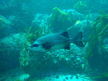


Ikan karang di wilayah ini paling beragam di False Bay, dan paling umum di zona terlarang di Kawasan Konservasi Laut, di mana mereka telah dilindungi oleh hukum selama beberapa dekade, meskipun perburuan masih terjadi, dan penegakan hukumnya sangat tidak dapat diandalkan. Sebagian besar ikan karang disamarkan sampai batas tertentu. Banyak yang berwarna abu-abu keperakan dan berbayang, seperti ikan air tawar Hottentot yang ada di mana-mana, Fransmadam keperakan, dan Stentjie. Lainnya memiliki batang vertikal atau tambalan gelap yang dapat membantu memecah profil mereka di rumput laut, seperti tunggul putih, Zebra, dan steenbra putih, sementara banyak spesies yang lebih kecil berwarna samar dan berbaur sangat baik dengan lingkungan mereka. Ini umumnya ikan yang menghabiskan sebagian besar waktunya di atau sangat dekat dengan karang, dan warnanya biasanya merupakan indikasi warna khas habitatnya. Ini termasuk berbagai klipfish endemik, dan beberapa blennie dan ikan gobi, fingerfins, Cape triplefin, Smoothskin scorpionfish, dua spesies horsefish, pipefish dan Rocksucker. Ada juga beberapa ikan merah, yang cukup terlihat, seperti ikan Romawi yang sangat umum, dan tunggul merah dan steenbra merah yang kurang umum. Sebagian besar ikan yang disebutkan adalah soliter atau ditemukan dalam kawanan kecil, tetapi ada juga Strepies dan Maasbanker yang cenderung berkelompok dalam jumlah yang cukup besar, dan kawanan Hottentot yang cukup besar terlihat cukup sering. Galjoen cukup langka dan biasanya terlihat dalam kelompok kecil di atas karang di mana ada banyak pergerakan gelombang, dan Cape knifejaw yang tampak serupa lebih menyukai terumbu yang lebih dalam dan profil tinggi di antara bebatuan. Seacatfish pemalu dan cenderung menghabiskan siang hari di celah-celah dan lubang.
Daerah berpasir

Daerah berpasir juga memiliki ciri khas ikan mereka, yang meliputi beberapa spesies pari, sol, gurnard, ikan buntal dan ikan pasir paruh, yang langka dan pemalu di siang hari, tetapi dapat terlihat dalam jumlah besar di malam hari di beberapa lokasi, ketika ia keluar dari pasir tempat ia bersembunyi dan berenang dengan bebas. Beberapa spesies klipfish juga tinggal di pasir, dengan berbagai spesies lebih menyukai kepadatan pasir yang berbeda, dengan yang lebih menyukai pasir halus yang memiliki tubuh lebih mirip ular, sedangkan yang di pasir kasar lebih kuat. Pola tubuh mereka cenderung cocok dengan jenis pasir juga.
Invertebrata karang
Invertebrata bentik memberikan sebagian besar warna cerah pada terumbu di wilayah ini, dan distribusi spesies adalah karakteristik dari sub-wilayah yang berbeda seperti kedalaman dan suhu air. Keanekaragamannya besar, dan terdapat variasi besar pada tutupan terumbu yang dominan dengan kedalaman dan lokasi geografis. Karakteristik kehidupan terumbu sangat bervariasi antara sisi timur dan barat Cape Peninsula, dan ini dikenal sebagai perbatasan antara South Western Cape dan Agulhas Inshore Bioregions. Zonasi vertikal juga merupakan karakteristik dari bioregion yang berbeda, sehingga dapat terlihat perbedaan yang sangat mencolok pada apa yang dapat dilihat di berbagai lokasi.
Ada kecenderungan umum untuk area tertentu terumbu untuk didominasi oleh spesies organisme tertentu, misalnya, Bintang bulu umum, Teripang dada merah, Teripang Mauve, Umpan Merah atau bulu babi, sejauh yang utama bagian dari luas permukaan ditutupi oleh organisme dominan. Ini tidak berarti bahwa tidak ada variasi, karena terdapat berbagai habitat di sebagian besar terumbu tergantung pada orientasi dan rugositas, dan sebagian besar, organisme sessile hidup di mana mereka dapat, dan ini sangat tergantung pada di mana larva planktonik. menemukan pijakan.
air tengah
Invertebrata pelagis pada dasarnya bersifat planktonik tidak dapat diprediksi kapan dan di mana mereka dapat dilihat. Mereka termasuk beberapa spesies ubur-ubur, beberapa spesies ubur-ubur sisir, beberapa siphonophores sporadis, salps dan pteropoda, dan banyak hal yang terlalu kecil untuk mudah diperhatikan. Ada juga cumi-cumi, tetapi mereka sangat pemalu dan jarang terlihat di siang hari.
Spons, cnidaria, ubur-ubur sisir, cacing pipih, cacing tersegmentasi, arthropoda, moluska, bryozoa, echinodermata, ascidia, ikan, burung laut dan mamalia laut yang tercatat dari wilayah ini terdaftar di Wikipedia:Daftar hewan laut Semenanjung Cape dan False Bay. Banyak dari ini mungkin terlihat oleh penyelam rekreasi.
rumput laut
Hutan rumput laut
Hutan rumput laut adalah rumput laut paling jelas di Cape Town. Ada tiga genera yang ditemukan secara lokal, kadang-kadang dalam jarak dekat. Yang paling jelas adalah bambu laut, yang mencapai permukaan saat dewasa, dan memiliki stipe tebal dengan rongga berisi gas di bagian atas, dan yang menjaga pelepah dekat permukaan untuk paparan cahaya maksimum. Rumput laut ini sangat umum di pesisir Atlantik, dan juga ditemukan di kedua sisi False Bay, tetapi lebih umum di bagian selatan teluk.
Rumput laut Split-fan yang lebih kecil tumbuh di terumbu yang lebih dalam, dan tidak mencapai permukaan. Stipes lebih pendek dan tidak ada rongga berisi gas, sehingga daun tetap terendam di perairan yang lebih gelap. Rumput laut ini ditemukan di perairan yang lebih dalam dari bambu Laut, dengan rentang geografis yang sama.
Yang ketiga adalah rumput laut Kandung Kemih, yang memiliki kelompok stipes tipis panjang, dengan daun panjang dan sejumlah besar kantong kecil berisi gas yang menjaga rumput laut tegak dan daun di permukaan. Rumput laut ini tidak ditemukan di False Bay, dan sebagian besar terlihat di dekat Pulau Robben.
Rumput ganggang dan tumbuhan bawah hutan rumput laut.
Di bawah daun rumput laut, terumbu di daerah yang lebih dangkal di mana ada cukup cahaya, dapat ditutupi oleh tumbuhan bawah berbagai macam rumput laut, dan spesies tertentu akan tergantung pada berbagai faktor, termasuk jumlah cahaya yang tersedia, dan jumlah air. gerakan. Biasanya, rumput laut hijau dan coklat akan ditemukan di daerah yang lebih dangkal, dan rumput laut merah akan lebih dalam, karena mereka dapat bertahan hidup dengan sedikit cahaya. Yang terdalam seringkali adalah alga koral merah, yang dapat membentuk rumput padat di permukaan atas bebatuan.
Terumbu karang.
Di mana ombaknya terlalu kuat atau cahayanya terlalu redup untuk rumput laut lainnya, alga koral yang bertatahkan mungkin masih menemukan pijakan dan berkembang. Ganggang merah ini membentuk kerak yang cukup keras dan melekat erat di terumbu, dan juga dikenal sebagai "cat merah muda", yang merupakan deskripsi yang adil dari penampilan mereka — mereka sama sekali tidak terlihat seperti rumput laut. Jangkauan mereka hampir di mana saja di wilayah di mana cukup cahaya menembus dan tidak ada penghuni lain di terumbu.
Ada sekitar 57 rumput laut hijau, 49 rumput laut coklat dan 240 rumput laut merah yang tercatat dari wilayah ini di Wikipedia:Daftar rumput laut Cape Peninsula dan False Bay.
Bangkai kapal

Itu Tanjung Badai dan Tanjung Harapan keduanya merupakan sebutan tradisional untuk wilayah ini, dan untuk alasan yang bagus. Cuaca kadang-kadang bisa sangat buruk, dan pantainya sangat terbuka, dengan sedikit pelabuhan yang terlindung, tetapi juga merupakan titik jalan penting di salah satu rute perdagangan maritim terbesar di dunia. Akibatnya, ada sejumlah besar kapal karam yang tercatat di sepanjang garis pantai setempat.
Banyak dari bangkai kapal ini tidak pernah ditemukan, dan banyak lainnya telah rusak tanpa bisa dikenali, atau tertutup pasir, atau dalam kasus Table Bay, terkubur di bawah proyek reklamasi tanah, tetapi beberapa berada di tempat yang dapat menyelam dan dapat dikunjungi oleh penyelam jika kondisinya sesuai.
Kedalaman bangkai kapal yang dapat menyelam bervariasi dari 3 atau 4 meter, hingga lebih dari 65 meter, dan kondisinya bervariasi dari serpihan kayu atau baja yang setengah terkubur, hingga kapal yang mempertahankan sebagian besar struktur dan penampilan aslinya, dan muncul dari kedalaman seolah-olah berlayar melalui dasar pasir.
Sebagian besar sangat bertatahkan organisme karang, mulai dari rumput laut di perairan dangkal hingga berbagai macam invertebrata berwarna-warni di perairan yang lebih dalam. Mereka juga melindungi berbagai ikan karang, dan dapat dikunjungi oleh ikan pelagis pada kesempatan yang tidak terduga. Akibatnya, mereka berfungsi sebagai terumbu buatan, dan sebagai hasilnya umumnya juga menarik bagi penyelam yang tidak terlalu tertarik pada mereka sebagai artefak.
Fitur topografi
Banyak situs dicirikan oleh fitur topografi yang menarik, termasuk puncak, selokan, gua, swim-through dan overhang. Fitur-fitur ini terkenal tidak hanya karena kontribusinya terhadap bentang laut, tetapi juga memberikan variasi besar dalam habitat yang tersedia di lokasi, dan hasilnya adalah korelasi kuat antara keanekaragaman hayati yang tinggi dan topografi yang menarik. Karakter topografi umum suatu situs tergantung pada geologi, dan situs granit dapat langsung dibedakan dari situs batupasir dan serpih sedimen. Batuan granit biasanya dibulatkan dan ditumpuk sebagai batu inti di singkapan batu yang sama, seringkali dengan pasir kuarsa putih di antara mereka, atau sebagai dasar yang miring secara bertahap. Tumpukan batu dengan berbagai ukuran ini sering membentuk puncak, dan parit dengan arah yang agak acak, dan dalam beberapa kasus, ceruk dan lubang di antaranya cukup besar bagi penyelam untuk berenang, memberikan struktur karang yang spektakuler.
Lapisan batupasir cenderung menghasilkan formasi yang didominasi oleh kemiringan dan pemogokan lokal, dan ini lebih dapat diprediksi. Namun, detail pada skala yang lebih kecil cenderung menghasilkan lebih banyak lubang kecil, celah, tepian dan punggungan daripada area granit, dan ini kurang spektakuler sebagai aturan umum. Ada pengecualian, di mana terumbu batu pasir sangat terjal, biasanya di mana kemiringannya cukup curam, tetapi tidak vertikal, dan garis pantainya cukup curam, tetapi pada bidang yang berbeda dengan kemiringannya.
Untungnya diktum lama "seperti di atas, jadi di bawah" berlaku cukup baik, dan karakter terumbu karang dapat diprediksi dengan cukup andal dengan mengamati lanskap garis pantai yang berdekatan. Pengecualian utama untuk aturan ini adalah selatan Teluk Smitswinkel, di mana ada batu pasir di atas air dan granit di bawahnya.
Struktur geologi dan sejarah wilayah ini dijelaskan secara singkat di Wikipedia:Geologi laut Semenanjung Cape dan False Bay
Baca baca
Buku referensi tentang ekologi perairan Cape Town:
Dari SURG, khusus untuk penyelam di wilayah ini: Tersedia dari toko selam dan toko buku pilihan di Cape Town, dan langsung dari SURG.
- Jones, Georgia. 2008. Panduan Lapangan untuk Hewan Laut di Semenanjung Cape, SURG, Cape Town. ISBN 9780620416399
- Zsilavecz, Guido. 2005. Ikan Pesisir Semenanjung Cape dan False Bay, SURG, Cape Town. ISBN 0620342307
- Zsilavecz, Guido. 2007. Nudibranch dari Cape Peninsula dan False Bay, SURG, Cape Town. ISBN 0620380543
Dari penerbit lain, dan aplikasi yang lebih umum:
- Cabang, G. dan Cabang, M. 1981, Pantai Hidup di Afrika Selatan, Struik, Cape Town. ISBN 0869771159
- Cabang, G.M. Griffiths, C.L. Cabang, M.L dan Beckley, L.E. 2010, Two Oceans – Panduan untuk Kehidupan laut di Afrika Selatan, David Philip, Cape Town. ISBN 9781770077720
- Gosliner, T. 1987. Nudibranch dari Arica Selatan, Penantang Laut & Jeff Hamann, Monterey. ISBN 0930118138
- Heemstra, P. dan Heemstra E. 2004, Ikan Pesisir Afrika Selatan, NISC/SAIAB, Grahamstown.
- Ed. Smith, M.M. dan Heemstra, P. 2003 Ikan Laut Smith. Struik, Cape Town
- Stegenga, H. Bolton, J.J. dan Anderson, R.J. 1997, Rumput laut dari Pantai Barat Afrika Selatan. Herbarium Bolus, Cape Town. ISBN 079921793X (agak teknis)
Buku referensi tentang Geologi Semenanjung Cape:
- Compton, John S. 2004, Batu dan Pegunungan Cape Town. Dua Lantai, Cape Town. ISBN 1919930701

![]()